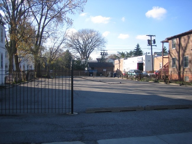
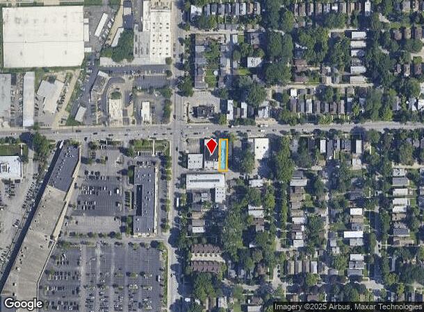
Property Record
1818 Dempster St, Evanston, IL 60202
NEARBY LISTINGS FOR SALE OR LEASE
Property Detail
1818 Dempster St
Chicago-Naperville-Elgin, IL-IN-WI
Golees Resub
10-24-200-003-0000
Cook
Taxexempt
Illinois
X
5
17031C0265J
0.90 AC
2021
Near North
2024
Chicago
809700
DEMOGRAPHICS near 1818 Dempster St
1 Mile
3 Mile
5 Mile
2024 Total Population
30,126
237,376
481,087
2029 Population
29,127
231,283
467,386
Pop Growth 2024-2029
(3.32%)
(2.57%)
(2.85%)
Average Age
40
40
40
2024 Total Households
12,239
91,639
192,227
HH Growth 2024-2029
(3.23%)
(2.79%)
(3.09%)
Median Household Inc
$77,257
$74,277
$74,036
Avg Household Size
2.30
2.40
2.30
2024 Avg HH Vehicles
1.00
1.00
1.00
Median Home Value
$382,661
$386,368
$394,943
Median Year Built
1953
1953
1952
Nearby Places
Map Layers
Map Styles
 Street
 Aerial
- Restaurants
- Banks
- Shops
- Fitness
- Groceries
PUBLIC TRANSPORTATION
TRANSIT/SUBWAY
Dempster Station (Purple Line - Chicago Transit Authority "L" Trains (The "L"))
DRIVE
WALK
Distance
Dempster Station (Purple Line - Chicago Transit Authority "L" Trains (The "L"))
3 min
18 min
0.9 mi
COMMUTER RAIL
Evanston Davis Street Station (Union Pacific North Line - Northeast Illinois Regional Commuter Railroad (Metra))
DRIVE
WALK
Distance
Evanston Davis Street Station (Union Pacific North Line - Northeast Illinois Regional Commuter Railroad (Metra))
3 min
1.3 mi
Evanston Main Street Station (Union Pacific North Line - Northeast Illinois Regional Commuter Railroad (Metra))
DRIVE
WALK
Distance
Evanston Main Street Station (Union Pacific North Line - Northeast Illinois Regional Commuter Railroad (Metra))
4 min
1.5 mi
AIRPORT
Chicago O'Hare International
DRIVE
WALK
Distance
Chicago O'Hare International
50 min
19.3 mi
Chicago Midway International
DRIVE
WALK
Distance
Chicago Midway International
41 min
21.4 mi
Nearby Properties
Address
Land Use
TOTAL SIZE
Lot Size
Zoning
Address
Land Use
TOTAL SIZE
Lot Size
Zoning
999,808 SF
50.13 AC
Address
Land Use
TOTAL SIZE
Lot Size
Zoning
180,397 SF
0.78 AC
Address
Land Use
TOTAL SIZE
Lot Size
Zoning
0.63 AC
Address
Land Use
TOTAL SIZE
Lot Size
Zoning
341,698 SF
0.64 AC
Address
Land Use
TOTAL SIZE
Lot Size
Zoning
165,067 SF
10.88 AC
Address
Land Use
TOTAL SIZE
Lot Size
Zoning
305,592 SF
27.35 AC
Address
Land Use
TOTAL SIZE
Lot Size
Zoning
82,139 SF
4.88 AC
Address
Land Use
TOTAL SIZE
Lot Size
Zoning
Address
Land Use
TOTAL SIZE
Lot Size
Zoning
892,012 SF
37.29 AC
Address
Land Use
TOTAL SIZE
Lot Size
Zoning
2.10 AC
Address
Land Use
TOTAL SIZE
Lot Size
Zoning
218,982 SF
1.97 AC
Address
Land Use
TOTAL SIZE
Lot Size
Zoning
372,244 SF
7.12 AC
Address
Land Use
TOTAL SIZE
Lot Size
Zoning
172,500 SF
2.42 AC
Address
Land Use
TOTAL SIZE
Lot Size
Zoning
303,960 SF
0.98 AC
Address
Land Use
TOTAL SIZE
Lot Size
Zoning
232,552 SF
5.78 AC
Address
Land Use
TOTAL SIZE
Lot Size
Zoning
429,949 SF
16.06 AC
Address
Land Use
TOTAL SIZE
Lot Size
Zoning
251,409 SF
16.33 AC
Address
Land Use
TOTAL SIZE
Lot Size
Zoning
176,115 SF
1.04 AC
Address
Land Use
TOTAL SIZE
Lot Size
Zoning
0.84 AC
Address
Land Use
TOTAL SIZE
Lot Size
Zoning
110,528 SF
3.05 AC
Address
Land Use
TOTAL SIZE
Lot Size
Zoning
1.67 AC
Address
Land Use
TOTAL SIZE
Lot Size
Zoning
231,865 SF
3.16 AC
Address
Land Use
TOTAL SIZE
Lot Size
Zoning
163,981 SF
4 AC
Address
Land Use
TOTAL SIZE
Lot Size
Zoning
5.65 AC
Address
Land Use
TOTAL SIZE
Lot Size
Zoning
145,548 SF
0.80 AC
Address
Land Use
TOTAL SIZE
Lot Size
Zoning
243,781 SF
0.84 AC
Address
Land Use
TOTAL SIZE
Lot Size
Zoning
0.30 AC
Address
Land Use
TOTAL SIZE
Lot Size
Zoning
208,785 SF
0.61 AC
Address
Land Use
TOTAL SIZE
Lot Size
Zoning
Address
Land Use
TOTAL SIZE
Lot Size
Zoning
0.84 AC
The World's #1 Commercial Real Estate Marketplace
Connect with us
© 2025 CoStar Group
The information above has been obtained from sources believed reliable. While we do not doubt its accuracy we have not verified it and make no guarantee, warranty or representation about it. It is your responsibility to independently confirm its accuracy and completeness. Any projections, opinions, assumptions, or estimates used are for example only and do not represent the current or future performance of the property. The value of this transaction to you depends on tax and other factors which should be evaluated by your tax, financial, and legal advisors. You and your advisors should conduct a careful, independent investigation of the property to determine to your satisfaction the suitability of the property for your needs.