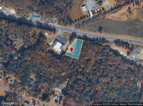
Property Record
1818 Route 70, Southampton, NJ 08088

NEARBY LISTINGS FOR SALE OR LEASE
Property Detail
1818 Route 70
33-03002-0000-00004-04
Burlington
Kennel
New Jersey
X
4.4
34005C0288F
0.78 AC
2024
South Burlington County
2025
Philadelphia
703202
Philadelphia-Camden-Wilmington, PA-NJ-DE-MD
1,326 SF
DEMOGRAPHICS near 1818 Route 70
1 Mile
3 Mile
5 Mile
2024 Total Population
245
10,732
37,608
2029 Population
247
10,904
38,149
Pop Growth 2024-2029
+ 0.82%
+ 1.60%
+ 1.44%
Average Age
41
51
45
2024 Total Households
82
4,730
14,504
HH Growth 2024-2029
+ 1.22%
+ 1.71%
+ 1.52%
Median Household Inc
$99,218
$73,899
$116,254
Avg Household Size
2.90
2.20
2.60
2024 Avg HH Vehicles
2.00
2.00
2.00
Median Home Value
$480,555
$267,531
$354,152
Median Year Built
1980
1976
1976
Nearby Places
Map Layers
Map Styles
 Street
 Aerial
- Restaurants
- Banks
- Shops
- Fitness
- Groceries
PUBLIC TRANSPORTATION
AIRPORT
Trenton Mercer
DRIVE
WALK
Distance
Trenton Mercer
45 min
32.3 mi
Philadelphia International
DRIVE
WALK
Distance
Philadelphia International
46 min
32.9 mi
Freight Ports
Port of Philadelphia
DRIVE
WALK
Distance
Port of Philadelphia
31 min
23.0 mi
SALE & LEASE HISTORY
LISTING DATE
SALE/LEASE

Nov 25, 2020
For Sale
Feb 05, 2020
For Sale
Nearby Properties
Address
Land Use
TOTAL SIZE
Lot Size
Zoning
Address
Land Use
TOTAL SIZE
Lot Size
Zoning
103.84 AC
PPE
Address
Land Use
TOTAL SIZE
Lot Size
Zoning
46.97 AC
Address
Land Use
TOTAL SIZE
Lot Size
Zoning
49.38 AC
PPE
Address
Land Use
TOTAL SIZE
Lot Size
Zoning
20,460 SF
23.95 AC
AR
Address
Land Use
TOTAL SIZE
Lot Size
Zoning
1,284 SF
20.03 AC
Address
Land Use
TOTAL SIZE
Lot Size
Zoning
40.08 AC
Address
Land Use
TOTAL SIZE
Lot Size
Zoning
1,750 SF
7.91 AC
I
Address
Land Use
TOTAL SIZE
Lot Size
Zoning
5.63 AC
HC
Address
Land Use
TOTAL SIZE
Lot Size
Zoning
15.20 AC
Address
Land Use
TOTAL SIZE
Lot Size
Zoning
864 SF
4.54 AC
Address
Land Use
TOTAL SIZE
Lot Size
Zoning
8.38 AC
HC
Address
Land Use
TOTAL SIZE
Lot Size
Zoning
Address
Land Use
TOTAL SIZE
Lot Size
Zoning
4.30 AC
RGD2
Address
Land Use
TOTAL SIZE
Lot Size
Zoning
9.37 AC
I
Address
Land Use
TOTAL SIZE
Lot Size
Zoning
3.45 AC
I
Address
Land Use
TOTAL SIZE
Lot Size
Zoning
9,736 SF
4.43 AC
RGD
Address
Land Use
TOTAL SIZE
Lot Size
Zoning
24,360 SF
15.77 AC
I
Address
Land Use
TOTAL SIZE
Lot Size
Zoning
15.65 AC
HC
Address
Land Use
TOTAL SIZE
Lot Size
Zoning
9,300 SF
26.36 AC
HC
Address
Land Use
TOTAL SIZE
Lot Size
Zoning
2.09 AC
HC
Address
Land Use
TOTAL SIZE
Lot Size
Zoning
3,366 SF
5 AC
AR
Address
Land Use
TOTAL SIZE
Lot Size
Zoning
16,000 SF
2.40 AC
I
Address
Land Use
TOTAL SIZE
Lot Size
Zoning
5.30 AC
I
Address
Land Use
TOTAL SIZE
Lot Size
Zoning
3.31 AC
Address
Land Use
TOTAL SIZE
Lot Size
Zoning
5,661 SF
1 AC
AR
Address
Land Use
TOTAL SIZE
Lot Size
Zoning
13.60 AC
I
Address
Land Use
TOTAL SIZE
Lot Size
Zoning
2.86 AC
Address
Land Use
TOTAL SIZE
Lot Size
Zoning
3.28 AC
HC
Address
Land Use
TOTAL SIZE
Lot Size
Zoning
1,351 SF
1.38 AC
HC
Address
Land Use
TOTAL SIZE
Lot Size
Zoning
57.69 AC
I
The World's #1 Commercial Real Estate Marketplace
Connect with us
© 2025 CoStar Group
The information above has been obtained from sources believed reliable. While we do not doubt its accuracy we have not verified it and make no guarantee, warranty or representation about it. It is your responsibility to independently confirm its accuracy and completeness. Any projections, opinions, assumptions, or estimates used are for example only and do not represent the current or future performance of the property. The value of this transaction to you depends on tax and other factors which should be evaluated by your tax, financial, and legal advisors. You and your advisors should conduct a careful, independent investigation of the property to determine to your satisfaction the suitability of the property for your needs.