Property Record
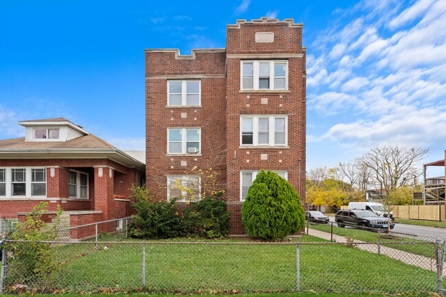
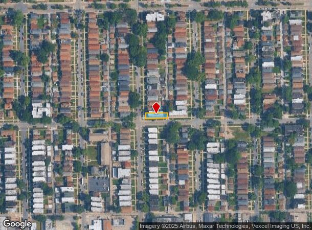
1818 W 78Th St, Chicago, IL 60620
This Property Is For Sale
NEARBY LISTINGS FOR SALE OR LEASE
Property Detail
1818 W 78Th St
Chicago-Naperville-Elgin, IL-IN-WI
Englefield Sub
20-30-423-018-0000
(ENGLEFIELD) SUB OF SE1/4 OF SE SEC 30-38-14
Apartment
Cook
X
Illinois
17031C0520J
21
2023
0.09 AC
2024
Gresham
710400
Chicago
6,588 SF
DEMOGRAPHICS near 1818 W 78Th St
1 Mile
3 Mile
5 Mile
2024 Total Population
32,245
256,001
689,049
2029 Population
30,996
244,877
658,525
Pop Growth 2024-2029
(3.87%)
(4.35%)
(4.43%)
Average Age
41
39
39
2024 Total Households
12,229
89,850
248,734
HH Growth 2024-2029
(4.35%)
(4.67%)
(4.57%)
Median Household Inc
$40,499
$42,464
$47,388
Avg Household Size
2.50
2.70
2.60
2024 Avg HH Vehicles
1.00
1.00
1.00
Median Home Value
$151,194
$181,089
$204,872
Median Year Built
1949
1949
1950
Nearby Places
Map Layers
Map Styles
 Street
 Aerial
- Restaurants
- Banks
- Shops
- Fitness
- Groceries
PUBLIC TRANSPORTATION
COMMUTER RAIL
Brainerd Station (Rock Island District Line - Northeast Illinois Regional Commuter Railroad (Metra))
DRIVE
WALK
Distance
Brainerd Station (Rock Island District Line - Northeast Illinois Regional Commuter Railroad (Metra))
5 min
2.0 mi
Wrightwood Station (SouthWest Service - Northeast Illinois Regional Commuter Railroad (Metra))
DRIVE
WALK
Distance
Wrightwood Station (SouthWest Service - Northeast Illinois Regional Commuter Railroad (Metra))
4 min
2.0 mi
AIRPORT
Chicago Midway International
DRIVE
WALK
Distance
Chicago Midway International
13 min
6.6 mi
Chicago O'Hare International
DRIVE
WALK
Distance
Chicago O'Hare International
66 min
33.2 mi
Nearby Properties
Address
Land Use
TOTAL SIZE
Lot Size
Zoning
Address
Land Use
TOTAL SIZE
Lot Size
Zoning
10.73 AC
PD 1243
Address
Land Use
TOTAL SIZE
Lot Size
Zoning
0.91 AC
PD 1177
Address
Land Use
TOTAL SIZE
Lot Size
Zoning
159,300 SF
13.36 AC
PD 425
Address
Land Use
TOTAL SIZE
Lot Size
Zoning
87,830 SF
0.76 AC
B1-1
Address
Land Use
TOTAL SIZE
Lot Size
Zoning
796,454 SF
25.68 AC
PMD13
Address
Land Use
TOTAL SIZE
Lot Size
Zoning
157,787 SF
12.23 AC
Address
Land Use
TOTAL SIZE
Lot Size
Zoning
1,615,006 SF
41.91 AC
PMD13
Address
Land Use
TOTAL SIZE
Lot Size
Zoning
7,200 SF
0.22 AC
B3-3
Address
Land Use
TOTAL SIZE
Lot Size
Zoning
Address
Land Use
TOTAL SIZE
Lot Size
Zoning
1.65 AC
B2-3
Address
Land Use
TOTAL SIZE
Lot Size
Zoning
223,310 SF
15.67 AC
Address
Land Use
TOTAL SIZE
Lot Size
Zoning
224,089 SF
Address
Land Use
TOTAL SIZE
Lot Size
Zoning
82,000 SF
Address
Land Use
TOTAL SIZE
Lot Size
Zoning
99,900 SF
12.45 AC
PD 1172
Address
Land Use
TOTAL SIZE
Lot Size
Zoning
166,292 SF
5.95 AC
PMD13
Address
Land Use
TOTAL SIZE
Lot Size
Zoning
13,700 SF
0.33 AC
B3-2
Address
Land Use
TOTAL SIZE
Lot Size
Zoning
141,165 SF
7.82 AC
PD 966
Address
Land Use
TOTAL SIZE
Lot Size
Zoning
285,672 SF
13.14 AC
Address
Land Use
TOTAL SIZE
Lot Size
Zoning
101,294 SF
8.10 AC
B3-1
Address
Land Use
TOTAL SIZE
Lot Size
Zoning
111,198 SF
10.60 AC
PD 566
Address
Land Use
TOTAL SIZE
Lot Size
Zoning
0.54 AC
RS-3
Address
Land Use
TOTAL SIZE
Lot Size
Zoning
69,857 SF
5.39 AC
PD 338
Address
Land Use
TOTAL SIZE
Lot Size
Zoning
65,186 SF
10.47 AC
PD 566
Address
Land Use
TOTAL SIZE
Lot Size
Zoning
91,200 SF
3.41 AC
PMD13
Address
Land Use
TOTAL SIZE
Lot Size
Zoning
213,670 SF
10.17 AC
PMD13
Address
Land Use
TOTAL SIZE
Lot Size
Zoning
298,540 SF
2.74 AC
B1-3
Address
Land Use
TOTAL SIZE
Lot Size
Zoning
0.35 AC
RS-3
Address
Land Use
TOTAL SIZE
Lot Size
Zoning
66,152 SF
5.47 AC
PD 430
Address
Land Use
TOTAL SIZE
Lot Size
Zoning
76,363 SF
6.40 AC
B3-1
Address
Land Use
TOTAL SIZE
Lot Size
Zoning
69,365 SF
4.10 AC
PMD13
The World's #1 Commercial Real Estate Marketplace
Connect with us
© 2025 CoStar Group
The information above has been obtained from sources believed reliable. While we do not doubt its accuracy we have not verified it and make no guarantee, warranty or representation about it. It is your responsibility to independently confirm its accuracy and completeness. Any projections, opinions, assumptions, or estimates used are for example only and do not represent the current or future performance of the property. The value of this transaction to you depends on tax and other factors which should be evaluated by your tax, financial, and legal advisors. You and your advisors should conduct a careful, independent investigation of the property to determine to your satisfaction the suitability of the property for your needs.