Property Record
1819 Airport Blvd, Cayce, SC 29033
NEARBY LISTINGS FOR SALE OR LEASE
Property Detail
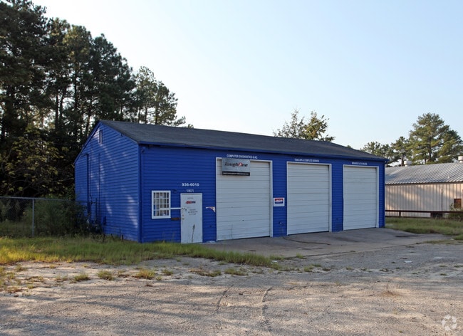
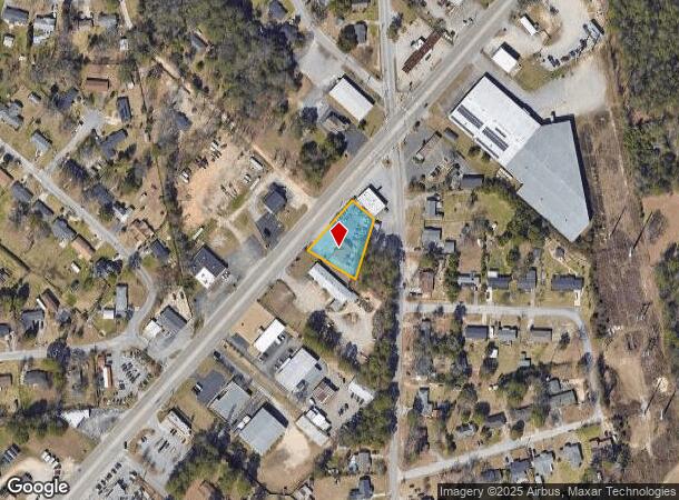
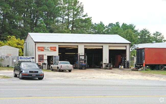
1819 Airport Blvd
005743-03-001
198 X 163 X 180 X 86 FT +-
Autorepair
Lexington
X
South Carolina
45063C0279J
0.56 AC
2025
Cayce/West Columbia
2024
Columbia
020202
Columbia, SC
1,500 SF
DEMOGRAPHICS near 1819 Airport Blvd
1 Mile
3 Mile
5 Mile
2024 Total Population
4,993
37,353
105,847
2029 Population
5,458
40,904
112,725
Pop Growth 2024-2029
+ 9.31%
+ 9.51%
+ 6.50%
Average Age
42
40
37
2024 Total Households
2,191
16,940
46,137
HH Growth 2024-2029
+ 9.45%
+ 9.79%
+ 6.72%
Median Household Inc
$47,602
$48,850
$51,688
Avg Household Size
2.20
2.10
2.10
2024 Avg HH Vehicles
2.00
2.00
2.00
Median Home Value
$127,837
$147,355
$166,961
Median Year Built
1969
1971
1978
Nearby Places
Map Layers
Map Styles
 Street
 Aerial
- Restaurants
- Banks
- Shops
- Fitness
- Groceries
PUBLIC TRANSPORTATION
COMMUTER RAIL
Columbia Amtrak Station (Silver Star - Amtrak)
DRIVE
WALK
Distance
Columbia Amtrak Station (Silver Star - Amtrak)
9 min
4.6 mi
AIRPORT
Columbia Metro
DRIVE
WALK
Distance
Columbia Metro
13 min
4.9 mi
Freight Ports
North Charleston Terminal
DRIVE
WALK
Distance
North Charleston Terminal
114 min
101.2 mi
SALE & LEASE HISTORY
LISTING DATE
SALE/LEASE

Sep 25, 2016
For Lease
Sep 24, 2016
For Sale
Nearby Properties
Address
Land Use
TOTAL SIZE
Lot Size
Zoning
Address
Land Use
TOTAL SIZE
Lot Size
Zoning
158,976 SF
11.28 AC
RM-2
Address
Land Use
TOTAL SIZE
Lot Size
Zoning
152,064 SF
9.58 AC
RM-2
Address
Land Use
TOTAL SIZE
Lot Size
Zoning
14.88 AC
PD
Address
Land Use
TOTAL SIZE
Lot Size
Zoning
461,888 SF
61.50 AC
ID
Address
Land Use
TOTAL SIZE
Lot Size
Zoning
3,614 SF
1,444.32 AC
ID
Address
Land Use
TOTAL SIZE
Lot Size
Zoning
62,886 SF
10.15 AC
C3
Address
Land Use
TOTAL SIZE
Lot Size
Zoning
2,813 SF
3.97 AC
C2
Address
Land Use
TOTAL SIZE
Lot Size
Zoning
20.65 AC
T/C
Address
Land Use
TOTAL SIZE
Lot Size
Zoning
21,018 SF
7.25 AC
R
Address
Land Use
TOTAL SIZE
Lot Size
Zoning
25,240 SF
9 AC
RG
Address
Land Use
TOTAL SIZE
Lot Size
Zoning
1,218 SF
8.99 AC
RG
Address
Land Use
TOTAL SIZE
Lot Size
Zoning
3,702 SF
19 AC
C3
Address
Land Use
TOTAL SIZE
Lot Size
Zoning
3,426 SF
20.31 AC
C2
Address
Land Use
TOTAL SIZE
Lot Size
Zoning
1,924 SF
12.27 AC
R4
Address
Land Use
TOTAL SIZE
Lot Size
Zoning
30,052 SF
3.84 AC
Address
Land Use
TOTAL SIZE
Lot Size
Zoning
297,500 SF
20.26 AC
ID
Address
Land Use
TOTAL SIZE
Lot Size
Zoning
8,118 SF
10.98 AC
RG
Address
Land Use
TOTAL SIZE
Lot Size
Zoning
222,557 SF
26.90 AC
ID
Address
Land Use
TOTAL SIZE
Lot Size
Zoning
10,304 SF
11.89 AC
R1
Address
Land Use
TOTAL SIZE
Lot Size
Zoning
5,091 SF
13.06 AC
RG
Address
Land Use
TOTAL SIZE
Lot Size
Zoning
107,890 SF
21.99 AC
C2
Address
Land Use
TOTAL SIZE
Lot Size
Zoning
5,502 SF
16.15 AC
ID
Address
Land Use
TOTAL SIZE
Lot Size
Zoning
1,386 SF
18.75 AC
R1
Address
Land Use
TOTAL SIZE
Lot Size
Zoning
318,309 SF
33.51 AC
ID
Address
Land Use
TOTAL SIZE
Lot Size
Zoning
41,860 SF
5.67 AC
C3
Address
Land Use
TOTAL SIZE
Lot Size
Zoning
7,383 SF
4.85 AC
ID
Address
Land Use
TOTAL SIZE
Lot Size
Zoning
279,568 SF
11.38 AC
ID
Address
Land Use
TOTAL SIZE
Lot Size
Zoning
34,267 SF
7.53 AC
ID
Address
Land Use
TOTAL SIZE
Lot Size
Zoning
44,352 SF
7.55 AC
D1
Address
Land Use
TOTAL SIZE
Lot Size
Zoning
66,062 SF
1.89 AC
The World's #1 Commercial Real Estate Marketplace
Connect with us
© 2025 CoStar Group
The information above has been obtained from sources believed reliable. While we do not doubt its accuracy we have not verified it and make no guarantee, warranty or representation about it. It is your responsibility to independently confirm its accuracy and completeness. Any projections, opinions, assumptions, or estimates used are for example only and do not represent the current or future performance of the property. The value of this transaction to you depends on tax and other factors which should be evaluated by your tax, financial, and legal advisors. You and your advisors should conduct a careful, independent investigation of the property to determine to your satisfaction the suitability of the property for your needs.