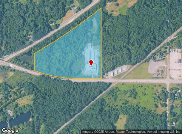
Property Record
1819 W Us Highway 20, Michigan City, IN 46360


NEARBY LISTINGS FOR SALE OR LEASE
Property Detail
1819 W Us Highway 20
64-04-01-400-007.000-009
W12 SE S RR S CORP LINE 1-37-5 26.40A
Warehouse
Porter
A
Indiana
18127C0090E
131 SF
2023
Porter County
2024
Chicago
050107
Chicago-Naperville-Elgin, IL-IN-WI
21,563 SF
DEMOGRAPHICS near 1819 W Us Highway 20
1 Mile
3 Mile
5 Mile
2024 Total Population
1,046
17,680
36,462
2029 Population
1,053
17,563
36,342
Pop Growth 2024-2029
+ 0.67%
(0.66%)
(0.33%)
Average Age
41
41
41
2024 Total Households
454
6,420
14,649
HH Growth 2024-2029
+ 0.66%
(0.87%)
(0.41%)
Median Household Inc
$45,147
$50,889
$52,328
Avg Household Size
2.20
2.30
2.20
2024 Avg HH Vehicles
2.00
2.00
2.00
Median Home Value
$129,230
$117,317
$131,217
Median Year Built
1974
1961
1962
Nearby Places
Map Layers
Map Styles
 Street
 Aerial
- Restaurants
- Banks
- Shops
- Fitness
- Groceries
PUBLIC TRANSPORTATION
COMMUTER RAIL
Beverly Shores (South Shore Line - Northern Indiana Commuter Transportation District (South Shore Line))
DRIVE
WALK
Distance
Beverly Shores (South Shore Line - Northern Indiana Commuter Transportation District (South Shore Line))
5 min
3.0 mi
11Th St. (Michigan City) (South Shore Line - Northern Indiana Commuter Transportation District (South Shore Line))
DRIVE
WALK
Distance
11Th St. (Michigan City) (South Shore Line - Northern Indiana Commuter Transportation District (South Shore Line))
8 min
3.9 mi
Freight Ports
Port Milwaukee
DRIVE
WALK
Distance
Port Milwaukee
175 min
139.6 mi
Nearby Properties
Address
Land Use
TOTAL SIZE
Lot Size
Zoning
Address
Land Use
TOTAL SIZE
Lot Size
Zoning
384,556 SF
88.01 AC
Address
Land Use
TOTAL SIZE
Lot Size
Zoning
472,695 SF
46.06 AC
Address
Land Use
TOTAL SIZE
Lot Size
Zoning
617,575 SF
7.36 AC
Address
Land Use
TOTAL SIZE
Lot Size
Zoning
71,212 SF
10.66 AC
Address
Land Use
TOTAL SIZE
Lot Size
Zoning
197,186 SF
31.58 AC
Address
Land Use
TOTAL SIZE
Lot Size
Zoning
165,756 SF
21.97 AC
Address
Land Use
TOTAL SIZE
Lot Size
Zoning
229,606 SF
24.92 AC
Address
Land Use
TOTAL SIZE
Lot Size
Zoning
58,932 SF
3.25 AC
Address
Land Use
TOTAL SIZE
Lot Size
Zoning
16,887 SF
20.17 AC
Address
Land Use
TOTAL SIZE
Lot Size
Zoning
82,217 SF
15.21 AC
Address
Land Use
TOTAL SIZE
Lot Size
Zoning
37,524 SF
4.11 AC
Address
Land Use
TOTAL SIZE
Lot Size
Zoning
204,752 SF
10.99 AC
Address
Land Use
TOTAL SIZE
Lot Size
Zoning
100,720 SF
11.58 AC
Address
Land Use
TOTAL SIZE
Lot Size
Zoning
57,102 SF
2.78 AC
Address
Land Use
TOTAL SIZE
Lot Size
Zoning
172,106 SF
33.69 AC
Address
Land Use
TOTAL SIZE
Lot Size
Zoning
129,367 SF
16.04 AC
Address
Land Use
TOTAL SIZE
Lot Size
Zoning
55,763 SF
11.51 AC
Address
Land Use
TOTAL SIZE
Lot Size
Zoning
36,522 SF
4.03 AC
Address
Land Use
TOTAL SIZE
Lot Size
Zoning
118,686 SF
21.85 AC
Address
Land Use
TOTAL SIZE
Lot Size
Zoning
42,120 SF
2.19 AC
Address
Land Use
TOTAL SIZE
Lot Size
Zoning
26,075 SF
6.07 AC
Address
Land Use
TOTAL SIZE
Lot Size
Zoning
64,000 SF
8.61 AC
Address
Land Use
TOTAL SIZE
Lot Size
Zoning
55,576 SF
3.98 AC
Address
Land Use
TOTAL SIZE
Lot Size
Zoning
22,523 SF
0.31 AC
Address
Land Use
TOTAL SIZE
Lot Size
Zoning
31,130 SF
1.56 AC
Address
Land Use
TOTAL SIZE
Lot Size
Zoning
81,960 SF
7.54 AC
Address
Land Use
TOTAL SIZE
Lot Size
Zoning
226,164 SF
15.19 AC
Address
Land Use
TOTAL SIZE
Lot Size
Zoning
37,208 SF
9.91 AC
Address
Land Use
TOTAL SIZE
Lot Size
Zoning
192,041 SF
8.94 AC
Address
Land Use
TOTAL SIZE
Lot Size
Zoning
63,300 SF
7.96 AC
The World's #1 Commercial Real Estate Marketplace
Connect with us
© 2025 CoStar Group
The information above has been obtained from sources believed reliable. While we do not doubt its accuracy we have not verified it and make no guarantee, warranty or representation about it. It is your responsibility to independently confirm its accuracy and completeness. Any projections, opinions, assumptions, or estimates used are for example only and do not represent the current or future performance of the property. The value of this transaction to you depends on tax and other factors which should be evaluated by your tax, financial, and legal advisors. You and your advisors should conduct a careful, independent investigation of the property to determine to your satisfaction the suitability of the property for your needs.