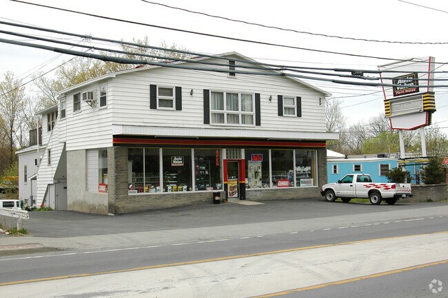
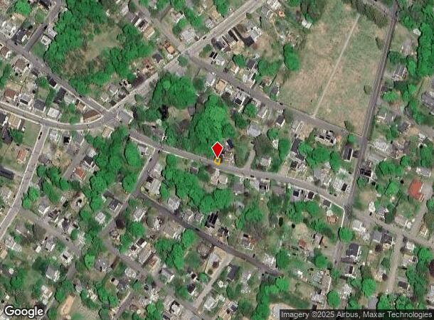
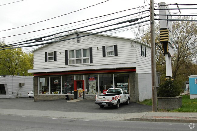
Property Record
182 E Main St, Beacon, NY 12508
NEARBY LISTINGS FOR SALE OR LEASE
Property Detail
182 E Main St
Dutchess County-Putnam County, NY
15 X 20 1443 0687
130200-6054-39-317642-0000
Dutchess
Wellgasoil
New York
X
317
36079C0077E
0.02 AC
0
Fishkill
2024
Westchester/So Connecticut
210101
DEMOGRAPHICS near 182 E Main St
1 Mile
3 Mile
5 Mile
2024 Total Population
8,095
34,294
85,701
2029 Population
8,065
34,643
86,537
Pop Growth 2024-2029
(0.37%)
+ 1.02%
+ 0.98%
Average Age
42
41
40
2024 Total Households
3,356
13,457
33,002
HH Growth 2024-2029
(0.45%)
+ 0.91%
+ 0.95%
Median Household Inc
$97,522
$77,464
$80,468
Avg Household Size
2.20
2.30
2.40
2024 Avg HH Vehicles
2.00
2.00
2.00
Median Home Value
$385,832
$388,831
$337,524
Median Year Built
1950
1960
1962
Nearby Places
- Restaurants
- Banks
- Shops
- Fitness
- Groceries
PUBLIC TRANSPORTATION
COMMUTER RAIL
Beacon Station (Hudson Line - Metro-North Commuter Railroad Company (Metro-North))
DRIVE
WALK
Distance
Beacon Station (Hudson Line - Metro-North Commuter Railroad Company (Metro-North))
6 min
2.3 mi
Breakneck Ridge Station (Hudson Line - Metro-North Commuter Railroad Company (Metro-North))
DRIVE
WALK
Distance
Breakneck Ridge Station (Hudson Line - Metro-North Commuter Railroad Company (Metro-North))
7 min
3.9 mi
AIRPORT
New York Stewart International
DRIVE
WALK
Distance
New York Stewart International
23 min
11.7 mi
Freight Ports
NY - Red Hook Container Terminal
DRIVE
WALK
Distance
NY - Red Hook Container Terminal
105 min
71.8 mi
Nearby Properties
Address
Land Use
TOTAL SIZE
Lot Size
Zoning
Address
Land Use
TOTAL SIZE
Lot Size
Zoning
211,240 SF
5.30 AC
WG
Address
Land Use
TOTAL SIZE
Lot Size
Zoning
251,689 SF
43.70 AC
RMF5
Address
Land Use
TOTAL SIZE
Lot Size
Zoning
48,135 SF
40.98 AC
RMF5
Address
Land Use
TOTAL SIZE
Lot Size
Zoning
101,170 SF
28.71 AC
RMF5
Address
Land Use
TOTAL SIZE
Lot Size
Zoning
17.59 AC
R1-40
Address
Land Use
TOTAL SIZE
Lot Size
Zoning
355,349 SF
28.50 AC
RM
Address
Land Use
TOTAL SIZE
Lot Size
Zoning
7.96 AC
RD-1.8
Address
Land Use
TOTAL SIZE
Lot Size
Zoning
47,187 SF
33 AC
R40
Address
Land Use
TOTAL SIZE
Lot Size
Zoning
36.65 AC
R1-20
Address
Land Use
TOTAL SIZE
Lot Size
Zoning
45.48 AC
HI
Address
Land Use
TOTAL SIZE
Lot Size
Zoning
10,746 SF
11 AC
PWD
Address
Land Use
TOTAL SIZE
Lot Size
Zoning
7.65 AC
RMF-5
Address
Land Use
TOTAL SIZE
Lot Size
Zoning
200 SF
11.97 AC
RD-3
Address
Land Use
TOTAL SIZE
Lot Size
Zoning
38,962 SF
16.80 AC
RMF5
Address
Land Use
TOTAL SIZE
Lot Size
Zoning
38.66 AC
R1-40
Address
Land Use
TOTAL SIZE
Lot Size
Zoning
20.50 AC
Address
Land Use
TOTAL SIZE
Lot Size
Zoning
5.70 AC
RD-3
Address
Land Use
TOTAL SIZE
Lot Size
Zoning
11.86 AC
Address
Land Use
TOTAL SIZE
Lot Size
Zoning
466.77 AC
R40
Address
Land Use
TOTAL SIZE
Lot Size
Zoning
9.17 AC
RD-3
Address
Land Use
TOTAL SIZE
Lot Size
Zoning
1.20 AC
Address
Land Use
TOTAL SIZE
Lot Size
Zoning
12 AC
R1-10
Address
Land Use
TOTAL SIZE
Lot Size
Zoning
27,472 SF
0.67 AC
LI
Address
Land Use
TOTAL SIZE
Lot Size
Zoning
32,347 SF
17.10 AC
R20
Address
Land Use
TOTAL SIZE
Lot Size
Zoning
38,699 SF
3.09 AC
GB
Address
Land Use
TOTAL SIZE
Lot Size
Zoning
49.90 AC
GB
Address
Land Use
TOTAL SIZE
Lot Size
Zoning
47,968 SF
5.19 AC
GB
Address
Land Use
TOTAL SIZE
Lot Size
Zoning
16.32 AC
RD-3
Address
Land Use
TOTAL SIZE
Lot Size
Zoning
69,006 SF
1.77 AC
DN
Address
Land Use
TOTAL SIZE
Lot Size
Zoning
2.69 AC
HI
The World's #1 Commercial Real Estate Marketplace
Connect with us
© 2025 CoStar Group
The information above has been obtained from sources believed reliable. While we do not doubt its accuracy we have not verified it and make no guarantee, warranty or representation about it. It is your responsibility to independently confirm its accuracy and completeness. Any projections, opinions, assumptions, or estimates used are for example only and do not represent the current or future performance of the property. The value of this transaction to you depends on tax and other factors which should be evaluated by your tax, financial, and legal advisors. You and your advisors should conduct a careful, independent investigation of the property to determine to your satisfaction the suitability of the property for your needs.