Property Record
182 N Sunbury Rd, Westerville, OH 43081


NEARBY LISTINGS FOR SALE OR LEASE
Property Detail
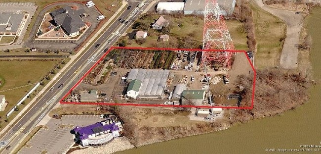
182 N Sunbury Rd
080-011381
United States Military Lands
Storebuilding
SUNBURY RD R17 T2 1-4T1 3 2.946 ACRES
X
Franklin
39041C0269K
Ohio
2024
2.95 AC
2024
Westerville
010000
Columbus
3,000 SF
Columbus, OH
DEMOGRAPHICS near 182 N Sunbury Rd
1 Mile
3 Mile
5 Mile
2024 Total Population
5,358
56,278
158,480
2029 Population
5,569
59,056
164,092
Pop Growth 2024-2029
+ 3.94%
+ 4.94%
+ 3.54%
Average Age
43
42
39
2024 Total Households
1,997
22,046
64,557
HH Growth 2024-2029
+ 4.36%
+ 4.88%
+ 3.30%
Median Household Inc
$123,503
$103,680
$90,690
Avg Household Size
2.60
2.50
2.40
2024 Avg HH Vehicles
2.00
2.00
2.00
Median Home Value
$337,132
$315,816
$299,202
Median Year Built
1985
1990
1991
Nearby Places
Map Layers
Map Styles
 Street
 Aerial
- Restaurants
- Banks
- Shops
- Fitness
- Groceries
PUBLIC TRANSPORTATION
AIRPORT
John Glenn Columbus International
DRIVE
WALK
Distance
John Glenn Columbus International
21 min
11.4 mi
Rickenbacker International
DRIVE
WALK
Distance
Rickenbacker International
41 min
27.1 mi
Nearby Properties
Address
Land Use
TOTAL SIZE
Lot Size
Zoning
Address
Land Use
TOTAL SIZE
Lot Size
Zoning
426,490 SF
19.43 AC
Address
Land Use
TOTAL SIZE
Lot Size
Zoning
446,516 SF
95.88 AC
Address
Land Use
TOTAL SIZE
Lot Size
Zoning
320,022 SF
37.14 AC
Address
Land Use
TOTAL SIZE
Lot Size
Zoning
3,263 SF
989.66 AC
Address
Land Use
TOTAL SIZE
Lot Size
Zoning
292,377 SF
36.29 AC
Address
Land Use
TOTAL SIZE
Lot Size
Zoning
170,259 SF
16.30 AC
Address
Land Use
TOTAL SIZE
Lot Size
Zoning
151,935 SF
9 AC
Address
Land Use
TOTAL SIZE
Lot Size
Zoning
137,489 SF
14.73 AC
Address
Land Use
TOTAL SIZE
Lot Size
Zoning
236,681 SF
7.83 AC
Address
Land Use
TOTAL SIZE
Lot Size
Zoning
100,848 SF
9.72 AC
Address
Land Use
TOTAL SIZE
Lot Size
Zoning
140,162 SF
34.63 AC
Address
Land Use
TOTAL SIZE
Lot Size
Zoning
28,068 SF
22.61 AC
Address
Land Use
TOTAL SIZE
Lot Size
Zoning
27,978 SF
11.35 AC
Address
Land Use
TOTAL SIZE
Lot Size
Zoning
61,326 SF
15.78 AC
Address
Land Use
TOTAL SIZE
Lot Size
Zoning
175,042 SF
8.10 AC
Address
Land Use
TOTAL SIZE
Lot Size
Zoning
189,276 SF
16.25 AC
Address
Land Use
TOTAL SIZE
Lot Size
Zoning
105,389 SF
8.16 AC
Address
Land Use
TOTAL SIZE
Lot Size
Zoning
77,831 SF
7.92 AC
Address
Land Use
TOTAL SIZE
Lot Size
Zoning
215,003 SF
22.42 AC
Address
Land Use
TOTAL SIZE
Lot Size
Zoning
110,583 SF
12.46 AC
Address
Land Use
TOTAL SIZE
Lot Size
Zoning
136,567 SF
12.48 AC
Address
Land Use
TOTAL SIZE
Lot Size
Zoning
111,505 SF
8.86 AC
Address
Land Use
TOTAL SIZE
Lot Size
Zoning
65,163 SF
7.04 AC
Address
Land Use
TOTAL SIZE
Lot Size
Zoning
18,041 SF
27.78 AC
Address
Land Use
TOTAL SIZE
Lot Size
Zoning
83,448 SF
4.89 AC
Address
Land Use
TOTAL SIZE
Lot Size
Zoning
71,451 SF
22.62 AC
Address
Land Use
TOTAL SIZE
Lot Size
Zoning
58,356 SF
2.84 AC
Address
Land Use
TOTAL SIZE
Lot Size
Zoning
166,320 SF
12.10 AC
Address
Land Use
TOTAL SIZE
Lot Size
Zoning
105,087 SF
5.75 AC
Address
Land Use
TOTAL SIZE
Lot Size
Zoning
49,607 SF
3.54 AC
The World's #1 Commercial Real Estate Marketplace
Connect with us
© 2026 CoStar Group
The information above has been obtained from sources believed reliable. While we do not doubt its accuracy we have not verified it and make no guarantee, warranty or representation about it. It is your responsibility to independently confirm its accuracy and completeness. Any projections, opinions, assumptions, or estimates used are for example only and do not represent the current or future performance of the property. The value of this transaction to you depends on tax and other factors which should be evaluated by your tax, financial, and legal advisors. You and your advisors should conduct a careful, independent investigation of the property to determine to your satisfaction the suitability of the property for your needs.