Property Record
182 State Route 31, Hampton, NJ 08827
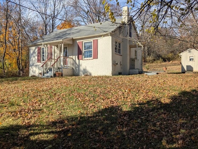
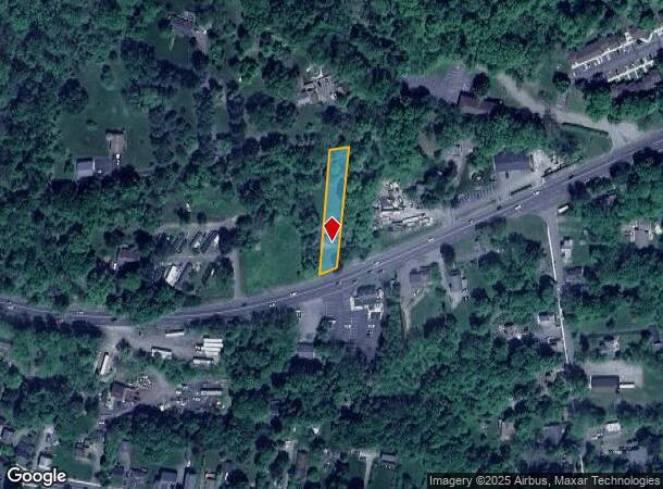
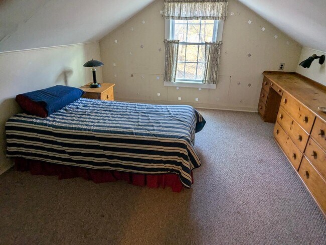
This Property Is For Sale
NEARBY LISTINGS FOR SALE OR LEASE
Property Detail
182 State Route 31
Newark, NJ-PA
Hunterdon
13-00021-0000-00016
New Jersey
Sfr
0.41 AC
X
Route 78 West
34041C0329E
Northern New Jersey
1,170 SF
DEMOGRAPHICS near 182 State Route 31
1 Mile
3 Mile
5 Mile
2024 Total Population
2,592
9,523
30,246
2029 Population
2,631
9,746
30,812
Pop Growth 2024-2029
+ 1.50%
+ 2.34%
+ 1.87%
Average Age
44
44
44
2024 Total Households
1,164
3,736
11,649
HH Growth 2024-2029
+ 1.55%
+ 2.33%
+ 1.84%
Median Household Inc
$84,722
$120,072
$113,314
Avg Household Size
2.20
2.50
2.50
2024 Avg HH Vehicles
2.00
2.00
2.00
Median Home Value
$321,764
$413,323
$387,343
Median Year Built
1973
1977
1971
Nearby Places
- Restaurants
- Banks
- Shops
- Fitness
- Groceries
PUBLIC TRANSPORTATION
COMMUTER RAIL
High Bridge (Raritan Valley Line - NJ Transit Commuter Rail (NJ Transit))
DRIVE
WALK
Distance
High Bridge (Raritan Valley Line - NJ Transit Commuter Rail (NJ Transit))
8 min
6.2 mi
Annandale (Raritan Valley Line - NJ Transit Commuter Rail (NJ Transit))
DRIVE
WALK
Distance
Annandale (Raritan Valley Line - NJ Transit Commuter Rail (NJ Transit))
11 min
8.1 mi
AIRPORT
Lehigh Valley International
DRIVE
WALK
Distance
Lehigh Valley International
51 min
31.7 mi
Freight Ports
New York Container Terminal
DRIVE
WALK
Distance
New York Container Terminal
68 min
52.3 mi
Nearby Properties
Address
Land Use
TOTAL SIZE
Lot Size
Zoning
Address
Land Use
TOTAL SIZE
Lot Size
Zoning
52.10 AC
PCOS
Address
Land Use
TOTAL SIZE
Lot Size
Zoning
215.75 AC
RC
Address
Land Use
TOTAL SIZE
Lot Size
Zoning
800 SF
28.04 AC
MR
Address
Land Use
TOTAL SIZE
Lot Size
Zoning
22.84 AC
HC
Address
Land Use
TOTAL SIZE
Lot Size
Zoning
11.15 AC
MFG
Address
Land Use
TOTAL SIZE
Lot Size
Zoning
6.24 AC
PVD
Address
Land Use
TOTAL SIZE
Lot Size
Zoning
3.98 AC
B-4
Address
Land Use
TOTAL SIZE
Lot Size
Zoning
8.97 AC
Address
Land Use
TOTAL SIZE
Lot Size
Zoning
1,280 SF
240.85 AC
PVD
Address
Land Use
TOTAL SIZE
Lot Size
Zoning
1.87 AC
PVD
Address
Land Use
TOTAL SIZE
Lot Size
Zoning
5.40 AC
OR
Address
Land Use
TOTAL SIZE
Lot Size
Zoning
5.50 AC
OR
Address
Land Use
TOTAL SIZE
Lot Size
Zoning
5.08 AC
HC
Address
Land Use
TOTAL SIZE
Lot Size
Zoning
5,752 SF
2.09 AC
RA
Address
Land Use
TOTAL SIZE
Lot Size
Zoning
203 AC
MR
Address
Land Use
TOTAL SIZE
Lot Size
Zoning
6.04 AC
HC
Address
Land Use
TOTAL SIZE
Lot Size
Zoning
1.98 AC
PVD
Address
Land Use
TOTAL SIZE
Lot Size
Zoning
1.70 AC
HC
Address
Land Use
TOTAL SIZE
Lot Size
Zoning
7,500 SF
6.05 AC
HC
Address
Land Use
TOTAL SIZE
Lot Size
Zoning
3 AC
B-2
Address
Land Use
TOTAL SIZE
Lot Size
Zoning
7,640 SF
1.87 AC
R1.5
Address
Land Use
TOTAL SIZE
Lot Size
Zoning
11,220 SF
4.06 AC
GA
Address
Land Use
TOTAL SIZE
Lot Size
Zoning
35 AC
I
Address
Land Use
TOTAL SIZE
Lot Size
Zoning
5,720 SF
17.47 AC
OR
Address
Land Use
TOTAL SIZE
Lot Size
Zoning
0.25 AC
Address
Land Use
TOTAL SIZE
Lot Size
Zoning
4,163 SF
2.59 AC
HC
Address
Land Use
TOTAL SIZE
Lot Size
Zoning
9,706 SF
3.03 AC
Address
Land Use
TOTAL SIZE
Lot Size
Zoning
11,061 SF
0.27 AC
DB
Address
Land Use
TOTAL SIZE
Lot Size
Zoning
0.22 AC
DB
Address
Land Use
TOTAL SIZE
Lot Size
Zoning
1,204 SF
10.55 AC
HC
The World's #1 Commercial Real Estate Marketplace
Connect with us
© 2025 CoStar Group
The information above has been obtained from sources believed reliable. While we do not doubt its accuracy we have not verified it and make no guarantee, warranty or representation about it. It is your responsibility to independently confirm its accuracy and completeness. Any projections, opinions, assumptions, or estimates used are for example only and do not represent the current or future performance of the property. The value of this transaction to you depends on tax and other factors which should be evaluated by your tax, financial, and legal advisors. You and your advisors should conduct a careful, independent investigation of the property to determine to your satisfaction the suitability of the property for your needs.