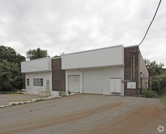
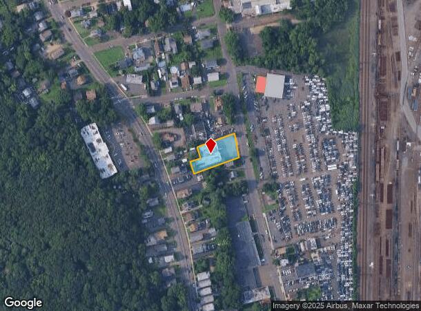
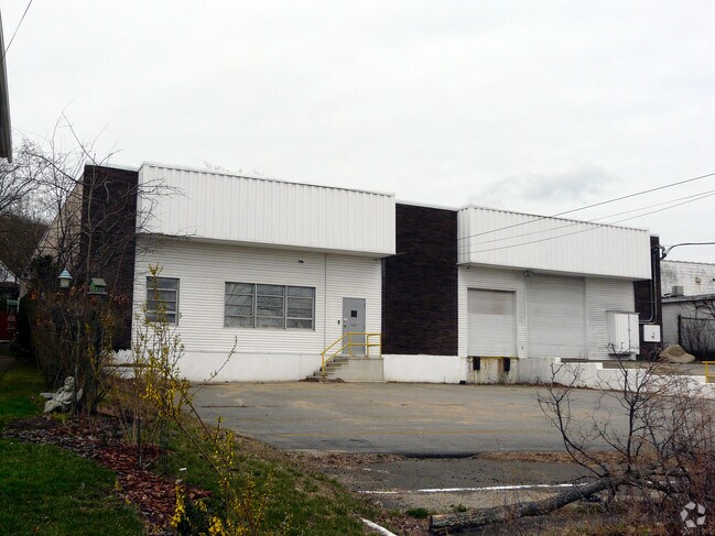
Property Record
182 Welton St, Hamden, CT 06517
NEARBY LISTINGS FOR SALE OR LEASE
Property Detail
182 Welton St
HAMD-002031-000008
New Haven
Religious
Connecticut
X
0000
09009C0434J
0.43 AC
2024
Hamden
2025
Westchester/So Connecticut
165200
New Haven, CT
8,247 SF
DEMOGRAPHICS near 182 Welton St
1 Mile
3 Mile
5 Mile
2024 Total Population
8,898
140,445
253,830
2029 Population
8,689
139,406
251,804
Pop Growth 2024-2029
(2.35%)
(0.74%)
(0.80%)
Average Age
35
37
38
2024 Total Households
3,544
55,409
100,325
HH Growth 2024-2029
(2.29%)
(0.63%)
(0.76%)
Median Household Inc
$66,955
$55,357
$63,758
Avg Household Size
2.40
2.30
2.30
2024 Avg HH Vehicles
1.00
1.00
1.00
Median Home Value
$293,420
$245,906
$251,062
Median Year Built
1948
1953
1958
Nearby Places
Map Layers
Map Styles
 Street
 Aerial
- Restaurants
- Banks
- Shops
- Fitness
- Groceries
PUBLIC TRANSPORTATION
COMMUTER RAIL
New Haven-State Street Station (New Haven Line - Metro-North Commuter Railroad Company (Metro-North))
DRIVE
WALK
Distance
New Haven-State Street Station (New Haven Line - Metro-North Commuter Railroad Company (Metro-North))
6 min
2.6 mi
DRIVE
WALK
Distance
7 min
3.3 mi
AIRPORT
Tweed/New Haven
DRIVE
WALK
Distance
Tweed/New Haven
13 min
5.8 mi
Nearby Properties
Address
Land Use
TOTAL SIZE
Lot Size
Zoning
Address
Land Use
TOTAL SIZE
Lot Size
Zoning
289,886 SF
2.21 AC
BD2
Address
Land Use
TOTAL SIZE
Lot Size
Zoning
347,604 SF
6.37 AC
RM2
Address
Land Use
TOTAL SIZE
Lot Size
Zoning
83,314 SF
2.14 AC
BA
Address
Land Use
TOTAL SIZE
Lot Size
Zoning
49,582 SF
1.62 AC
RH2
Address
Land Use
TOTAL SIZE
Lot Size
Zoning
132,345 SF
3.48 AC
RH2
Address
Land Use
TOTAL SIZE
Lot Size
Zoning
446,320 SF
BD1
Address
Land Use
TOTAL SIZE
Lot Size
Zoning
217,040 SF
2.20 AC
RH2
Address
Land Use
TOTAL SIZE
Lot Size
Zoning
101,654 SF
1.45 AC
PDU 14
Address
Land Use
TOTAL SIZE
Lot Size
Zoning
5.14 AC
H/C
Address
Land Use
TOTAL SIZE
Lot Size
Zoning
122,856 SF
1.66 AC
RH2
Address
Land Use
TOTAL SIZE
Lot Size
Zoning
133,767 SF
1.25 AC
BD2
Address
Land Use
TOTAL SIZE
Lot Size
Zoning
8,758 SF
12.74 AC
IH
Address
Land Use
TOTAL SIZE
Lot Size
Zoning
111,274 SF
22.62 AC
CEM
Address
Land Use
TOTAL SIZE
Lot Size
Zoning
258,313 SF
23.50 AC
PDU 34
Address
Land Use
TOTAL SIZE
Lot Size
Zoning
9,767 SF
33.63 AC
RM1
Address
Land Use
TOTAL SIZE
Lot Size
Zoning
486,703 SF
2.12 AC
BD
Address
Land Use
TOTAL SIZE
Lot Size
Zoning
72,708 SF
1.91 AC
PDU 87
Address
Land Use
TOTAL SIZE
Lot Size
Zoning
117,902 SF
1.41 AC
BD
Address
Land Use
TOTAL SIZE
Lot Size
Zoning
318,210 SF
2.73 AC
BA
Address
Land Use
TOTAL SIZE
Lot Size
Zoning
316,781 SF
9.20 AC
PDU 94
Address
Land Use
TOTAL SIZE
Lot Size
Zoning
102,115 SF
0.77 AC
RH2
Address
Land Use
TOTAL SIZE
Lot Size
Zoning
180,310 SF
2.70 AC
RH2
Address
Land Use
TOTAL SIZE
Lot Size
Zoning
2.55 AC
BD
Address
Land Use
TOTAL SIZE
Lot Size
Zoning
0.01 AC
T5
Address
Land Use
TOTAL SIZE
Lot Size
Zoning
78,878 SF
3.12 AC
RM2
Address
Land Use
TOTAL SIZE
Lot Size
Zoning
123,166 SF
2.33 AC
RH2
Address
Land Use
TOTAL SIZE
Lot Size
Zoning
68,706 SF
3.34 AC
BA1
Address
Land Use
TOTAL SIZE
Lot Size
Zoning
7,345 SF
3.09 AC
IL/RM2
Address
Land Use
TOTAL SIZE
Lot Size
Zoning
296,444 SF
23.30 AC
T145
Address
Land Use
TOTAL SIZE
Lot Size
Zoning
29,647 SF
0.99 AC
RH2
The World's #1 Commercial Real Estate Marketplace
Connect with us
© 2026 CoStar Group
The information above has been obtained from sources believed reliable. While we do not doubt its accuracy we have not verified it and make no guarantee, warranty or representation about it. It is your responsibility to independently confirm its accuracy and completeness. Any projections, opinions, assumptions, or estimates used are for example only and do not represent the current or future performance of the property. The value of this transaction to you depends on tax and other factors which should be evaluated by your tax, financial, and legal advisors. You and your advisors should conduct a careful, independent investigation of the property to determine to your satisfaction the suitability of the property for your needs.