Property Record
182 White Rock Rd, Billings, MO 65610


NEARBY LISTINGS FOR SALE OR LEASE
-
-
View all Billings listings for sale on LoopNet.com
Property Detail
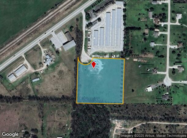
182 White Rock Rd
Springfield, MO
White Estates
07-0.7-36-000-000-014.003
LOT 3 WHITE ESTATES
Agriculturalland
Christian
X
Missouri
29043C0007D
3
2023
5 AC
2024
West Christian County
020101
Springfield
1,200 SF
DEMOGRAPHICS near 182 White Rock Rd
1 Mile
3 Mile
5 Mile
2024 Total Population
330
11,887
27,620
2029 Population
365
12,616
29,395
Pop Growth 2024-2029
+ 10.61%
+ 6.13%
+ 6.43%
Average Age
43
38
37
2024 Total Households
128
4,445
10,275
HH Growth 2024-2029
+ 10.94%
+ 6.34%
+ 6.57%
Median Household Inc
$80,172
$72,600
$66,237
Avg Household Size
2.60
2.60
2.70
2024 Avg HH Vehicles
3.00
2.00
2.00
Median Home Value
$225,000
$188,939
$183,155
Median Year Built
1991
1992
1994
Nearby Places
Map Layers
Map Styles
 Street
 Aerial
- Restaurants
- Banks
- Shops
- Fitness
- Groceries
PUBLIC TRANSPORTATION
AIRPORT
Springfield-Branson Ntl
DRIVE
WALK
Distance
Springfield-Branson Ntl
35 min
18.0 mi
Nearby Properties
Address
Land Use
TOTAL SIZE
Lot Size
Zoning
Address
Land Use
TOTAL SIZE
Lot Size
Zoning
5.24 AC
Address
Land Use
TOTAL SIZE
Lot Size
Zoning
3.31 AC
INC
Address
Land Use
TOTAL SIZE
Lot Size
Zoning
38,069 SF
3.10 AC
INC
Address
Land Use
TOTAL SIZE
Lot Size
Zoning
5,815 SF
1.45 AC
INC
Address
Land Use
TOTAL SIZE
Lot Size
Zoning
1,200 SF
6 AC
Address
Land Use
TOTAL SIZE
Lot Size
Zoning
1.82 AC
INC.
Address
Land Use
TOTAL SIZE
Lot Size
Zoning
10,750 SF
3.23 AC
INC
Address
Land Use
TOTAL SIZE
Lot Size
Zoning
1.87 AC
INC
Address
Land Use
TOTAL SIZE
Lot Size
Zoning
1.60 AC
INC
Address
Land Use
TOTAL SIZE
Lot Size
Zoning
1.50 AC
INC
Address
Land Use
TOTAL SIZE
Lot Size
Zoning
7,988 SF
0.79 AC
INC
Address
Land Use
TOTAL SIZE
Lot Size
Zoning
9,112 SF
1.44 AC
Address
Land Use
TOTAL SIZE
Lot Size
Zoning
1,712 SF
2.05 AC
INC.
Address
Land Use
TOTAL SIZE
Lot Size
Zoning
9,200 SF
0.74 AC
INC
Address
Land Use
TOTAL SIZE
Lot Size
Zoning
1.41 AC
INC
Address
Land Use
TOTAL SIZE
Lot Size
Zoning
41,658 SF
2.97 AC
INC
Address
Land Use
TOTAL SIZE
Lot Size
Zoning
6,188 SF
1.79 AC
INC
Address
Land Use
TOTAL SIZE
Lot Size
Zoning
Address
Land Use
TOTAL SIZE
Lot Size
Zoning
1.74 AC
INC
Address
Land Use
TOTAL SIZE
Lot Size
Zoning
Address
Land Use
TOTAL SIZE
Lot Size
Zoning
15,342 SF
127.80 AC
Address
Land Use
TOTAL SIZE
Lot Size
Zoning
0.94 AC
INC
Address
Land Use
TOTAL SIZE
Lot Size
Zoning
4,680 SF
1.07 AC
INC
Address
Land Use
TOTAL SIZE
Lot Size
Zoning
2,015 SF
1 AC
INC
Address
Land Use
TOTAL SIZE
Lot Size
Zoning
4,420 SF
1.41 AC
INC
Address
Land Use
TOTAL SIZE
Lot Size
Zoning
15,176 SF
0.51 AC
INC
Address
Land Use
TOTAL SIZE
Lot Size
Zoning
2,409 SF
1.50 AC
INC
Address
Land Use
TOTAL SIZE
Lot Size
Zoning
13,380 SF
1.02 AC
INC
Address
Land Use
TOTAL SIZE
Lot Size
Zoning
15,176 SF
0.86 AC
INC
Address
Land Use
TOTAL SIZE
Lot Size
Zoning
6,463 SF
1.01 AC
INC
The World's #1 Commercial Real Estate Marketplace
Connect with us
© 2025 CoStar Group
The information above has been obtained from sources believed reliable. While we do not doubt its accuracy we have not verified it and make no guarantee, warranty or representation about it. It is your responsibility to independently confirm its accuracy and completeness. Any projections, opinions, assumptions, or estimates used are for example only and do not represent the current or future performance of the property. The value of this transaction to you depends on tax and other factors which should be evaluated by your tax, financial, and legal advisors. You and your advisors should conduct a careful, independent investigation of the property to determine to your satisfaction the suitability of the property for your needs.