Property Record
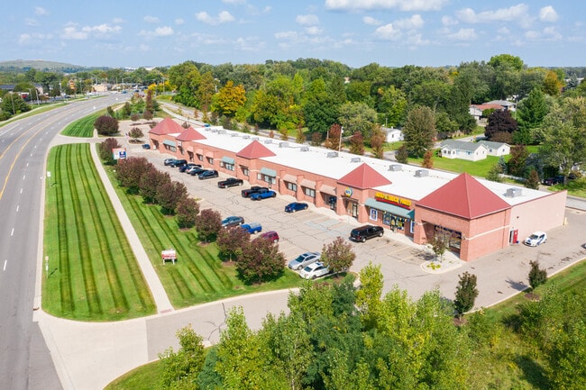
1821 N Perry St, Pontiac, MI 48340


NEARBY LISTINGS FOR SALE OR LEASE
Property Detail
1821 N Perry St
14-15-226-007
T3N, R10E, SEC 15 PART OF NE 1/4 BEG AT PT DIST N 89-59-35 E 14.60 FT & S 27-20-15 W 805.16 FT FROM NE SEC COR, TH ALG CURVE
Regionalshoppingcenterormallwithanchorstore
Oakland
X
Michigan
26125C0367F
4.82 AC
2024
Pontiac
2025
Detroit
141002
Detroit-Warren-Dearborn, MI
26,478 SF
DEMOGRAPHICS near 1821 N Perry St
1 Mile
3 Mile
5 Mile
2024 Total Population
6,358
54,014
156,663
2029 Population
6,341
53,809
156,220
Pop Growth 2024-2029
(0.27%)
(0.38%)
(0.28%)
Average Age
37
37
39
2024 Total Households
2,853
20,759
61,999
HH Growth 2024-2029
(0.63%)
(0.45%)
(0.33%)
Median Household Inc
$52,432
$51,009
$67,732
Avg Household Size
2.10
2.40
2.40
2024 Avg HH Vehicles
2.00
2.00
2.00
Median Home Value
$143,579
$137,883
$263,878
Median Year Built
1975
1972
1975
Nearby Places
Map Layers
Map Styles
 Street
 Aerial
- Restaurants
- Banks
- Shops
- Fitness
- Groceries
PUBLIC TRANSPORTATION
COMMUTER RAIL
DRIVE
WALK
Distance
9 min
4.1 mi
AIRPORT
Bishop International
DRIVE
WALK
Distance
Bishop International
55 min
39.0 mi
Windsor International
DRIVE
WALK
Distance
Windsor International
60 min
40.1 mi
Detroit Metro Wayne County
DRIVE
WALK
Distance
Detroit Metro Wayne County
64 min
49.7 mi
SALE & LEASE HISTORY
LISTING DATE
SALE/LEASE

Sep 25, 2016
For Lease
Sep 16, 2020
For Sale
Oct 07, 2024
For Sale
Nearby Properties
Address
Land Use
TOTAL SIZE
Lot Size
Zoning
Address
Land Use
TOTAL SIZE
Lot Size
Zoning
7,879,586 SF
457.68 AC
TR
Address
Land Use
TOTAL SIZE
Lot Size
Zoning
2,734,739 SF
80.39 AC
Address
Land Use
TOTAL SIZE
Lot Size
Zoning
671,780 SF
Address
Land Use
TOTAL SIZE
Lot Size
Zoning
238,755 SF
Address
Land Use
TOTAL SIZE
Lot Size
Zoning
715,400 SF
Address
Land Use
TOTAL SIZE
Lot Size
Zoning
316,358 SF
20.89 AC
P
Address
Land Use
TOTAL SIZE
Lot Size
Zoning
527,000 SF
36.03 AC
Address
Land Use
TOTAL SIZE
Lot Size
Zoning
453,700 SF
Address
Land Use
TOTAL SIZE
Lot Size
Zoning
404,427 SF
28.15 AC
TR
Address
Land Use
TOTAL SIZE
Lot Size
Zoning
430,338 SF
46.09 AC
Address
Land Use
TOTAL SIZE
Lot Size
Zoning
238,755 SF
18.12 AC
Address
Land Use
TOTAL SIZE
Lot Size
Zoning
1,771,589 SF
96.73 AC
Address
Land Use
TOTAL SIZE
Lot Size
Zoning
337,992 SF
18.96 AC
TR
Address
Land Use
TOTAL SIZE
Lot Size
Zoning
247,500 SF
Address
Land Use
TOTAL SIZE
Lot Size
Zoning
6,255,758 SF
223.95 AC
Address
Land Use
TOTAL SIZE
Lot Size
Zoning
6,255,758 SF
233.05 AC
II
Address
Land Use
TOTAL SIZE
Lot Size
Zoning
246,150 SF
26.64 AC
TR
Address
Land Use
TOTAL SIZE
Lot Size
Zoning
487,797 SF
34.74 AC
TR
Address
Land Use
TOTAL SIZE
Lot Size
Zoning
278,387 SF
43.37 AC
Address
Land Use
TOTAL SIZE
Lot Size
Zoning
131,817 SF
67 AC
SP
Address
Land Use
TOTAL SIZE
Lot Size
Zoning
214,772 SF
Address
Land Use
TOTAL SIZE
Lot Size
Zoning
337,992 SF
Address
Land Use
TOTAL SIZE
Lot Size
Zoning
430,338 SF
43.22 AC
Address
Land Use
TOTAL SIZE
Lot Size
Zoning
280,000 SF
Address
Land Use
TOTAL SIZE
Lot Size
Zoning
213,112 SF
12.17 AC
I1
Address
Land Use
TOTAL SIZE
Lot Size
Zoning
144,349 SF
12.42 AC
SP
Address
Land Use
TOTAL SIZE
Lot Size
Zoning
210,000 SF
14.46 AC
TR
Address
Land Use
TOTAL SIZE
Lot Size
Zoning
455,045 SF
23.47 AC
I1
Address
Land Use
TOTAL SIZE
Lot Size
Zoning
101,568 SF
8.06 AC
Address
Land Use
TOTAL SIZE
Lot Size
Zoning
172,076 SF
11.18 AC
The World's #1 Commercial Real Estate Marketplace
Connect with us
© 2026 CoStar Group
The information above has been obtained from sources believed reliable. While we do not doubt its accuracy we have not verified it and make no guarantee, warranty or representation about it. It is your responsibility to independently confirm its accuracy and completeness. Any projections, opinions, assumptions, or estimates used are for example only and do not represent the current or future performance of the property. The value of this transaction to you depends on tax and other factors which should be evaluated by your tax, financial, and legal advisors. You and your advisors should conduct a careful, independent investigation of the property to determine to your satisfaction the suitability of the property for your needs.