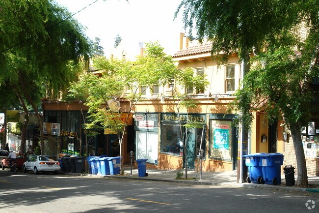
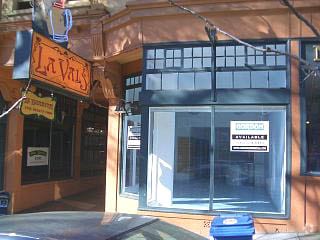
Property Record
1820 Euclid Ave, Berkeley, CA 94709
NEARBY LISTINGS FOR SALE OR LEASE
Property Detail
1820 Euclid Ave
Oakland-Fremont-Berkeley, CA
Daleys Scenic Park
058-2191-002-00
PORTION LOTS23-28
Storesoffices
Alameda
X
California
06013C0244G
23-28
2024
0.29 AC
2025
Berkeley
422500
East Bay/Oakland
18,667 SF
DEMOGRAPHICS near 1820 Euclid Ave
1 Mile
3 Mile
5 Mile
2024 Total Population
52,218
197,298
366,911
2029 Population
50,993
191,919
358,290
Pop Growth 2024-2029
(2.35%)
(2.73%)
(2.35%)
Average Age
33
39
41
2024 Total Households
18,124
78,561
152,773
HH Growth 2024-2029
(2.22%)
(2.85%)
(2.43%)
Median Household Inc
$66,644
$109,972
$110,656
Avg Household Size
2.10
2.20
2.20
2024 Avg HH Vehicles
1.00
1.00
1.00
Median Home Value
$1,090,934
$1,092,803
$1,076,765
Median Year Built
1957
1949
1954
Nearby Places
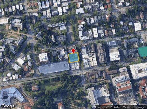
Map Layers
Map Styles
 Street
 Aerial
- Restaurants
- Banks
- Shops
- Fitness
- Groceries
PUBLIC TRANSPORTATION
TRANSIT/SUBWAY
Downtown Berkeley Station (Fremont - Richmond - Bay Area Rapid Transit (BART), Richmond - Millbrae - Bay Area Rapid Transit (BART))
DRIVE
WALK
Distance
Downtown Berkeley Station (Fremont - Richmond - Bay Area Rapid Transit (BART), Richmond - Millbrae - Bay Area Rapid Transit (BART))
3 min
14 min
0.7 mi
COMMUTER RAIL
DRIVE
WALK
Distance
8 min
2.4 mi
DRIVE
WALK
Distance
12 min
3.8 mi
AIRPORT
Metro Oakland International
DRIVE
WALK
Distance
Metro Oakland International
27 min
15.3 mi
San Francisco International
DRIVE
WALK
Distance
San Francisco International
43 min
25.7 mi
Nearby Properties
Address
Land Use
TOTAL SIZE
Lot Size
Zoning
Address
Land Use
TOTAL SIZE
Lot Size
Zoning
358,014 SF
5.03 AC
Address
Land Use
TOTAL SIZE
Lot Size
Zoning
167,071 SF
0.70 AC
Address
Land Use
TOTAL SIZE
Lot Size
Zoning
540,434 SF
14.37 AC
Address
Land Use
TOTAL SIZE
Lot Size
Zoning
395,549 SF
17.05 AC
Address
Land Use
TOTAL SIZE
Lot Size
Zoning
250,642 SF
17.05 AC
Address
Land Use
TOTAL SIZE
Lot Size
Zoning
240,633 SF
1.59 AC
Address
Land Use
TOTAL SIZE
Lot Size
Zoning
261,134 SF
2.23 AC
Address
Land Use
TOTAL SIZE
Lot Size
Zoning
169,157 SF
10.20 AC
Address
Land Use
TOTAL SIZE
Lot Size
Zoning
224,160 SF
5.03 AC
Address
Land Use
TOTAL SIZE
Lot Size
Zoning
4.77 AC
Address
Land Use
TOTAL SIZE
Lot Size
Zoning
309,451 SF
0.87 AC
Address
Land Use
TOTAL SIZE
Lot Size
Zoning
238,118 SF
2.14 AC
Address
Land Use
TOTAL SIZE
Lot Size
Zoning
60,670 SF
1.57 AC
Address
Land Use
TOTAL SIZE
Lot Size
Zoning
196,209 SF
3.14 AC
Address
Land Use
TOTAL SIZE
Lot Size
Zoning
123,750 SF
0.81 AC
Address
Land Use
TOTAL SIZE
Lot Size
Zoning
270,667 SF
2.76 AC
Address
Land Use
TOTAL SIZE
Lot Size
Zoning
254,000 SF
1.71 AC
Address
Land Use
TOTAL SIZE
Lot Size
Zoning
127,260 SF
5 AC
I
Address
Land Use
TOTAL SIZE
Lot Size
Zoning
203,859 SF
2.35 AC
Address
Land Use
TOTAL SIZE
Lot Size
Zoning
131,862 SF
1.19 AC
Address
Land Use
TOTAL SIZE
Lot Size
Zoning
166,731 SF
0.54 AC
Address
Land Use
TOTAL SIZE
Lot Size
Zoning
180,977 SF
1.21 AC
Address
Land Use
TOTAL SIZE
Lot Size
Zoning
111,710 SF
15.47 AC
Address
Land Use
TOTAL SIZE
Lot Size
Zoning
134,608 SF
1.15 AC
Address
Land Use
TOTAL SIZE
Lot Size
Zoning
86,144 SF
0.52 AC
Address
Land Use
TOTAL SIZE
Lot Size
Zoning
126,087 SF
2.29 AC
Address
Land Use
TOTAL SIZE
Lot Size
Zoning
137,102 SF
3.63 AC
Address
Land Use
TOTAL SIZE
Lot Size
Zoning
159,705 SF
1.64 AC
COMM
Address
Land Use
TOTAL SIZE
Lot Size
Zoning
65,839 SF
0.62 AC
C2
Address
Land Use
TOTAL SIZE
Lot Size
Zoning
12.31 AC
The World's #1 Commercial Real Estate Marketplace
Connect with us
© 2026 CoStar Group
The information above has been obtained from sources believed reliable. While we do not doubt its accuracy we have not verified it and make no guarantee, warranty or representation about it. It is your responsibility to independently confirm its accuracy and completeness. Any projections, opinions, assumptions, or estimates used are for example only and do not represent the current or future performance of the property. The value of this transaction to you depends on tax and other factors which should be evaluated by your tax, financial, and legal advisors. You and your advisors should conduct a careful, independent investigation of the property to determine to your satisfaction the suitability of the property for your needs.