Property Record
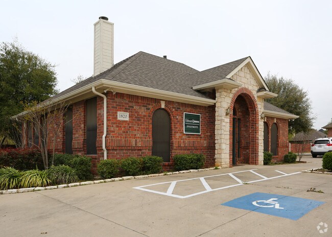
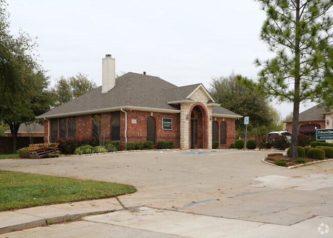
1820 Hurstview Dr, Hurst, TX 76054

Property Detail
1820 Hurstview Dr
Dallas-Fort Worth-Arlington, TX
SHADY OAKS ADDITION-HURST BLOCK 44 LOT BR4A
07511787
Tarrant
Commercialnec
Texas
B and X Area of moderate flood hazard, usually the area between the limits of the 100-year and 500-year floods.
br4a
2023
0.21 AC
2025
HEB/Mid-Cities
113613
Dallas/Ft Worth
1,200 SF
NEARBY LISTINGS FOR SALE OR LEASE
DEMOGRAPHICS near 1820 Hurstview Dr
1 mile
3 mile
5 mile
2024 Total Population
8,685
119,659
268,467
2029 Population
9,080
125,761
281,560
Pop Growth 2024-2029
+ 4.55%
+ 5.10%
+ 4.88%
Average Age
44
40
40
2024 Total Households
3,547
47,968
103,688
HH Growth 2024-2029
+ 4.76%
+ 5.23%
+ 5.01%
Median Household Inc
$102,923
$80,973
$91,635
Avg Household Size
2.40
2.40
2.50
2024 Avg HH Vehicles
2.00
2.00
2.00
Median Home Value
$380,891
$359,169
$370,218
Median Year Built
1978
1980
1984
Nearby Places
Map Layers
Map Styles
 Street
 Aerial
Transit
 Traffic
 Biking
Places
Listings with unknown addresses are not visible on the map
- Restaurants
- Banks
- Shops
- Fitness
- Groceries
PUBLIC TRANSPORTATION
COMMUTER RAIL
Drive
Walk
Distance
11 min
4.4 mi
Drive
Walk
Distance
8 min
4.4 mi
AIRPORT
Dallas-Fort Worth International
Drive
Walk
Distance
Dallas-Fort Worth International
22 min
13.8 mi
Dallas Love Field
Drive
Walk
Distance
Dallas Love Field
33 min
22.5 mi
Nearby Properties
Address
Land Use
TOTAL SIZE
Lot Size
Zoning
Address
Land Use
TOTAL SIZE
Lot Size
Zoning
1,300,314 SF
40.15 AC
Address
Land Use
TOTAL SIZE
Lot Size
Zoning
285,754 SF
69.41 AC
Address
Land Use
TOTAL SIZE
Lot Size
Zoning
356,000 SF
39.44 AC
Address
Land Use
TOTAL SIZE
Lot Size
Zoning
521,150 SF
92.05 AC
Address
Land Use
TOTAL SIZE
Lot Size
Zoning
388,447 SF
9.47 AC
Address
Land Use
TOTAL SIZE
Lot Size
Zoning
174,596 SF
11.91 AC
Address
Land Use
TOTAL SIZE
Lot Size
Zoning
172,000 SF
6.34 AC
Address
Land Use
TOTAL SIZE
Lot Size
Zoning
318,602 SF
9.90 AC
Address
Land Use
TOTAL SIZE
Lot Size
Zoning
223,131 SF
12.50 AC
Address
Land Use
TOTAL SIZE
Lot Size
Zoning
348,941 SF
22.25 AC
Address
Land Use
TOTAL SIZE
Lot Size
Zoning
240,154 SF
6.92 AC
Address
Land Use
TOTAL SIZE
Lot Size
Zoning
79,244 SF
54.50 AC
Address
Land Use
TOTAL SIZE
Lot Size
Zoning
236,701 SF
15.96 AC
Address
Land Use
TOTAL SIZE
Lot Size
Zoning
237,551 SF
4.39 AC
Address
Land Use
TOTAL SIZE
Lot Size
Zoning
208,238 SF
12.55 AC
Address
Land Use
TOTAL SIZE
Lot Size
Zoning
173,068 SF
15.55 AC
Address
Land Use
TOTAL SIZE
Lot Size
Zoning
232,295 SF
21.49 AC
Address
Land Use
TOTAL SIZE
Lot Size
Zoning
197,964 SF
4.57 AC
Address
Land Use
TOTAL SIZE
Lot Size
Zoning
235,530 SF
13.21 AC
Address
Land Use
TOTAL SIZE
Lot Size
Zoning
194,625 SF
15.07 AC
Address
Land Use
TOTAL SIZE
Lot Size
Zoning
221,591 SF
14.50 AC
Address
Land Use
TOTAL SIZE
Lot Size
Zoning
220,650 SF
3.03 AC
Address
Land Use
TOTAL SIZE
Lot Size
Zoning
161,332 SF
8.56 AC
Address
Land Use
TOTAL SIZE
Lot Size
Zoning
151,023 SF
5.18 AC
Address
Land Use
TOTAL SIZE
Lot Size
Zoning
160,608 SF
8.29 AC
Address
Land Use
TOTAL SIZE
Lot Size
Zoning
262,233 SF
16.13 AC
Address
Land Use
TOTAL SIZE
Lot Size
Zoning
192,482 SF
9.77 AC
Address
Land Use
TOTAL SIZE
Lot Size
Zoning
199,744 SF
9.99 AC
Address
Land Use
TOTAL SIZE
Lot Size
Zoning
165,762 SF
10.71 AC
Address
Land Use
TOTAL SIZE
Lot Size
Zoning
201,144 SF
9.77 AC
The World's #1 Commercial Real Estate Marketplace
Connect with us
© 2026 CoStar Group
The information above has been obtained from sources believed reliable. While we do not doubt its accuracy we have not verified it and make no guarantee, warranty or representation about it. It is your responsibility to independently confirm its accuracy and completeness. Any projections, opinions, assumptions, or estimates used are for example only and do not represent the current or future performance of the property. The value of this transaction to you depends on tax and other factors which should be evaluated by your tax, financial, and legal advisors. You and your advisors should conduct a careful, independent investigation of the property to determine to your satisfaction the suitability of the property for your needs.