Property Record
1820 N Brown Rd, Lawrenceville, GA 30043
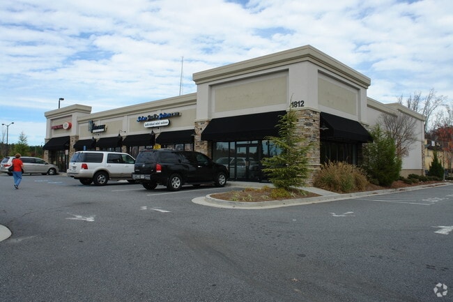

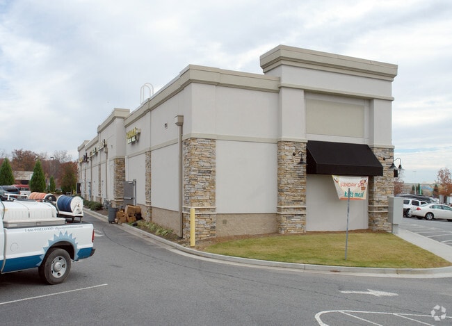
Property Detail
1820 N Brown Rd
7-115-042
BLCOK D NORTH BROWN RD
Stripcommercialcenter
Gwinnett
C2
Georgia
B and X Area of moderate flood hazard, usually the area between the limits of the 100-year and 500-year floods.
115
0
1.73 AC
2025
Gwinnett Mall/Duluth
050560
Atlanta
10,572 SF
Atlanta-Sandy Springs-Roswell, GA
NEARBY LISTINGS FOR SALE OR LEASE
DEMOGRAPHICS near 1820 N Brown Rd
1 mile
3 mile
5 mile
2025 Total Population
8,399
84,864
245,625
2030 Population
8,927
88,714
256,378
Pop Growth 2025-2030
+ 6.29%
+ 4.54%
+ 4.38%
Average Age
39
38
37
2025 Total Households
2,962
29,939
86,472
HH Growth 2025-2030
+ 6.14%
+ 4.61%
+ 4.49%
Median Household Inc
$82,291
$83,873
$79,267
Avg Household Size
2.70
2.80
2.80
2025 Avg HH Vehicles
2.00
2.00
2.00
Median Home Value
$570,694
$396,107
$383,948
Median Year Built
2005
1996
1995
Nearby Places
Map Layers
Map Styles
 Street
 Aerial
Layers
 Traffic
 Biking
Places
Listings with unknown addresses are not visible on the map
- Restaurants
- Banks
- Shops
- Fitness
- Groceries
PUBLIC TRANSPORTATION
AIRPORT
Hartsfield - Jackson Atlanta International
Drive
Walk
Distance
Hartsfield - Jackson Atlanta International
50 min
36.4 mi
SALE & LEASE HISTORY
LISTING DATE
SALE/LEASE

Sep 24, 2016
For Lease
Nearby Properties
Address
Land Use
TOTAL SIZE
Lot Size
Zoning
Address
Land Use
TOTAL SIZE
Lot Size
Zoning
1,457,980 SF
98.78 AC
MUR
Address
Land Use
TOTAL SIZE
Lot Size
Zoning
594,977 SF
47.90 AC
RM13
Address
Land Use
TOTAL SIZE
Lot Size
Zoning
482,658 SF
17.05 AC
MUR
Address
Land Use
TOTAL SIZE
Lot Size
Zoning
563,525 SF
47.80 AC
RM13
Address
Land Use
TOTAL SIZE
Lot Size
Zoning
628,779 SF
97.15 AC
M1
Address
Land Use
TOTAL SIZE
Lot Size
Zoning
1,588,972 SF
112.95 AC
C2
Address
Land Use
TOTAL SIZE
Lot Size
Zoning
441,836 SF
35.71 AC
RM13
Address
Land Use
TOTAL SIZE
Lot Size
Zoning
684,224 SF
77.07 AC
OI
Address
Land Use
TOTAL SIZE
Lot Size
Zoning
461,985 SF
56.76 AC
RM10
Address
Land Use
TOTAL SIZE
Lot Size
Zoning
365,821 SF
17.08 AC
RM24
Address
Land Use
TOTAL SIZE
Lot Size
Zoning
404,176 SF
32.67 AC
M2
Address
Land Use
TOTAL SIZE
Lot Size
Zoning
393,913 SF
25.93 AC
RM13
Address
Land Use
TOTAL SIZE
Lot Size
Zoning
348,681 SF
35.52 AC
RM10
Address
Land Use
TOTAL SIZE
Lot Size
Zoning
440,998 SF
35.04 AC
RM
Address
Land Use
TOTAL SIZE
Lot Size
Zoning
584,576 SF
38.60 AC
RM13
Address
Land Use
TOTAL SIZE
Lot Size
Zoning
280,454 SF
19.97 AC
MUR
Address
Land Use
TOTAL SIZE
Lot Size
Zoning
471,807 SF
69.50 AC
R100
Address
Land Use
TOTAL SIZE
Lot Size
Zoning
275,136 SF
44.76 AC
RM13
Address
Land Use
TOTAL SIZE
Lot Size
Zoning
285,038 SF
1.93 AC
MUR
Address
Land Use
TOTAL SIZE
Lot Size
Zoning
340,573 SF
22.12 AC
RM13
Address
Land Use
TOTAL SIZE
Lot Size
Zoning
314,338 SF
28.83 AC
RM13
Address
Land Use
TOTAL SIZE
Lot Size
Zoning
587,415 SF
4.32 AC
HRR
Address
Land Use
TOTAL SIZE
Lot Size
Zoning
316,443 SF
30.15 AC
RM13
Address
Land Use
TOTAL SIZE
Lot Size
Zoning
304,276 SF
14.90 AC
MUR
Address
Land Use
TOTAL SIZE
Lot Size
Zoning
315,806 SF
13.03 AC
MUR
Address
Land Use
TOTAL SIZE
Lot Size
Zoning
336,554 SF
30.40 AC
RM
Address
Land Use
TOTAL SIZE
Lot Size
Zoning
303,275 SF
19.80 AC
RM13
Address
Land Use
TOTAL SIZE
Lot Size
Zoning
262,476 SF
20.51 AC
RM13
Address
Land Use
TOTAL SIZE
Lot Size
Zoning
377,960 SF
29.70 AC
RM13
Address
Land Use
TOTAL SIZE
Lot Size
Zoning
365,351 SF
30.70 AC
OI
The World's #1 Commercial Real Estate Marketplace
Connect with us
© 2026 CoStar Group
The information above has been obtained from sources believed reliable. While we do not doubt its accuracy we have not verified it and make no guarantee, warranty or representation about it. It is your responsibility to independently confirm its accuracy and completeness. Any projections, opinions, assumptions, or estimates used are for example only and do not represent the current or future performance of the property. The value of this transaction to you depends on tax and other factors which should be evaluated by your tax, financial, and legal advisors. You and your advisors should conduct a careful, independent investigation of the property to determine to your satisfaction the suitability of the property for your needs.