Property Record
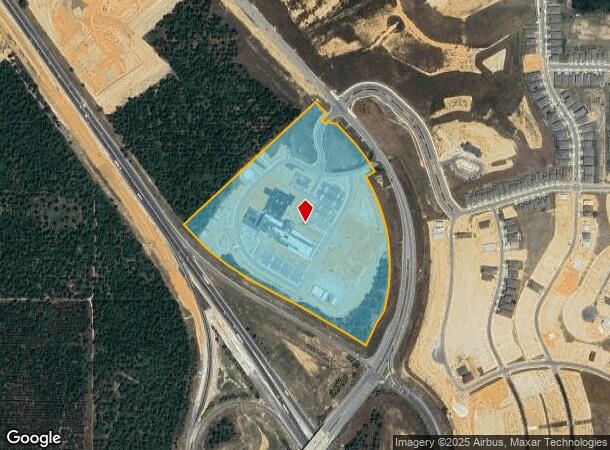
1820 N Hancock Rd, Minneola, FL 34715


NEARBY LISTINGS FOR SALE OR LEASE
Property Detail
1820 N Hancock Rd
Orlando
That Part Of Lake Highlands
Orlando-Kissimmee-Sanford, FL
THAT PART OF SECTION 4 TOWNSHIP 22 SOUTH RANGE 26 EAST AND THAT PART OF LAKE HIGHLANDS COMPANY PLAT PB 3 PG 24 DESCRIBED AS FOLLOWS: COMMENCE AT THE NORTHWEST CORNER OF SAID SECTION 4 THENCE SOUTH 89-27-26 EAST ALONG THE NORTH LINE OF THE NORTHWEST 1
04-22-26-0002-000-01000
Lake
Commercialacreage
Florida
2024
10
2026
30.07 AC
031301
Lake County
DEMOGRAPHICS near 1820 N Hancock Rd
1 Mile
3 Mile
5 Mile
2024 Total Population
2,027
29,293
66,185
2029 Population
2,465
34,804
77,882
Pop Growth 2024-2029
+ 21.61%
+ 18.81%
+ 17.67%
Average Age
39
40
41
2024 Total Households
688
10,192
23,960
HH Growth 2024-2029
+ 21.51%
+ 18.57%
+ 17.45%
Median Household Inc
$85,470
$82,600
$82,592
Avg Household Size
3.00
2.90
2.70
2024 Avg HH Vehicles
2.00
2.00
2.00
Median Home Value
$346,061
$339,153
$329,408
Median Year Built
2010
2005
2003
Nearby Places
- Restaurants
- Banks
- Shops
- Fitness
- Groceries
PUBLIC TRANSPORTATION
AIRPORT
Orlando International
DRIVE
WALK
Distance
Orlando International
58 min
46.7 mi
Freight Ports
Port of Tampa Bay
DRIVE
WALK
Distance
Port of Tampa Bay
111 min
86.5 mi
Nearby Properties
Address
Land Use
TOTAL SIZE
Lot Size
Zoning
Address
Land Use
TOTAL SIZE
Lot Size
Zoning
403,970 SF
30.99 AC
PUD
Address
Land Use
TOTAL SIZE
Lot Size
Zoning
337,218 SF
16.38 AC
Address
Land Use
TOTAL SIZE
Lot Size
Zoning
199.94 AC
PUDR
Address
Land Use
TOTAL SIZE
Lot Size
Zoning
83.86 AC
Address
Land Use
TOTAL SIZE
Lot Size
Zoning
2,000 SF
45.35 AC
PFD
Address
Land Use
TOTAL SIZE
Lot Size
Zoning
2,000 SF
63.78 AC
Address
Land Use
TOTAL SIZE
Lot Size
Zoning
80,774 SF
6.61 AC
Address
Land Use
TOTAL SIZE
Lot Size
Zoning
128,174 SF
9.88 AC
B1
Address
Land Use
TOTAL SIZE
Lot Size
Zoning
80,546 SF
6.75 AC
B1
Address
Land Use
TOTAL SIZE
Lot Size
Zoning
62,415 SF
10.19 AC
Address
Land Use
TOTAL SIZE
Lot Size
Zoning
74,375 SF
6.69 AC
Address
Land Use
TOTAL SIZE
Lot Size
Zoning
123,387 SF
47.51 AC
R3
Address
Land Use
TOTAL SIZE
Lot Size
Zoning
55,754 SF
9.14 AC
R2
Address
Land Use
TOTAL SIZE
Lot Size
Zoning
2,000 SF
19.45 AC
Address
Land Use
TOTAL SIZE
Lot Size
Zoning
30,926 SF
0.38 AC
Address
Land Use
TOTAL SIZE
Lot Size
Zoning
73,040 SF
4.89 AC
I1
Address
Land Use
TOTAL SIZE
Lot Size
Zoning
77,712 SF
5.38 AC
PUD
Address
Land Use
TOTAL SIZE
Lot Size
Zoning
40,798 SF
7.51 AC
P
Address
Land Use
TOTAL SIZE
Lot Size
Zoning
2,000 SF
4.49 AC
R1
Address
Land Use
TOTAL SIZE
Lot Size
Zoning
339.82 AC
Address
Land Use
TOTAL SIZE
Lot Size
Zoning
28,836 SF
2.34 AC
Address
Land Use
TOTAL SIZE
Lot Size
Zoning
28,560 SF
9.89 AC
PUD
Address
Land Use
TOTAL SIZE
Lot Size
Zoning
14,106 SF
1.69 AC
RSF2
Address
Land Use
TOTAL SIZE
Lot Size
Zoning
2,000 SF
17.63 AC
P
Address
Land Use
TOTAL SIZE
Lot Size
Zoning
30,224 SF
96.75 AC
CFD
Address
Land Use
TOTAL SIZE
Lot Size
Zoning
31,018 SF
2.88 AC
B1
Address
Land Use
TOTAL SIZE
Lot Size
Zoning
51,272 SF
4.91 AC
C2
Address
Land Use
TOTAL SIZE
Lot Size
Zoning
36,768 SF
3.59 AC
P
Address
Land Use
TOTAL SIZE
Lot Size
Zoning
23,504 SF
11.97 AC
CFD
The World's #1 Commercial Real Estate Marketplace
Connect with us
© 2025 CoStar Group
The information above has been obtained from sources believed reliable. While we do not doubt its accuracy we have not verified it and make no guarantee, warranty or representation about it. It is your responsibility to independently confirm its accuracy and completeness. Any projections, opinions, assumptions, or estimates used are for example only and do not represent the current or future performance of the property. The value of this transaction to you depends on tax and other factors which should be evaluated by your tax, financial, and legal advisors. You and your advisors should conduct a careful, independent investigation of the property to determine to your satisfaction the suitability of the property for your needs.