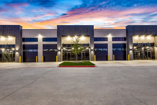
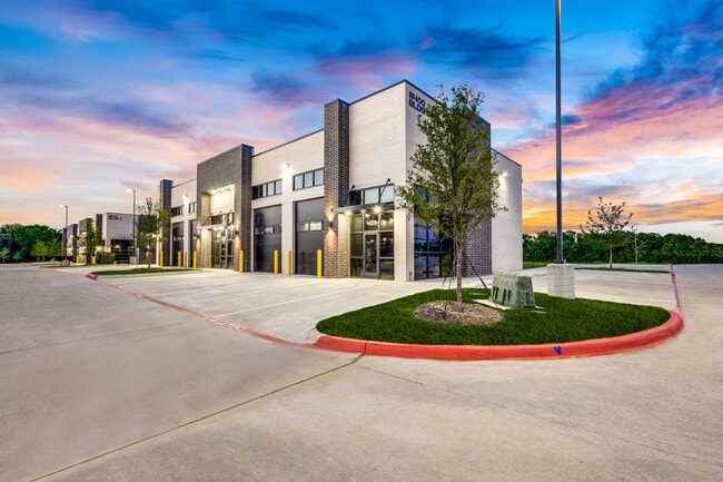
Property Record
1820 N Highway 78, Wylie, TX 75098

Current Lease Availabilities
NEARBY LISTINGS FOR SALE OR LEASE
Property Detail
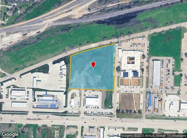
1820 N Highway 78
Dallas/Ft Worth
Woodlake Village (Cwy)
Dallas-Fort Worth-Arlington, TX
WOODLAKE VILLAGE, BLK A, LOT 6; ( REPLAT )
R-2381-00A-0060-1
Collin
Vacantlandnec
Texas
2024
6
2025
4.74 AC
031308
Plano
DEMOGRAPHICS near 1820 N Highway 78
1 Mile
3 Mile
5 Mile
2024 Total Population
5,019
44,531
114,199
2029 Population
5,790
50,981
130,421
Pop Growth 2024-2029
+ 15.36%
+ 14.48%
+ 14.21%
Average Age
38
37
37
2024 Total Households
1,667
14,310
36,199
HH Growth 2024-2029
+ 15.60%
+ 14.66%
+ 14.44%
Median Household Inc
$119,032
$118,693
$125,047
Avg Household Size
3.00
3.10
3.10
2024 Avg HH Vehicles
2.00
2.00
2.00
Median Home Value
$385,010
$413,460
$450,932
Median Year Built
2007
2006
2007
Nearby Places
Map Layers
Map Styles
 Street
 Aerial
- Restaurants
- Banks
- Shops
- Fitness
- Groceries
PUBLIC TRANSPORTATION
AIRPORT
Dallas Love Field
DRIVE
WALK
Distance
Dallas Love Field
46 min
31.0 mi
Freight Ports
Port of Shreveport
DRIVE
WALK
Distance
Port of Shreveport
223 min
195.6 mi
Nearby Properties
Address
Land Use
TOTAL SIZE
Lot Size
Zoning
Address
Land Use
TOTAL SIZE
Lot Size
Zoning
603,573 SF
58.20 AC
Address
Land Use
TOTAL SIZE
Lot Size
Zoning
266,957 SF
11.34 AC
MFR
Address
Land Use
TOTAL SIZE
Lot Size
Zoning
393,054 SF
55.95 AC
Address
Land Use
TOTAL SIZE
Lot Size
Zoning
257,718 SF
13.10 AC
RESIDENTIA
Address
Land Use
TOTAL SIZE
Lot Size
Zoning
274,329 SF
44.89 AC
Address
Land Use
TOTAL SIZE
Lot Size
Zoning
274,416 SF
18.40 AC
PD
Address
Land Use
TOTAL SIZE
Lot Size
Zoning
85,393 SF
10 AC
Address
Land Use
TOTAL SIZE
Lot Size
Zoning
132,306 SF
7.85 AC
MF
Address
Land Use
TOTAL SIZE
Lot Size
Zoning
77,225 SF
9.59 AC
Address
Land Use
TOTAL SIZE
Lot Size
Zoning
106,866 SF
15.69 AC
Address
Land Use
TOTAL SIZE
Lot Size
Zoning
97,898 SF
10.82 AC
Address
Land Use
TOTAL SIZE
Lot Size
Zoning
203,192 SF
17.69 AC
Address
Land Use
TOTAL SIZE
Lot Size
Zoning
128,849 SF
7.70 AC
Address
Land Use
TOTAL SIZE
Lot Size
Zoning
141,396 SF
8.40 AC
NS
Address
Land Use
TOTAL SIZE
Lot Size
Zoning
304,978 SF
81.51 AC
Address
Land Use
TOTAL SIZE
Lot Size
Zoning
88,580 SF
38.80 AC
Address
Land Use
TOTAL SIZE
Lot Size
Zoning
145,635 SF
12.15 AC
Address
Land Use
TOTAL SIZE
Lot Size
Zoning
125,000 SF
22.42 AC
FLOOD
Address
Land Use
TOTAL SIZE
Lot Size
Zoning
91,585 SF
4.33 AC
I
Address
Land Use
TOTAL SIZE
Lot Size
Zoning
151,759 SF
14.02 AC
MF
Address
Land Use
TOTAL SIZE
Lot Size
Zoning
267,312 SF
10.05 AC
Address
Land Use
TOTAL SIZE
Lot Size
Zoning
54,240 SF
2.12 AC
MF
Address
Land Use
TOTAL SIZE
Lot Size
Zoning
33,638 SF
7.14 AC
AG
Address
Land Use
TOTAL SIZE
Lot Size
Zoning
67,031 SF
18.83 AC
Address
Land Use
TOTAL SIZE
Lot Size
Zoning
408,994 SF
33.67 AC
I
Address
Land Use
TOTAL SIZE
Lot Size
Zoning
94,981 SF
11.55 AC
Address
Land Use
TOTAL SIZE
Lot Size
Zoning
40,762 SF
4.70 AC
CR
Address
Land Use
TOTAL SIZE
Lot Size
Zoning
50,671 SF
2.48 AC
Address
Land Use
TOTAL SIZE
Lot Size
Zoning
108,582 SF
10 AC
Address
Land Use
TOTAL SIZE
Lot Size
Zoning
62,487 SF
7.25 AC
CR
The World's #1 Commercial Real Estate Marketplace
Connect with us
© 2026 CoStar Group
The information above has been obtained from sources believed reliable. While we do not doubt its accuracy we have not verified it and make no guarantee, warranty or representation about it. It is your responsibility to independently confirm its accuracy and completeness. Any projections, opinions, assumptions, or estimates used are for example only and do not represent the current or future performance of the property. The value of this transaction to you depends on tax and other factors which should be evaluated by your tax, financial, and legal advisors. You and your advisors should conduct a careful, independent investigation of the property to determine to your satisfaction the suitability of the property for your needs.