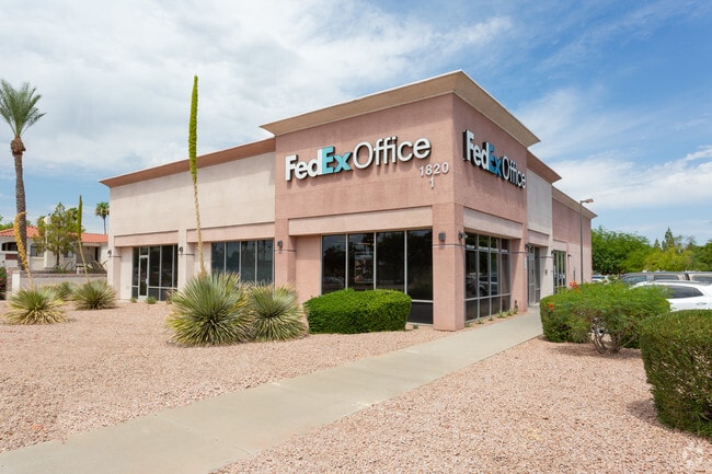
Property Record
1820 S Power Rd, Mesa, AZ 85206


NEARBY LISTINGS FOR SALE OR LEASE
Property Detail
1820 S Power Rd
141-54-019L
POR SE4 SEC 36 DAF COM SE COR SD SEC TH W 915.29F TH N 01D 24M W 244.68F TH NLY 749.62F TH N 43D 33M E 351.59F TH N 46D 26M W 65F POB TH ALG NELY LN 290F TH N43D 33M E 55F TH S 48D 12M E 36.78F TH N 4 1D 47M W 194.92F S 48D 12M E 50F TH S 41D 46M W 1
Storebuilding
Maricopa
X
Arizona
04013C2295L
0.86 AC
2025
Red Mountain/Mesa
2025
Phoenix
422639
Phoenix-Mesa-Chandler, AZ
6,544 SF
DEMOGRAPHICS near 1820 S Power Rd
1 Mile
3 Mile
5 Mile
2024 Total Population
8,142
113,123
304,591
2029 Population
8,793
123,358
330,992
Pop Growth 2024-2029
+ 8.00%
+ 9.05%
+ 8.67%
Average Age
39
44
42
2024 Total Households
3,139
46,182
117,849
HH Growth 2024-2029
+ 8.19%
+ 9.64%
+ 8.96%
Median Household Inc
$71,683
$67,656
$72,781
Avg Household Size
2.50
2.40
2.50
2024 Avg HH Vehicles
2.00
2.00
2.00
Median Home Value
$374,452
$317,138
$338,048
Median Year Built
1993
1992
1993
Nearby Places
Map Layers
Map Styles
 Street
 Aerial
- Restaurants
- Banks
- Shops
- Fitness
- Groceries
PUBLIC TRANSPORTATION
AIRPORT
Phoenix-Mesa Gateway
DRIVE
WALK
Distance
Phoenix-Mesa Gateway
11 min
6.3 mi
Phoenix Sky Harbor International
DRIVE
WALK
Distance
Phoenix Sky Harbor International
31 min
22.7 mi
Freight Ports
Port of San Diego
DRIVE
WALK
Distance
Port of San Diego
417 min
378.8 mi
Nearby Properties
Address
Land Use
TOTAL SIZE
Lot Size
Zoning
Address
Land Use
TOTAL SIZE
Lot Size
Zoning
184.86 AC
Address
Land Use
TOTAL SIZE
Lot Size
Zoning
1,522,034 SF
32.67 AC
C-N
Address
Land Use
TOTAL SIZE
Lot Size
Zoning
981,158 SF
43.42 AC
C-G
Address
Land Use
TOTAL SIZE
Lot Size
Zoning
93.03 AC
Address
Land Use
TOTAL SIZE
Lot Size
Zoning
403,171 SF
34.53 AC
PF
Address
Land Use
TOTAL SIZE
Lot Size
Zoning
4.60 AC
C-C
Address
Land Use
TOTAL SIZE
Lot Size
Zoning
441,928 SF
17.31 AC
RM3
Address
Land Use
TOTAL SIZE
Lot Size
Zoning
390,917 SF
15.82 AC
RM4
Address
Land Use
TOTAL SIZE
Lot Size
Zoning
461,845 SF
21.62 AC
LI
Address
Land Use
TOTAL SIZE
Lot Size
Zoning
274,993 SF
16.44 AC
Address
Land Use
TOTAL SIZE
Lot Size
Zoning
18.75 AC
PF
Address
Land Use
TOTAL SIZE
Lot Size
Zoning
711,933 SF
45.84 AC
Address
Land Use
TOTAL SIZE
Lot Size
Zoning
3.03 AC
C-C
Address
Land Use
TOTAL SIZE
Lot Size
Zoning
142,871 SF
40.83 AC
PF
Address
Land Use
TOTAL SIZE
Lot Size
Zoning
10.63 AC
Address
Land Use
TOTAL SIZE
Lot Size
Zoning
129,201 SF
24.65 AC
LI
Address
Land Use
TOTAL SIZE
Lot Size
Zoning
160,296 SF
33.63 AC
PF
Address
Land Use
TOTAL SIZE
Lot Size
Zoning
456,889 SF
25.99 AC
Address
Land Use
TOTAL SIZE
Lot Size
Zoning
269,763 SF
17.49 AC
M-H
Address
Land Use
TOTAL SIZE
Lot Size
Zoning
344,619 SF
13.85 AC
M-H
Address
Land Use
TOTAL SIZE
Lot Size
Zoning
425,158 SF
23.71 AC
M-H
Address
Land Use
TOTAL SIZE
Lot Size
Zoning
98,852 SF
1.23 AC
C-G
Address
Land Use
TOTAL SIZE
Lot Size
Zoning
224,633 SF
13.55 AC
M-M
Address
Land Use
TOTAL SIZE
Lot Size
Zoning
223,174 SF
11.32 AC
M-M
Address
Land Use
TOTAL SIZE
Lot Size
Zoning
307,545 SF
17.61 AC
M-H
Address
Land Use
TOTAL SIZE
Lot Size
Zoning
1.68 AC
Address
Land Use
TOTAL SIZE
Lot Size
Zoning
1.68 AC
Address
Land Use
TOTAL SIZE
Lot Size
Zoning
219,041 SF
5.71 AC
I-1
Address
Land Use
TOTAL SIZE
Lot Size
Zoning
7.82 AC
The World's #1 Commercial Real Estate Marketplace
Connect with us
© 2026 CoStar Group
The information above has been obtained from sources believed reliable. While we do not doubt its accuracy we have not verified it and make no guarantee, warranty or representation about it. It is your responsibility to independently confirm its accuracy and completeness. Any projections, opinions, assumptions, or estimates used are for example only and do not represent the current or future performance of the property. The value of this transaction to you depends on tax and other factors which should be evaluated by your tax, financial, and legal advisors. You and your advisors should conduct a careful, independent investigation of the property to determine to your satisfaction the suitability of the property for your needs.