Property Record
1820 S Wesleyan Blvd, Rocky Mount, NC 27803


NEARBY LISTINGS FOR SALE OR LEASE
Property Detail
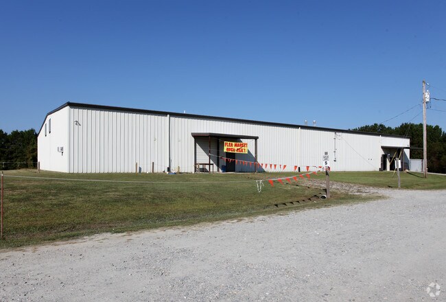
1820 S Wesleyan Blvd
3748-15-74-2261
Minor Final Plat Of R Winslow Bone
Storebuilding
5 80 AC, 1 BLK A BONE SPLIT OUT OF 374815732874 AC 1C 1 BLK A BONE
X
Nash
3720374800J
North Carolina
2025
5.80 AC
2025
Rocky Mount/Wilson
010200
Other Market Areas
25,500 SF
Rocky Mount, NC
DEMOGRAPHICS near 1820 S Wesleyan Blvd
1 Mile
3 Mile
5 Mile
2024 Total Population
649
17,046
45,523
2029 Population
653
17,384
46,376
Pop Growth 2024-2029
+ 0.62%
+ 1.98%
+ 1.87%
Average Age
41
40
41
2024 Total Households
274
7,140
19,187
HH Growth 2024-2029
+ 0.36%
+ 1.90%
+ 1.90%
Median Household Inc
$58,228
$38,151
$42,444
Avg Household Size
2.30
2.30
2.30
2024 Avg HH Vehicles
2.00
2.00
2.00
Median Home Value
$91,974
$113,528
$129,800
Median Year Built
1989
1975
1975
Nearby Places
Map Layers
Map Styles
 Street
 Aerial
- Restaurants
- Banks
- Shops
- Fitness
- Groceries
PUBLIC TRANSPORTATION
COMMUTER RAIL
Rocky Mount (Carolinian - Amtrak, Palmetto - Amtrak, Silver Meteor - Amtrak, Silver Star - Amtrak)
DRIVE
WALK
Distance
Rocky Mount (Carolinian - Amtrak, Palmetto - Amtrak, Silver Meteor - Amtrak, Silver Star - Amtrak)
7 min
4.8 mi
Freight Ports
Port of Morehead City
DRIVE
WALK
Distance
Port of Morehead City
186 min
137.8 mi
Nearby Properties
Address
Land Use
TOTAL SIZE
Lot Size
Zoning
Address
Land Use
TOTAL SIZE
Lot Size
Zoning
130,639 SF
60.52 AC
A1M
Address
Land Use
TOTAL SIZE
Lot Size
Zoning
32,051 SF
18.50 AC
R6
Address
Land Use
TOTAL SIZE
Lot Size
Zoning
15,650 SF
32.25 AC
R10
Address
Land Use
TOTAL SIZE
Lot Size
Zoning
26,401 SF
7.50 AC
R10
Address
Land Use
TOTAL SIZE
Lot Size
Zoning
3,360 SF
6.27 AC
R10
Address
Land Use
TOTAL SIZE
Lot Size
Zoning
29,187 SF
29.05 AC
R10
Address
Land Use
TOTAL SIZE
Lot Size
Zoning
1,298 SF
10.51 AC
R6
Address
Land Use
TOTAL SIZE
Lot Size
Zoning
41,452 SF
5.55 AC
RC
Address
Land Use
TOTAL SIZE
Lot Size
Zoning
11,708 SF
6.10 AC
R10
Address
Land Use
TOTAL SIZE
Lot Size
Zoning
27,571 SF
6.98 AC
R6
Address
Land Use
TOTAL SIZE
Lot Size
Zoning
2,134 SF
9.10 AC
R6
Address
Land Use
TOTAL SIZE
Lot Size
Zoning
9,000 SF
10.54 AC
R30
Address
Land Use
TOTAL SIZE
Lot Size
Zoning
50,744 SF
9.70 AC
Address
Land Use
TOTAL SIZE
Lot Size
Zoning
57,586 SF
8.59 AC
B2
Address
Land Use
TOTAL SIZE
Lot Size
Zoning
20,066 SF
4.34 AC
R30
Address
Land Use
TOTAL SIZE
Lot Size
Zoning
21,240 SF
3.97 AC
R10
Address
Land Use
TOTAL SIZE
Lot Size
Zoning
18,422 SF
3.18 AC
R6
Address
Land Use
TOTAL SIZE
Lot Size
Zoning
3,051 SF
8.03 AC
R6
Address
Land Use
TOTAL SIZE
Lot Size
Zoning
2,436 SF
7.46 AC
R6
Address
Land Use
TOTAL SIZE
Lot Size
Zoning
72,912 SF
6.70 AC
I2
Address
Land Use
TOTAL SIZE
Lot Size
Zoning
11,499 SF
4.06 AC
R6
Address
Land Use
TOTAL SIZE
Lot Size
Zoning
15,844 SF
5.10 AC
R6
Address
Land Use
TOTAL SIZE
Lot Size
Zoning
10,660 SF
9.73 AC
R6
Address
Land Use
TOTAL SIZE
Lot Size
Zoning
26,220 SF
0.98 AC
R6
Address
Land Use
TOTAL SIZE
Lot Size
Zoning
126,920 SF
7.73 AC
B5
Address
Land Use
TOTAL SIZE
Lot Size
Zoning
13,430 SF
2.41 AC
Address
Land Use
TOTAL SIZE
Lot Size
Zoning
4,476 SF
5 AC
Address
Land Use
TOTAL SIZE
Lot Size
Zoning
14,000 SF
26.16 AC
B5
Address
Land Use
TOTAL SIZE
Lot Size
Zoning
10,056 SF
3.01 AC
R30
Address
Land Use
TOTAL SIZE
Lot Size
Zoning
936 SF
1.99 AC
R10
The World's #1 Commercial Real Estate Marketplace
Connect with us
© 2026 CoStar Group
The information above has been obtained from sources believed reliable. While we do not doubt its accuracy we have not verified it and make no guarantee, warranty or representation about it. It is your responsibility to independently confirm its accuracy and completeness. Any projections, opinions, assumptions, or estimates used are for example only and do not represent the current or future performance of the property. The value of this transaction to you depends on tax and other factors which should be evaluated by your tax, financial, and legal advisors. You and your advisors should conduct a careful, independent investigation of the property to determine to your satisfaction the suitability of the property for your needs.