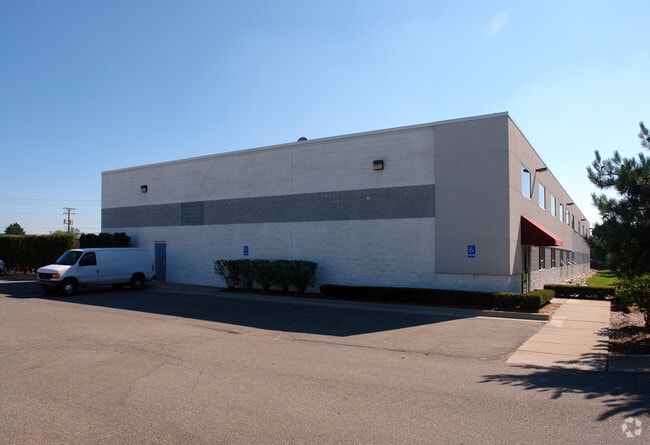
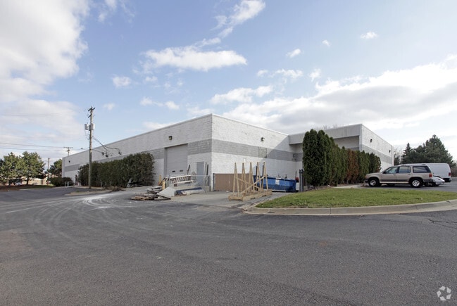
Property Record
1820 W West Maple Rd, Commerce Township, MI 48390
NEARBY LISTINGS FOR SALE OR LEASE
Property Detail
1820 W West Maple Rd
Detroit-Warren-Dearborn, MI
Maple-Benstein Sub
17-33-253-005
T2N, R8E, SEC 33 MAPLE-BENSTEIN SUB LOT 5 5-20-87 FR 252-001
Manufacturinglight
Oakland
X
Michigan
26125C0467F
5
2024
1.94 AC
2024
Central I-96 Corridor
135200
Detroit
23,986 SF
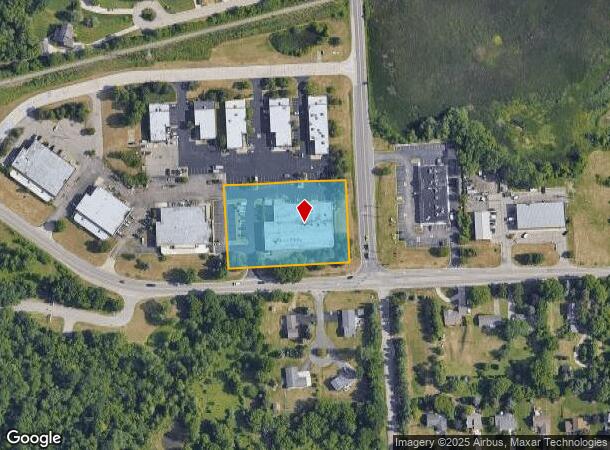
DEMOGRAPHICS near 1820 W West Maple Rd
1 Mile
3 Mile
5 Mile
2024 Total Population
11,018
59,063
123,289
2029 Population
10,909
58,303
121,973
Pop Growth 2024-2029
(0.99%)
(1.29%)
(1.07%)
Average Age
39
42
42
2024 Total Households
5,373
26,956
51,348
HH Growth 2024-2029
(1.04%)
(1.50%)
(1.18%)
Median Household Inc
$75,312
$74,907
$90,802
Avg Household Size
2.00
2.20
2.40
2024 Avg HH Vehicles
2.00
2.00
2.00
Median Home Value
$290,705
$290,699
$346,665
Median Year Built
1993
1991
1990
Nearby Places
Map Layers
Map Styles
 Street
 Aerial
- Restaurants
- Banks
- Shops
- Fitness
- Groceries
PUBLIC TRANSPORTATION
AIRPORT
Detroit Metro Wayne County
DRIVE
WALK
Distance
Detroit Metro Wayne County
46 min
33.4 mi
Windsor International
DRIVE
WALK
Distance
Windsor International
69 min
43.6 mi
Bishop International
DRIVE
WALK
Distance
Bishop International
67 min
49.4 mi
Nearby Properties
Address
Land Use
TOTAL SIZE
Lot Size
Zoning
Address
Land Use
TOTAL SIZE
Lot Size
Zoning
162,600 SF
102.81 AC
RM-1
Address
Land Use
TOTAL SIZE
Lot Size
Zoning
873,288 SF
Address
Land Use
TOTAL SIZE
Lot Size
Zoning
72.63 AC
RM-1
Address
Land Use
TOTAL SIZE
Lot Size
Zoning
86.19 AC
RC2
Address
Land Use
TOTAL SIZE
Lot Size
Zoning
563,160 SF
47.06 AC
Address
Land Use
TOTAL SIZE
Lot Size
Zoning
400,505 SF
26.50 AC
Address
Land Use
TOTAL SIZE
Lot Size
Zoning
59.71 AC
RM-1
Address
Land Use
TOTAL SIZE
Lot Size
Zoning
17,277 SF
17.73 AC
R-A
Address
Land Use
TOTAL SIZE
Lot Size
Zoning
63,152 SF
14 AC
R-C
Address
Land Use
TOTAL SIZE
Lot Size
Zoning
38.85 AC
RC2
Address
Land Use
TOTAL SIZE
Lot Size
Zoning
19.26 AC
R-A
Address
Land Use
TOTAL SIZE
Lot Size
Zoning
2,073 SF
116.28 AC
MH
Address
Land Use
TOTAL SIZE
Lot Size
Zoning
7,646 SF
24.55 AC
RM1
Address
Land Use
TOTAL SIZE
Lot Size
Zoning
196,222 SF
Address
Land Use
TOTAL SIZE
Lot Size
Zoning
4,140 SF
120 AC
MM
Address
Land Use
TOTAL SIZE
Lot Size
Zoning
126,720 SF
8.31 AC
Address
Land Use
TOTAL SIZE
Lot Size
Zoning
227,946 SF
20.96 AC
AI
Address
Land Use
TOTAL SIZE
Lot Size
Zoning
22.93 AC
RM-1
Address
Land Use
TOTAL SIZE
Lot Size
Zoning
26.54 AC
RM-1
Address
Land Use
TOTAL SIZE
Lot Size
Zoning
200,926 SF
30.87 AC
M1
Address
Land Use
TOTAL SIZE
Lot Size
Zoning
101,752 SF
7.20 AC
Address
Land Use
TOTAL SIZE
Lot Size
Zoning
Address
Land Use
TOTAL SIZE
Lot Size
Zoning
14.93 AC
RC2
Address
Land Use
TOTAL SIZE
Lot Size
Zoning
Address
Land Use
TOTAL SIZE
Lot Size
Zoning
7,646 SF
24.55 AC
RM-1
Address
Land Use
TOTAL SIZE
Lot Size
Zoning
233,158 SF
24.50 AC
Address
Land Use
TOTAL SIZE
Lot Size
Zoning
132,101 SF
Address
Land Use
TOTAL SIZE
Lot Size
Zoning
20.33 AC
RM-1
Address
Land Use
TOTAL SIZE
Lot Size
Zoning
118,592 SF
Address
Land Use
TOTAL SIZE
Lot Size
Zoning
2,080 SF
68.30 AC
MM
The World's #1 Commercial Real Estate Marketplace
Connect with us
© 2025 CoStar Group
The information above has been obtained from sources believed reliable. While we do not doubt its accuracy we have not verified it and make no guarantee, warranty or representation about it. It is your responsibility to independently confirm its accuracy and completeness. Any projections, opinions, assumptions, or estimates used are for example only and do not represent the current or future performance of the property. The value of this transaction to you depends on tax and other factors which should be evaluated by your tax, financial, and legal advisors. You and your advisors should conduct a careful, independent investigation of the property to determine to your satisfaction the suitability of the property for your needs.