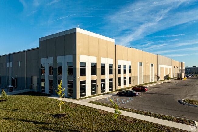
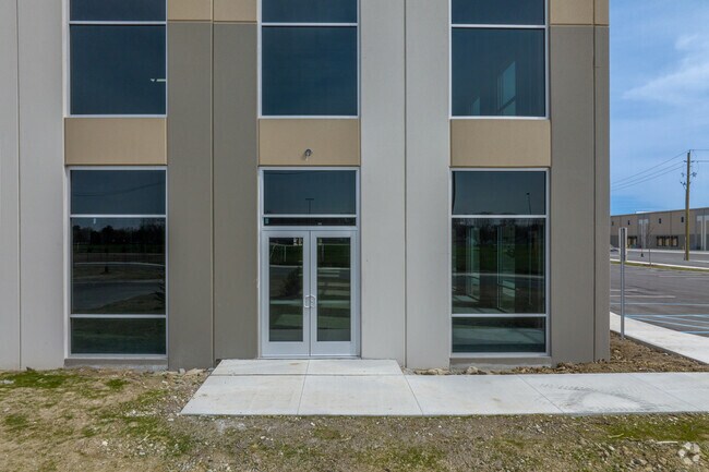
Property Record
18200 Vernier Rd, Harper Woods, MI 48225

NEARBY LISTINGS FOR SALE OR LEASE
Property Detail
18200 Vernier Rd
Detroit
Eastland Center
Detroit-Warren-Dearborn, MI
THAT PART OF PRIVATE CLAIM FF AND PRIVATE CLAIM 393, CITY OF HARPER WOODS, WAYNE COUNTY, MICHIGAN, DESCRIBED AS: COMMENCING AT A CONCRETE MONUMENT LOCATED AT THE INTERSECTION OF THE CENTERLINE OF EIGHT MILE ROAD (204 FEET WIDE) WITH THE CENTERLINE OF
42-009-99-0003-730
Wayne
Commercialnec
Michigan
2025
37.36 AC
2025
Detroit East
551400
DEMOGRAPHICS near 18200 Vernier Rd
1 Mile
3 Mile
5 Mile
2024 Total Population
18,341
170,971
339,478
2029 Population
17,902
169,399
336,859
Pop Growth 2024-2029
(2.39%)
(0.92%)
(0.77%)
Average Age
38
38
39
2024 Total Households
6,984
65,392
132,700
HH Growth 2024-2029
(2.51%)
(1.09%)
(0.89%)
Median Household Inc
$51,678
$52,011
$52,259
Avg Household Size
2.60
2.50
2.50
2024 Avg HH Vehicles
1.00
2.00
2.00
Median Home Value
$119,644
$125,895
$134,885
Median Year Built
1955
1953
1954
Nearby Places
Map Layers
Map Styles
 Street
 Aerial
- Restaurants
- Banks
- Shops
- Fitness
- Groceries
PUBLIC TRANSPORTATION
AIRPORT
Windsor International
DRIVE
WALK
Distance
Windsor International
44 min
23.2 mi
Detroit Metro Wayne County
DRIVE
WALK
Distance
Detroit Metro Wayne County
48 min
32.7 mi
Freight Ports
Port of Toledo
DRIVE
WALK
Distance
Port of Toledo
94 min
73.5 mi
SALE & LEASE HISTORY
LISTING DATE
SALE/LEASE

Mar 24, 2022
For Lease
Nearby Properties
Address
Land Use
TOTAL SIZE
Lot Size
Zoning
Address
Land Use
TOTAL SIZE
Lot Size
Zoning
1,034,990 SF
28.60 AC
Address
Land Use
TOTAL SIZE
Lot Size
Zoning
211,065 SF
8.84 AC
C.F
Address
Land Use
TOTAL SIZE
Lot Size
Zoning
575,081 SF
8.53 AC
R6
Address
Land Use
TOTAL SIZE
Lot Size
Zoning
182,866 SF
5.08 AC
PD
Address
Land Use
TOTAL SIZE
Lot Size
Zoning
89,970 SF
2.86 AC
RM-1
Address
Land Use
TOTAL SIZE
Lot Size
Zoning
101,733 SF
1.10 AC
C-2
Address
Land Use
TOTAL SIZE
Lot Size
Zoning
103,069 SF
11.41 AC
B-3
Address
Land Use
TOTAL SIZE
Lot Size
Zoning
105,354 SF
2.33 AC
B-3
Address
Land Use
TOTAL SIZE
Lot Size
Zoning
115,307 SF
7.01 AC
RM-1
Address
Land Use
TOTAL SIZE
Lot Size
Zoning
75,284 SF
0.87 AC
C
Address
Land Use
TOTAL SIZE
Lot Size
Zoning
167,589 SF
16.80 AC
B-3
Address
Land Use
TOTAL SIZE
Lot Size
Zoning
119,898 SF
14.65 AC
B-2
Address
Land Use
TOTAL SIZE
Lot Size
Zoning
136,270 SF
3.42 AC
LI
Address
Land Use
TOTAL SIZE
Lot Size
Zoning
91,739 SF
6.54 AC
B-2
Address
Land Use
TOTAL SIZE
Lot Size
Zoning
30,244 SF
2.06 AC
B-1
Address
Land Use
TOTAL SIZE
Lot Size
Zoning
28,300 SF
11.49 AC
I-1
Address
Land Use
TOTAL SIZE
Lot Size
Zoning
156,352 SF
2.72 AC
B-3
Address
Land Use
TOTAL SIZE
Lot Size
Zoning
26,068 SF
5.57 AC
B-2
Address
Land Use
TOTAL SIZE
Lot Size
Zoning
46,246 SF
3.19 AC
B-3
Address
Land Use
TOTAL SIZE
Lot Size
Zoning
30,919 SF
0.86 AC
C
Address
Land Use
TOTAL SIZE
Lot Size
Zoning
36,417 SF
0.68 AC
B4
Address
Land Use
TOTAL SIZE
Lot Size
Zoning
92,903 SF
1.70 AC
LI
Address
Land Use
TOTAL SIZE
Lot Size
Zoning
80,320 SF
4.73 AC
RM-1
Address
Land Use
TOTAL SIZE
Lot Size
Zoning
36,191 SF
3.87 AC
B-2
Address
Land Use
TOTAL SIZE
Lot Size
Zoning
60,694 SF
3.05 AC
B-2
Address
Land Use
TOTAL SIZE
Lot Size
Zoning
56,170 SF
3.19 AC
RM-1
Address
Land Use
TOTAL SIZE
Lot Size
Zoning
11.56 AC
RM-1
Address
Land Use
TOTAL SIZE
Lot Size
Zoning
87,897 SF
4.50 AC
RM-1
Address
Land Use
TOTAL SIZE
Lot Size
Zoning
3,312 SF
8.81 AC
R-1A
Address
Land Use
TOTAL SIZE
Lot Size
Zoning
49,807 SF
0.84 AC
PD
The World's #1 Commercial Real Estate Marketplace
Connect with us
© 2026 CoStar Group
The information above has been obtained from sources believed reliable. While we do not doubt its accuracy we have not verified it and make no guarantee, warranty or representation about it. It is your responsibility to independently confirm its accuracy and completeness. Any projections, opinions, assumptions, or estimates used are for example only and do not represent the current or future performance of the property. The value of this transaction to you depends on tax and other factors which should be evaluated by your tax, financial, and legal advisors. You and your advisors should conduct a careful, independent investigation of the property to determine to your satisfaction the suitability of the property for your needs.