Property Record
18209 E Mainstreet, Parker, CO 80134
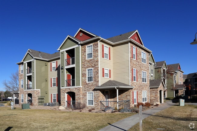


Property Detail
18209 E Mainstreet
Denver-Aurora-Centennial, CO
MOST OF LOT 1 BLOCK 2 TRAILSIDE VILLAGE 18.625 AM/L
2233-211-10-007
DOUGLAS
Apartment
Colorado
AE The base floodplain where base flood elevations are provided. AE Zones are now used on new format FIRMs instead of A1-A30 Zones.
1
2024
18.63 AC
2025
South Douglas County
013904
Denver
514,882 SF
NEARBY LISTINGS FOR SALE OR LEASE
DEMOGRAPHICS near 18209 E Mainstreet
1 mile
3 mile
5 mile
2025 Total Population
12,362
83,408
129,261
2030 Population
13,242
89,815
138,950
Pop Growth 2025-2030
+ 7.12%
+ 7.68%
+ 7.50%
Average Age
37
37
39
2025 Total Households
4,883
29,874
47,624
HH Growth 2025-2030
+ 7.43%
+ 7.97%
+ 7.60%
Median Household Inc
$100,530
$130,361
$126,512
Avg Household Size
2.50
2.70
2.70
2025 Avg HH Vehicles
2.00
2.00
2.00
Median Home Value
$653,067
$703,011
$717,162
Median Year Built
1998
2003
2004
Nearby Places
Map Layers
Map Styles
 Street
 Aerial
Layers
 Traffic
 Biking
Places
Listings with unknown addresses are not visible on the map
- Restaurants
- Banks
- Shops
- Fitness
- Groceries
PUBLIC TRANSPORTATION
AIRPORT
Denver International
Drive
Walk
Distance
Denver International
35 min
30.5 mi
Freight Ports
Tulsa Port Of Catoosa
Drive
Walk
Distance
Tulsa Port Of Catoosa
728 min
710.4 mi
Nearby Properties
Address
Land Use
TOTAL SIZE
Lot Size
Zoning
Address
Land Use
TOTAL SIZE
Lot Size
Zoning
381,657 SF
33.84 AC
Address
Land Use
TOTAL SIZE
Lot Size
Zoning
494,489 SF
22.16 AC
Address
Land Use
TOTAL SIZE
Lot Size
Zoning
181,361 SF
549.62 AC
Address
Land Use
TOTAL SIZE
Lot Size
Zoning
207,872 SF
44.94 AC
PDU
Address
Land Use
TOTAL SIZE
Lot Size
Zoning
343,018 SF
15.13 AC
Address
Land Use
TOTAL SIZE
Lot Size
Zoning
344,128 SF
19.06 AC
Address
Land Use
TOTAL SIZE
Lot Size
Zoning
455,049 SF
16.96 AC
Address
Land Use
TOTAL SIZE
Lot Size
Zoning
132,601 SF
16.08 AC
Address
Land Use
TOTAL SIZE
Lot Size
Zoning
93,100 SF
8.78 AC
Address
Land Use
TOTAL SIZE
Lot Size
Zoning
442,567 SF
16.91 AC
Address
Land Use
TOTAL SIZE
Lot Size
Zoning
453,901 SF
16.34 AC
Address
Land Use
TOTAL SIZE
Lot Size
Zoning
445,938 SF
19.85 AC
Address
Land Use
TOTAL SIZE
Lot Size
Zoning
53,500 SF
6 AC
Address
Land Use
TOTAL SIZE
Lot Size
Zoning
375,171 SF
12.88 AC
Address
Land Use
TOTAL SIZE
Lot Size
Zoning
389,337 SF
22.01 AC
Address
Land Use
TOTAL SIZE
Lot Size
Zoning
93,100 SF
8.95 AC
Address
Land Use
TOTAL SIZE
Lot Size
Zoning
132,601 SF
16.05 AC
Address
Land Use
TOTAL SIZE
Lot Size
Zoning
369,624 SF
21.98 AC
Address
Land Use
TOTAL SIZE
Lot Size
Zoning
307,904 SF
15.72 AC
Address
Land Use
TOTAL SIZE
Lot Size
Zoning
88,280 SF
34.08 AC
A1
Address
Land Use
TOTAL SIZE
Lot Size
Zoning
138,348 SF
14.96 AC
RR
Address
Land Use
TOTAL SIZE
Lot Size
Zoning
117,593 SF
37.91 AC
A1
Address
Land Use
TOTAL SIZE
Lot Size
Zoning
122,154 SF
13.90 AC
Address
Land Use
TOTAL SIZE
Lot Size
Zoning
75,651 SF
10.02 AC
PDU
Address
Land Use
TOTAL SIZE
Lot Size
Zoning
67,060 SF
3.87 AC
Address
Land Use
TOTAL SIZE
Lot Size
Zoning
74,804 SF
Address
Land Use
TOTAL SIZE
Lot Size
Zoning
291,852 SF
11.09 AC
PDU
Address
Land Use
TOTAL SIZE
Lot Size
Zoning
119,298 SF
11.11 AC
Address
Land Use
TOTAL SIZE
Lot Size
Zoning
302,161 SF
11.02 AC
The World's #1 Commercial Real Estate Marketplace
Connect with us
© 2026 CoStar Group
The information above has been obtained from sources believed reliable. While we do not doubt its accuracy we have not verified it and make no guarantee, warranty or representation about it. It is your responsibility to independently confirm its accuracy and completeness. Any projections, opinions, assumptions, or estimates used are for example only and do not represent the current or future performance of the property. The value of this transaction to you depends on tax and other factors which should be evaluated by your tax, financial, and legal advisors. You and your advisors should conduct a careful, independent investigation of the property to determine to your satisfaction the suitability of the property for your needs.