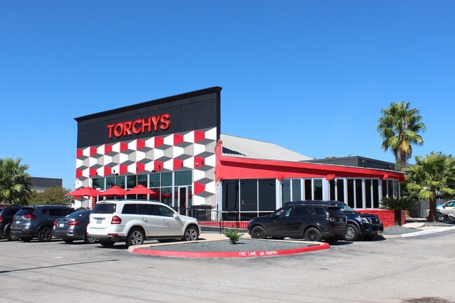
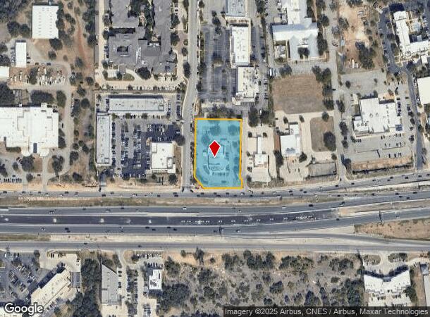
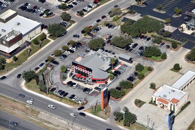
Property Record
18210 Sonterra Pl, San Antonio, TX 78258
NEARBY LISTINGS FOR SALE OR LEASE
Property Detail
18210 Sonterra Pl
San Antonio-New Braunfels, TX
Temple Sage Sub
16331-001-0100
NCB 16331 BLK 1 LOT 10 TEMPLE SAGE SUBD UT-3 AMENDING PER AMENDING PLAT 9563/76 FILED 11-5-04
Restaurantbuilding
Bexar
X
Texas
48029C0255G
10
2024
1.68 AC
2025
Far North Central
191816
San Antonio
7,833 SF
DEMOGRAPHICS near 18210 Sonterra Pl
1 Mile
3 Mile
5 Mile
2024 Total Population
7,786
80,069
210,162
2029 Population
8,254
85,065
223,805
Pop Growth 2024-2029
+ 6.01%
+ 6.24%
+ 6.49%
Average Age
41
40
39
2024 Total Households
3,527
32,080
85,321
HH Growth 2024-2029
+ 6.18%
+ 6.49%
+ 6.68%
Median Household Inc
$86,430
$99,667
$88,637
Avg Household Size
2.20
2.40
2.40
2024 Avg HH Vehicles
2.00
2.00
2.00
Median Home Value
$422,911
$359,442
$337,528
Median Year Built
1996
1996
1995
Nearby Places
Map Layers
Map Styles
 Street
 Aerial
- Restaurants
- Banks
- Shops
- Fitness
- Groceries
PUBLIC TRANSPORTATION
AIRPORT
San Antonio International
DRIVE
WALK
Distance
San Antonio International
14 min
9.0 mi
Freight Ports
Calhoun Port
DRIVE
WALK
Distance
Calhoun Port
189 min
158.5 mi
SALE & LEASE HISTORY
LISTING DATE
SALE/LEASE

Jul 08, 2020
For Sale
Jan 20, 2017
For Lease
Nearby Properties
Address
Land Use
TOTAL SIZE
Lot Size
Zoning
Address
Land Use
TOTAL SIZE
Lot Size
Zoning
621,591 SF
15.25 AC
Address
Land Use
TOTAL SIZE
Lot Size
Zoning
427,456 SF
37.12 AC
Address
Land Use
TOTAL SIZE
Lot Size
Zoning
631,284 SF
14.61 AC
Address
Land Use
TOTAL SIZE
Lot Size
Zoning
387,893 SF
11.97 AC
Address
Land Use
TOTAL SIZE
Lot Size
Zoning
352,144 SF
29.83 AC
Address
Land Use
TOTAL SIZE
Lot Size
Zoning
311,728 SF
7.47 AC
Address
Land Use
TOTAL SIZE
Lot Size
Zoning
480,363 SF
28.52 AC
Address
Land Use
TOTAL SIZE
Lot Size
Zoning
292,126 SF
12.86 AC
Address
Land Use
TOTAL SIZE
Lot Size
Zoning
315,719 SF
13.91 AC
Address
Land Use
TOTAL SIZE
Lot Size
Zoning
308,375 SF
15.77 AC
Address
Land Use
TOTAL SIZE
Lot Size
Zoning
303,085 SF
12.42 AC
Address
Land Use
TOTAL SIZE
Lot Size
Zoning
309,507 SF
14.95 AC
Address
Land Use
TOTAL SIZE
Lot Size
Zoning
177,316 SF
19.83 AC
Address
Land Use
TOTAL SIZE
Lot Size
Zoning
209,715 SF
22.91 AC
Address
Land Use
TOTAL SIZE
Lot Size
Zoning
327,760 SF
18.75 AC
Address
Land Use
TOTAL SIZE
Lot Size
Zoning
284,202 SF
13.59 AC
Address
Land Use
TOTAL SIZE
Lot Size
Zoning
138,292 SF
17.91 AC
Address
Land Use
TOTAL SIZE
Lot Size
Zoning
317,041 SF
26.69 AC
Address
Land Use
TOTAL SIZE
Lot Size
Zoning
69,860 SF
20.10 AC
Address
Land Use
TOTAL SIZE
Lot Size
Zoning
289,271 SF
16.87 AC
Address
Land Use
TOTAL SIZE
Lot Size
Zoning
234,914 SF
16.29 AC
Address
Land Use
TOTAL SIZE
Lot Size
Zoning
154,937 SF
22 AC
Address
Land Use
TOTAL SIZE
Lot Size
Zoning
269,525 SF
17.75 AC
Address
Land Use
TOTAL SIZE
Lot Size
Zoning
341,841 SF
22 AC
Address
Land Use
TOTAL SIZE
Lot Size
Zoning
249,562 SF
9.65 AC
Address
Land Use
TOTAL SIZE
Lot Size
Zoning
340,570 SF
19.15 AC
Address
Land Use
TOTAL SIZE
Lot Size
Zoning
281,805 SF
14.52 AC
Address
Land Use
TOTAL SIZE
Lot Size
Zoning
99,301 SF
13.49 AC
Address
Land Use
TOTAL SIZE
Lot Size
Zoning
273,257 SF
17.62 AC
Address
Land Use
TOTAL SIZE
Lot Size
Zoning
297,882 SF
17.16 AC
The World's #1 Commercial Real Estate Marketplace
Connect with us
© 2025 CoStar Group
The information above has been obtained from sources believed reliable. While we do not doubt its accuracy we have not verified it and make no guarantee, warranty or representation about it. It is your responsibility to independently confirm its accuracy and completeness. Any projections, opinions, assumptions, or estimates used are for example only and do not represent the current or future performance of the property. The value of this transaction to you depends on tax and other factors which should be evaluated by your tax, financial, and legal advisors. You and your advisors should conduct a careful, independent investigation of the property to determine to your satisfaction the suitability of the property for your needs.