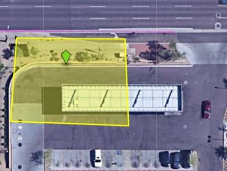
Property Record
1855 W Greenway Rd, Phoenix, AZ 85023

NEARBY LISTINGS FOR SALE OR LEASE
Property Detail
1855 W Greenway Rd
208-16-547J
TH POR NW4 SEC 7 DAF COM NW COR SD SEC TH S 466.34F TH E 65F TO SWLY COR LOT 1 GREENWAY PLAZA MCR 520-15 POB TH ALG WLY LN SD LOT 1 N 124.87F TH W 10.21F TH N 10.47F TH N 250F TH N 44D 44M E 29.95F TO NLY LN SD LOT 1 TH E 5.84F TH S 81D 28M E 73.10F
Storebuilding
Maricopa
AE
Arizona
04013C1290M
1
2025
1.71 AC
2025
N Phoenix/I-17 Corr
103605
Phoenix
17,736 SF
Phoenix-Mesa-Scottsdale, AZ
DEMOGRAPHICS near 1855 W Greenway Rd
1 Mile
3 Mile
5 Mile
2024 Total Population
15,391
148,887
383,211
2029 Population
16,928
160,857
413,613
Pop Growth 2024-2029
+ 9.99%
+ 8.04%
+ 7.93%
Average Age
37
38
38
2024 Total Households
6,343
59,883
151,121
HH Growth 2024-2029
+ 10.42%
+ 8.28%
+ 8.12%
Median Household Inc
$52,289
$60,161
$62,272
Avg Household Size
2.40
2.40
2.40
2024 Avg HH Vehicles
2.00
2.00
2.00
Median Home Value
$351,253
$313,144
$311,171
Median Year Built
1989
1981
1982
Nearby Places
Map Layers
Map Styles
 Street
 Aerial
- Restaurants
- Banks
- Shops
- Fitness
- Groceries
PUBLIC TRANSPORTATION
AIRPORT
Phoenix Sky Harbor International
DRIVE
WALK
Distance
Phoenix Sky Harbor International
31 min
20.6 mi
Phoenix-Mesa Gateway
DRIVE
WALK
Distance
Phoenix-Mesa Gateway
64 min
47.8 mi
Nearby Properties
Address
Land Use
TOTAL SIZE
Lot Size
Zoning
Address
Land Use
TOTAL SIZE
Lot Size
Zoning
249,119 SF
15.40 AC
PUD
Address
Land Use
TOTAL SIZE
Lot Size
Zoning
10.70 AC
I-P
Address
Land Use
TOTAL SIZE
Lot Size
Zoning
98,760 SF
6.76 AC
A-1
Address
Land Use
TOTAL SIZE
Lot Size
Zoning
526,912 SF
55.64 AC
Address
Land Use
TOTAL SIZE
Lot Size
Zoning
704,521 SF
15.12 AC
C-C
Address
Land Use
TOTAL SIZE
Lot Size
Zoning
1,089,213 SF
53.03 AC
R-3
Address
Land Use
TOTAL SIZE
Lot Size
Zoning
17,365 SF
1.50 AC
C-G
Address
Land Use
TOTAL SIZE
Lot Size
Zoning
2.62 AC
IND.PK.
Address
Land Use
TOTAL SIZE
Lot Size
Zoning
16,284 SF
3.77 AC
M-H
Address
Land Use
TOTAL SIZE
Lot Size
Zoning
452,506 SF
55.11 AC
RH
Address
Land Use
TOTAL SIZE
Lot Size
Zoning
314,839 SF
39 AC
R-18
Address
Land Use
TOTAL SIZE
Lot Size
Zoning
290,321 SF
37.97 AC
R-8
Address
Land Use
TOTAL SIZE
Lot Size
Zoning
336,529 SF
11.23 AC
R4A
Address
Land Use
TOTAL SIZE
Lot Size
Zoning
469,322 SF
22.40 AC
M-H
Address
Land Use
TOTAL SIZE
Lot Size
Zoning
229,000 SF
18.99 AC
I-P
Address
Land Use
TOTAL SIZE
Lot Size
Zoning
268,353 SF
20.45 AC
I-P
Address
Land Use
TOTAL SIZE
Lot Size
Zoning
362,729 SF
21.85 AC
Address
Land Use
TOTAL SIZE
Lot Size
Zoning
145,956 SF
10.30 AC
CP/GCP
Address
Land Use
TOTAL SIZE
Lot Size
Zoning
358,670 SF
18.14 AC
M-H
Address
Land Use
TOTAL SIZE
Lot Size
Zoning
358,005 SF
8.54 AC
M-H
Address
Land Use
TOTAL SIZE
Lot Size
Zoning
120,494 SF
11.17 AC
C-C
Address
Land Use
TOTAL SIZE
Lot Size
Zoning
221,641 SF
21.60 AC
C-2
Address
Land Use
TOTAL SIZE
Lot Size
Zoning
171,751 SF
8.61 AC
C-2
Address
Land Use
TOTAL SIZE
Lot Size
Zoning
2.99 AC
C-R
Address
Land Use
TOTAL SIZE
Lot Size
Zoning
267,747 SF
8.91 AC
M-H
Address
Land Use
TOTAL SIZE
Lot Size
Zoning
229,447 SF
23.43 AC
Address
Land Use
TOTAL SIZE
Lot Size
Zoning
277,659 SF
23.52 AC
Address
Land Use
TOTAL SIZE
Lot Size
Zoning
313,047 SF
11.87 AC
R4A
Address
Land Use
TOTAL SIZE
Lot Size
Zoning
85,760 SF
11.51 AC
R-8
Address
Land Use
TOTAL SIZE
Lot Size
Zoning
147,184 SF
15.02 AC
C-C
The World's #1 Commercial Real Estate Marketplace
Connect with us
© 2026 CoStar Group
The information above has been obtained from sources believed reliable. While we do not doubt its accuracy we have not verified it and make no guarantee, warranty or representation about it. It is your responsibility to independently confirm its accuracy and completeness. Any projections, opinions, assumptions, or estimates used are for example only and do not represent the current or future performance of the property. The value of this transaction to you depends on tax and other factors which should be evaluated by your tax, financial, and legal advisors. You and your advisors should conduct a careful, independent investigation of the property to determine to your satisfaction the suitability of the property for your needs.