Property Record
1825 Joyce Ave, Columbus, OH 43219


Save to a Folder
{{folder.Name}}
{{folder.ListingIds.length}} Properties
{{folder.ListingIds.length}} Property
Create a New Folder
Property Detail
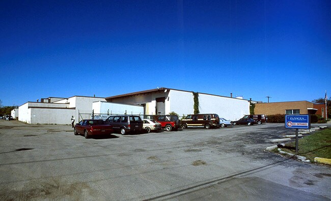
1825 Joyce Ave
Columbus, OH
RANCK RD R18 T1 1/4T4 7.607 ACRES
010-098527
Franklin
Lightindustrial
Ohio
B and X Area of moderate flood hazard, usually the area between the limits of the 100-year and 500-year floods.
18
2024
7.61 AC
2025
N Central Columbus
007511
Columbus
101,922 SF
NEARBY LISTINGS FOR SALE OR LEASE
DEMOGRAPHICS near 1825 Joyce Ave
1 mile
3 mile
5 mile
2025 Total Population
17,573
172,945
396,905
2030 Population
18,473
180,319
412,597
Pop Growth 2025-2030
+ 5.12%
+ 4.26%
+ 3.95%
Average Age
36
34
36
2025 Total Households
6,380
68,962
169,182
HH Growth 2025-2030
+ 5.17%
+ 4.65%
+ 4.19%
Median Household Inc
$36,528
$48,173
$58,979
Avg Household Size
2.60
2.20
2.20
2025 Avg HH Vehicles
1.00
2.00
2.00
Median Home Value
$116,755
$243,238
$303,656
Median Year Built
1956
1963
1963
Nearby Places
Map Layers
Map Styles
 Street
 Aerial
Layers
 Traffic
 Biking
Places
Listings with unknown addresses are not visible on the map
- Restaurants
- Banks
- Shops
- Fitness
- Groceries
PUBLIC TRANSPORTATION
AIRPORT
John Glenn Columbus International
Drive
Walk
Distance
John Glenn Columbus International
12 min
5.5 mi
Rickenbacker International
Drive
Walk
Distance
Rickenbacker International
30 min
17.8 mi
Nearby Properties
Address
Land Use
TOTAL SIZE
Lot Size
Zoning
Address
Land Use
TOTAL SIZE
Lot Size
Zoning
13.50 AC
Address
Land Use
TOTAL SIZE
Lot Size
Zoning
382,270 SF
319.59 AC
Address
Land Use
TOTAL SIZE
Lot Size
Zoning
Address
Land Use
TOTAL SIZE
Lot Size
Zoning
1,099,074 SF
39.47 AC
Address
Land Use
TOTAL SIZE
Lot Size
Zoning
1.64 AC
Address
Land Use
TOTAL SIZE
Lot Size
Zoning
560,146 SF
63.19 AC
Address
Land Use
TOTAL SIZE
Lot Size
Zoning
378,522 SF
41.13 AC
Address
Land Use
TOTAL SIZE
Lot Size
Zoning
284,481 SF
94.09 AC
Address
Land Use
TOTAL SIZE
Lot Size
Zoning
4.90 AC
Address
Land Use
TOTAL SIZE
Lot Size
Zoning
770,975 SF
64.63 AC
Address
Land Use
TOTAL SIZE
Lot Size
Zoning
2.25 AC
Address
Land Use
TOTAL SIZE
Lot Size
Zoning
4.46 AC
Address
Land Use
TOTAL SIZE
Lot Size
Zoning
180,636 SF
4.33 AC
Address
Land Use
TOTAL SIZE
Lot Size
Zoning
325,684 SF
2 AC
Address
Land Use
TOTAL SIZE
Lot Size
Zoning
24.14 AC
Address
Land Use
TOTAL SIZE
Lot Size
Zoning
242,613 SF
0.10 AC
Address
Land Use
TOTAL SIZE
Lot Size
Zoning
339,332 SF
1.42 AC
Address
Land Use
TOTAL SIZE
Lot Size
Zoning
184,777 SF
3.67 AC
Address
Land Use
TOTAL SIZE
Lot Size
Zoning
361,680 SF
4.12 AC
Address
Land Use
TOTAL SIZE
Lot Size
Zoning
0.99 AC
Address
Land Use
TOTAL SIZE
Lot Size
Zoning
1.39 AC
Address
Land Use
TOTAL SIZE
Lot Size
Zoning
301,882 SF
1.13 AC
Address
Land Use
TOTAL SIZE
Lot Size
Zoning
307,197 SF
4.15 AC
Address
Land Use
TOTAL SIZE
Lot Size
Zoning
349,372 SF
3.09 AC
Address
Land Use
TOTAL SIZE
Lot Size
Zoning
29,668 SF
1.32 AC
Address
Land Use
TOTAL SIZE
Lot Size
Zoning
255,831 SF
2.50 AC
Address
Land Use
TOTAL SIZE
Lot Size
Zoning
201,866 SF
3.61 AC
Address
Land Use
TOTAL SIZE
Lot Size
Zoning
156,039 SF
4.23 AC
Address
Land Use
TOTAL SIZE
Lot Size
Zoning
230,354 SF
1.05 AC
Address
Land Use
TOTAL SIZE
Lot Size
Zoning
299,220 SF
29.68 AC
The World's #1 Commercial Real Estate Marketplace
Connect with us
© 2026 CoStar Group
The information above has been obtained from sources believed reliable. While we do not doubt its accuracy we have not verified it and make no guarantee, warranty or representation about it. It is your responsibility to independently confirm its accuracy and completeness. Any projections, opinions, assumptions, or estimates used are for example only and do not represent the current or future performance of the property. The value of this transaction to you depends on tax and other factors which should be evaluated by your tax, financial, and legal advisors. You and your advisors should conduct a careful, independent investigation of the property to determine to your satisfaction the suitability of the property for your needs.