Property Record
1825 State Route 34, Belmar, NJ 07719

NEARBY LISTINGS FOR SALE OR LEASE
Property Detail
1825 State Route 34
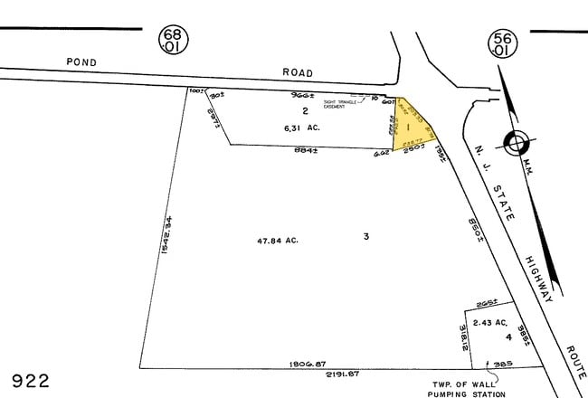
52-00922-0000-00004
FACILITY NAME: PUMPING STATION
Utilities
Monmouth
X
New Jersey
34025C0340F
4
0
2.43 AC
2025
Western Monmouth
808501
Northern New Jersey
600 SF
New York-Jersey City-White Plains, NY-NJ
DEMOGRAPHICS near 1825 State Route 34
1 Mile
3 Mile
5 Mile
2024 Total Population
719
14,998
106,085
2029 Population
715
14,927
107,089
Pop Growth 2024-2029
(0.56%)
(0.47%)
+ 0.95%
Average Age
43
44
45
2024 Total Households
252
5,495
42,856
HH Growth 2024-2029
(0.79%)
(0.73%)
+ 0.77%
Median Household Inc
$134,191
$121,479
$106,287
Avg Household Size
2.70
2.60
2.40
2024 Avg HH Vehicles
2.00
2.00
2.00
Median Home Value
$682,330
$529,738
$491,310
Median Year Built
1990
1978
1976
Nearby Places
Map Layers
Map Styles
 Street
 Aerial
- Restaurants
- Banks
- Shops
- Fitness
- Groceries
PUBLIC TRANSPORTATION
COMMUTER RAIL
Spring Lake (North Jersey Coast Line - NJ Transit Commuter Rail (NJ Transit))
DRIVE
WALK
Distance
Spring Lake (North Jersey Coast Line - NJ Transit Commuter Rail (NJ Transit))
9 min
5.3 mi
Belmar (North Jersey Coast Line - NJ Transit Commuter Rail (NJ Transit))
DRIVE
WALK
Distance
Belmar (North Jersey Coast Line - NJ Transit Commuter Rail (NJ Transit))
7 min
5.3 mi
Freight Ports
New York Container Terminal
DRIVE
WALK
Distance
New York Container Terminal
59 min
44.6 mi
Nearby Properties
Address
Land Use
TOTAL SIZE
Lot Size
Zoning
Address
Land Use
TOTAL SIZE
Lot Size
Zoning
37.47 AC
AH
Address
Land Use
TOTAL SIZE
Lot Size
Zoning
152,121 SF
22.16 AC
OR10
Address
Land Use
TOTAL SIZE
Lot Size
Zoning
190,893 SF
36.69 AC
POS
Address
Land Use
TOTAL SIZE
Lot Size
Zoning
192,708 SF
33.36 AC
OR10
Address
Land Use
TOTAL SIZE
Lot Size
Zoning
3,094 SF
277.60 AC
C
Address
Land Use
TOTAL SIZE
Lot Size
Zoning
7.79 AC
MLCC
Address
Land Use
TOTAL SIZE
Lot Size
Zoning
25,536 SF
21.95 AC
OR10
Address
Land Use
TOTAL SIZE
Lot Size
Zoning
17,586 SF
386.01 AC
POS
Address
Land Use
TOTAL SIZE
Lot Size
Zoning
145,918 SF
20.31 AC
OR-5
Address
Land Use
TOTAL SIZE
Lot Size
Zoning
45,236 SF
48.30 AC
POS
Address
Land Use
TOTAL SIZE
Lot Size
Zoning
28,819 SF
13.59 AC
ES
Address
Land Use
TOTAL SIZE
Lot Size
Zoning
111,580 SF
25 AC
POS
Address
Land Use
TOTAL SIZE
Lot Size
Zoning
3,400 SF
262.97 AC
AI
Address
Land Use
TOTAL SIZE
Lot Size
Zoning
332,213 SF
26.55 AC
OR10
Address
Land Use
TOTAL SIZE
Lot Size
Zoning
8,749 SF
5.73 AC
OPML
Address
Land Use
TOTAL SIZE
Lot Size
Zoning
2,976 SF
336.41 AC
POS
Address
Land Use
TOTAL SIZE
Lot Size
Zoning
63,277 SF
3.03 AC
POS
Address
Land Use
TOTAL SIZE
Lot Size
Zoning
1,982 SF
2.47 AC
OR-2
Address
Land Use
TOTAL SIZE
Lot Size
Zoning
14,874 SF
12.49 AC
OP10
Address
Land Use
TOTAL SIZE
Lot Size
Zoning
2,656 SF
95.46 AC
POS
Address
Land Use
TOTAL SIZE
Lot Size
Zoning
296.61 AC
POS
Address
Land Use
TOTAL SIZE
Lot Size
Zoning
142,676 SF
10.47 AC
OR-2
Address
Land Use
TOTAL SIZE
Lot Size
Zoning
257.92 AC
POS
Address
Land Use
TOTAL SIZE
Lot Size
Zoning
22,700 SF
7.53 AC
POS
Address
Land Use
TOTAL SIZE
Lot Size
Zoning
79,746 SF
9.06 AC
OR10
Address
Land Use
TOTAL SIZE
Lot Size
Zoning
7.10 AC
R-5
Address
Land Use
TOTAL SIZE
Lot Size
Zoning
8.26 AC
C-5
Address
Land Use
TOTAL SIZE
Lot Size
Zoning
4,060 SF
270.36 AC
CR40
Address
Land Use
TOTAL SIZE
Lot Size
Zoning
6.04 AC
OP-2
Address
Land Use
TOTAL SIZE
Lot Size
Zoning
10.11 AC
SED
The World's #1 Commercial Real Estate Marketplace
Connect with us
© 2026 CoStar Group
The information above has been obtained from sources believed reliable. While we do not doubt its accuracy we have not verified it and make no guarantee, warranty or representation about it. It is your responsibility to independently confirm its accuracy and completeness. Any projections, opinions, assumptions, or estimates used are for example only and do not represent the current or future performance of the property. The value of this transaction to you depends on tax and other factors which should be evaluated by your tax, financial, and legal advisors. You and your advisors should conduct a careful, independent investigation of the property to determine to your satisfaction the suitability of the property for your needs.