Property Record
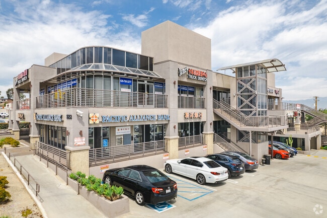
18253 Colima Rd, Rowland Heights, CA 91748


Current Lease Availabilities
NEARBY LISTINGS FOR SALE OR LEASE
Property Detail
18253 Colima Rd
Los Angeles-Long Beach-Glendale, CA
The Rancho La Puente
8270-006-037
FOR DESC SEE ASSESSORS MAPS POR OF RANCHO LA PUENTE
Storesoffices
Los Angeles
X
California
06037C1875F
6
2024
0.22 AC
2025
Eastern SGV
408213
Los Angeles
32,628 SF
DEMOGRAPHICS near 18253 Colima Rd
1 Mile
3 Mile
5 Mile
2024 Total Population
20,751
119,482
317,112
2029 Population
20,102
114,935
306,765
Pop Growth 2024-2029
(3.13%)
(3.81%)
(3.26%)
Average Age
41
42
41
2024 Total Households
6,433
34,697
93,548
HH Growth 2024-2029
(3.23%)
(4.03%)
(3.43%)
Median Household Inc
$69,094
$88,723
$95,963
Avg Household Size
3.10
3.30
3.30
2024 Avg HH Vehicles
2.00
2.00
2.00
Median Home Value
$706,735
$716,109
$736,262
Median Year Built
1973
1973
1971
Nearby Places
Map Layers
Map Styles
 Street
 Aerial
- Restaurants
- Banks
- Shops
- Fitness
- Groceries
PUBLIC TRANSPORTATION
COMMUTER RAIL
Industry (Riverside Line - Southern California Regional Rail Authority (Metrolink))
DRIVE
WALK
Distance
Industry (Riverside Line - Southern California Regional Rail Authority (Metrolink))
8 min
4.5 mi
Fullerton (91 Line - Southern California Regional Rail Authority (Metrolink), Orange County Line - Southern California Regional Rail Authority (Metrolink))
DRIVE
WALK
Distance
Fullerton (91 Line - Southern California Regional Rail Authority (Metrolink), Orange County Line - Southern California Regional Rail Authority (Metrolink))
17 min
9.6 mi
AIRPORT
Ontario International
DRIVE
WALK
Distance
Ontario International
28 min
21.1 mi
John Wayne/Orange County
DRIVE
WALK
Distance
John Wayne/Orange County
35 min
27.1 mi
Long Beach (Daugherty Field)
DRIVE
WALK
Distance
Long Beach (Daugherty Field)
39 min
29.1 mi
Freight Ports
Port of Long Beach
DRIVE
WALK
Distance
Port of Long Beach
45 min
34.7 mi
Nearby Properties
Address
Land Use
TOTAL SIZE
Lot Size
Zoning
Address
Land Use
TOTAL SIZE
Lot Size
Zoning
421,122 SF
1.30 AC
IDM*
Address
Land Use
TOTAL SIZE
Lot Size
Zoning
286,700 SF
13.31 AC
IDMA*
Address
Land Use
TOTAL SIZE
Lot Size
Zoning
996,725 SF
33.01 AC
1DM*
Address
Land Use
TOTAL SIZE
Lot Size
Zoning
382,108 SF
21.83 AC
IDM*
Address
Land Use
TOTAL SIZE
Lot Size
Zoning
236,508 SF
11.42 AC
LCC2DP*
Address
Land Use
TOTAL SIZE
Lot Size
Zoning
198,188 SF
27.20 AC
IDM*
Address
Land Use
TOTAL SIZE
Lot Size
Zoning
681,411 SF
24.61 AC
IDC*
Address
Land Use
TOTAL SIZE
Lot Size
Zoning
354,888 SF
8.54 AC
IDM*
Address
Land Use
TOTAL SIZE
Lot Size
Zoning
84,890 SF
4.93 AC
IDM11/2*
Address
Land Use
TOTAL SIZE
Lot Size
Zoning
196,965 SF
27.03 AC
IDMA*
Address
Land Use
TOTAL SIZE
Lot Size
Zoning
350,178 SF
14.97 AC
IDM*
Address
Land Use
TOTAL SIZE
Lot Size
Zoning
366,329 SF
16.15 AC
IDM*
Address
Land Use
TOTAL SIZE
Lot Size
Zoning
498,696 SF
22.90 AC
1DM*
Address
Land Use
TOTAL SIZE
Lot Size
Zoning
163,346 SF
9.70 AC
IDM*
Address
Land Use
TOTAL SIZE
Lot Size
Zoning
175,880 SF
8.03 AC
IDM*
Address
Land Use
TOTAL SIZE
Lot Size
Zoning
887,697 SF
21.59 AC
IDM*
Address
Land Use
TOTAL SIZE
Lot Size
Zoning
88,131 SF
3.58 AC
IDM*
Address
Land Use
TOTAL SIZE
Lot Size
Zoning
149,110 SF
8.48 AC
WCPCD1*
Address
Land Use
TOTAL SIZE
Lot Size
Zoning
107,401 SF
7.81 AC
IDM*
Address
Land Use
TOTAL SIZE
Lot Size
Zoning
112,536 SF
4.13 AC
IDM*
Address
Land Use
TOTAL SIZE
Lot Size
Zoning
609,112 SF
13.90 AC
IDM*
Address
Land Use
TOTAL SIZE
Lot Size
Zoning
199,164 SF
11.06 AC
1DM*
Address
Land Use
TOTAL SIZE
Lot Size
Zoning
250,080 SF
14.35 AC
IDM*
Address
Land Use
TOTAL SIZE
Lot Size
Zoning
57,288 SF
4.33 AC
LCC2DPBE*
Address
Land Use
TOTAL SIZE
Lot Size
Zoning
604,793 SF
32.47 AC
IDM11/2*
Address
Land Use
TOTAL SIZE
Lot Size
Zoning
371,694 SF
8.60 AC
IDC*
Address
Land Use
TOTAL SIZE
Lot Size
Zoning
80,608 SF
5.34 AC
WCPCD1*
Address
Land Use
TOTAL SIZE
Lot Size
Zoning
80,608 SF
4.80 AC
WCPCD1*
Address
Land Use
TOTAL SIZE
Lot Size
Zoning
81,072 SF
4.95 AC
WCPCD1*
Address
Land Use
TOTAL SIZE
Lot Size
Zoning
613,137 SF
13.25 AC
IDM11/2*
The World's #1 Commercial Real Estate Marketplace
Connect with us
© 2025 CoStar Group
The information above has been obtained from sources believed reliable. While we do not doubt its accuracy we have not verified it and make no guarantee, warranty or representation about it. It is your responsibility to independently confirm its accuracy and completeness. Any projections, opinions, assumptions, or estimates used are for example only and do not represent the current or future performance of the property. The value of this transaction to you depends on tax and other factors which should be evaluated by your tax, financial, and legal advisors. You and your advisors should conduct a careful, independent investigation of the property to determine to your satisfaction the suitability of the property for your needs.