Property Record
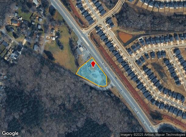
1826 Pageland Hwy, Monroe, NC 28112


Current Lease Availabilities
NEARBY LISTINGS FOR SALE OR LEASE
Property Detail
1826 Pageland Hwy
09-125-137
7238-090
Autorepair
Union
X
North Carolina
3710544400J
1.07 AC
2025
Union County
2025
Charlotte
020602
Charlotte-Concord-Gastonia, NC-SC
2,000 SF
DEMOGRAPHICS near 1826 Pageland Hwy
1 Mile
3 Mile
5 Mile
2024 Total Population
1,547
15,258
37,932
2029 Population
1,741
16,941
42,109
Pop Growth 2024-2029
+ 12.54%
+ 11.03%
+ 11.01%
Average Age
45
38
38
2024 Total Households
507
5,138
12,752
HH Growth 2024-2029
+ 12.62%
+ 11.07%
+ 11.35%
Median Household Inc
$78,155
$46,390
$57,398
Avg Household Size
2.80
2.80
2.70
2024 Avg HH Vehicles
2.00
2.00
2.00
Median Home Value
$323,077
$253,561
$242,843
Median Year Built
1987
1981
1985
Nearby Places
- Restaurants
- Banks
- Shops
- Fitness
- Groceries
Nearby Properties
Address
Land Use
TOTAL SIZE
Lot Size
Zoning
Address
Land Use
TOTAL SIZE
Lot Size
Zoning
68,870 SF
33.25 AC
HC WINGATE
Address
Land Use
TOTAL SIZE
Lot Size
Zoning
134,187 SF
32.44 AC
R-10 MONRO
Address
Land Use
TOTAL SIZE
Lot Size
Zoning
99,235 SF
1.92 AC
CBD MONROE
Address
Land Use
TOTAL SIZE
Lot Size
Zoning
82.26 AC
G-I MONROE
Address
Land Use
TOTAL SIZE
Lot Size
Zoning
7,104 SF
11.99 AC
R-MF MONRO
Address
Land Use
TOTAL SIZE
Lot Size
Zoning
4,608 SF
5.08 AC
OT MONROE
Address
Land Use
TOTAL SIZE
Lot Size
Zoning
104,837 SF
29.15 AC
CD MONROE
Address
Land Use
TOTAL SIZE
Lot Size
Zoning
3,276 SF
6.20 AC
R-MF MONRO
Address
Land Use
TOTAL SIZE
Lot Size
Zoning
121,790 SF
52.36 AC
G-I MONROE
Address
Land Use
TOTAL SIZE
Lot Size
Zoning
79,493 SF
32.65 AC
RA-20 UNIO
Address
Land Use
TOTAL SIZE
Lot Size
Zoning
41,820 SF
6.23 AC
G-I MONROE
Address
Land Use
TOTAL SIZE
Lot Size
Zoning
2,873 SF
55.59 AC
G-I MONROE
Address
Land Use
TOTAL SIZE
Lot Size
Zoning
65,122 SF
5.26 AC
R-10 MONRO
Address
Land Use
TOTAL SIZE
Lot Size
Zoning
32,815 SF
8.28 AC
R-20 MONRO
Address
Land Use
TOTAL SIZE
Lot Size
Zoning
214,256 SF
16.68 AC
G-I MONROE
Address
Land Use
TOTAL SIZE
Lot Size
Zoning
2,712 SF
7.11 AC
R-MH MONRO
Address
Land Use
TOTAL SIZE
Lot Size
Zoning
33,699 SF
2.55 AC
OT MONROE
Address
Land Use
TOTAL SIZE
Lot Size
Zoning
80,000 SF
10.19 AC
G-I MONROE
Address
Land Use
TOTAL SIZE
Lot Size
Zoning
18,200 SF
0.76 AC
CBD MONROE
Address
Land Use
TOTAL SIZE
Lot Size
Zoning
13,016 SF
15.38 AC
GB MONROE
Address
Land Use
TOTAL SIZE
Lot Size
Zoning
61,165 SF
6.59 AC
GB MONROE
Address
Land Use
TOTAL SIZE
Lot Size
Zoning
33,946 SF
2.48 AC
CD MONROE
Address
Land Use
TOTAL SIZE
Lot Size
Zoning
97,344 SF
31.11 AC
R-10 MONRO
Address
Land Use
TOTAL SIZE
Lot Size
Zoning
21,576 SF
1.37 AC
GB MONROE
Address
Land Use
TOTAL SIZE
Lot Size
Zoning
40,297 SF
7.95 AC
CD MONROE
Address
Land Use
TOTAL SIZE
Lot Size
Zoning
2,712 SF
6.78 AC
R-MF MONRO
Address
Land Use
TOTAL SIZE
Lot Size
Zoning
34,529 SF
32.09 AC
G-I MONROE
Address
Land Use
TOTAL SIZE
Lot Size
Zoning
36,821 SF
1.75 AC
OT MONROE
Address
Land Use
TOTAL SIZE
Lot Size
Zoning
7,177 SF
52.47 AC
G-I MONROE
Address
Land Use
TOTAL SIZE
Lot Size
Zoning
194,706 SF
20.47 AC
G-I MONROE
The World's #1 Commercial Real Estate Marketplace
Connect with us
© 2025 CoStar Group
The information above has been obtained from sources believed reliable. While we do not doubt its accuracy we have not verified it and make no guarantee, warranty or representation about it. It is your responsibility to independently confirm its accuracy and completeness. Any projections, opinions, assumptions, or estimates used are for example only and do not represent the current or future performance of the property. The value of this transaction to you depends on tax and other factors which should be evaluated by your tax, financial, and legal advisors. You and your advisors should conduct a careful, independent investigation of the property to determine to your satisfaction the suitability of the property for your needs.