Property Record
301 H D Atha Rd, Monroe, GA 30655
NEARBY LISTINGS FOR SALE OR LEASE
-
-
View all Monroe listings for sale on LoopNet.com
Property Detail
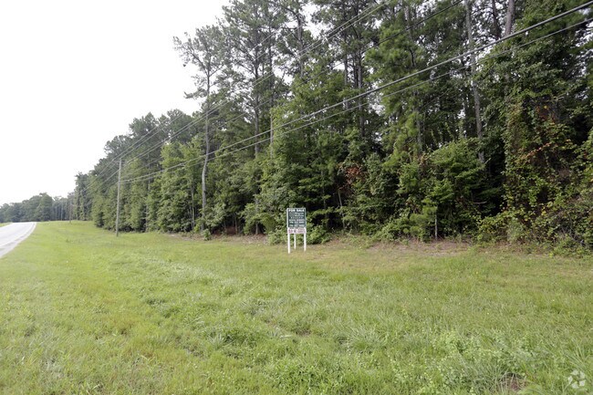
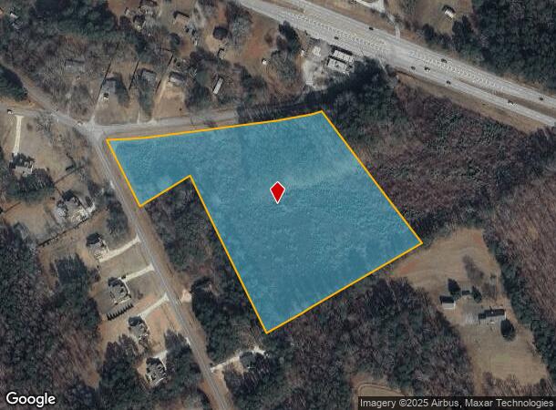
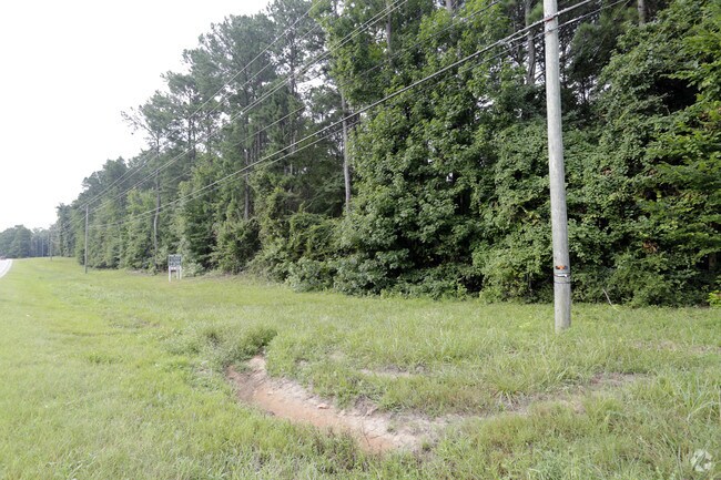
301 H D Atha Rd
Atlanta-Sandy Springs-Roswell, GA
09171A-County Indus. Acre
C075000000008000
TR#1, 10.00AC
Commercialacreage
Walton
X
Georgia
13297C0125E
26
2024
10 AC
2024
Walton County
110702
Atlanta
DEMOGRAPHICS near 301 H D Atha Rd
1 Mile
3 Mile
5 Mile
2024 Total Population
1,934
11,647
39,390
2029 Population
2,228
13,430
45,481
Pop Growth 2024-2029
+ 15.20%
+ 15.31%
+ 15.46%
Average Age
40
41
41
2024 Total Households
660
4,013
14,082
HH Growth 2024-2029
+ 15.61%
+ 15.70%
+ 15.84%
Median Household Inc
$90,058
$81,627
$68,423
Avg Household Size
2.90
2.80
2.70
2024 Avg HH Vehicles
2.00
3.00
2.00
Median Home Value
$293,661
$298,138
$273,207
Median Year Built
2003
2000
1995
Nearby Places
Map Layers
Map Styles
 Street
 Aerial
- Restaurants
- Banks
- Shops
- Fitness
- Groceries
SALE & LEASE HISTORY
LISTING DATE
SALE/LEASE

Jul 26, 2017
For Sale
Nearby Properties
Address
Land Use
TOTAL SIZE
Lot Size
Zoning
Address
Land Use
TOTAL SIZE
Lot Size
Zoning
117,471 SF
65.68 AC
B3
Address
Land Use
TOTAL SIZE
Lot Size
Zoning
188,663 SF
25.40 AC
B3
Address
Land Use
TOTAL SIZE
Lot Size
Zoning
96,129 SF
32.74 AC
A1
Address
Land Use
TOTAL SIZE
Lot Size
Zoning
104,716 SF
11.70 AC
B3
Address
Land Use
TOTAL SIZE
Lot Size
Zoning
45,428 SF
8.11 AC
B3
Address
Land Use
TOTAL SIZE
Lot Size
Zoning
12,240 SF
7.16 AC
B3
Address
Land Use
TOTAL SIZE
Lot Size
Zoning
15,522 SF
2.05 AC
B3
Address
Land Use
TOTAL SIZE
Lot Size
Zoning
31,618 SF
4.22 AC
B3
Address
Land Use
TOTAL SIZE
Lot Size
Zoning
105.57 AC
B3 PCD
Address
Land Use
TOTAL SIZE
Lot Size
Zoning
4,950 SF
6.96 AC
M1
Address
Land Use
TOTAL SIZE
Lot Size
Zoning
18,200 SF
4.55 AC
B3
Address
Land Use
TOTAL SIZE
Lot Size
Zoning
8,640 SF
53 AC
A1
Address
Land Use
TOTAL SIZE
Lot Size
Zoning
12,800 SF
7.36 AC
B3
Address
Land Use
TOTAL SIZE
Lot Size
Zoning
25,340 SF
7.59 AC
B1
Address
Land Use
TOTAL SIZE
Lot Size
Zoning
199.96 AC
R1
Address
Land Use
TOTAL SIZE
Lot Size
Zoning
336.93 AC
A1 WP2
Address
Land Use
TOTAL SIZE
Lot Size
Zoning
188.42 AC
B2 R1
Address
Land Use
TOTAL SIZE
Lot Size
Zoning
8.36 AC
B3
Address
Land Use
TOTAL SIZE
Lot Size
Zoning
10,145 SF
8.41 AC
B3
Address
Land Use
TOTAL SIZE
Lot Size
Zoning
5,000 SF
5.83 AC
B2
Address
Land Use
TOTAL SIZE
Lot Size
Zoning
10,903 SF
9.92 AC
A1
Address
Land Use
TOTAL SIZE
Lot Size
Zoning
221.69 AC
A1 A2
Address
Land Use
TOTAL SIZE
Lot Size
Zoning
5,543 SF
2.05 AC
B3
Address
Land Use
TOTAL SIZE
Lot Size
Zoning
4,891 SF
189.99 AC
A1
Address
Land Use
TOTAL SIZE
Lot Size
Zoning
13,520 SF
1.66 AC
B3
Address
Land Use
TOTAL SIZE
Lot Size
Zoning
6,872 SF
1.27 AC
B3
Address
Land Use
TOTAL SIZE
Lot Size
Zoning
175.91 AC
A1
Address
Land Use
TOTAL SIZE
Lot Size
Zoning
12,000 SF
3 AC
B2
Address
Land Use
TOTAL SIZE
Lot Size
Zoning
8,160 SF
4.52 AC
B2
Address
Land Use
TOTAL SIZE
Lot Size
Zoning
7,190 SF
1.41 AC
B2
The World's #1 Commercial Real Estate Marketplace
Connect with us
© 2025 CoStar Group
The information above has been obtained from sources believed reliable. While we do not doubt its accuracy we have not verified it and make no guarantee, warranty or representation about it. It is your responsibility to independently confirm its accuracy and completeness. Any projections, opinions, assumptions, or estimates used are for example only and do not represent the current or future performance of the property. The value of this transaction to you depends on tax and other factors which should be evaluated by your tax, financial, and legal advisors. You and your advisors should conduct a careful, independent investigation of the property to determine to your satisfaction the suitability of the property for your needs.