Property Record
183 23Rd Ave E, Dickinson, ND 58601


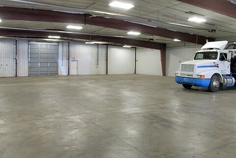
Property Detail
183 23Rd Ave E
Dickinson, ND
LOT 1, BLOCK 4, EAST DALE 4TH
41165204000100
Stark
Commercialnec
North Dakota
B and X Area of moderate flood hazard, usually the area between the limits of the 100-year and 500-year floods.
1
2025
1.10 AC
2025
North Dakota Area
963400
Other Market Areas
20,000 SF
NEARBY LISTINGS FOR SALE OR LEASE
DEMOGRAPHICS near 183 23Rd Ave E
1 mile
3 mile
5 mile
2025 Total Population
2,195
21,186
28,457
2030 Population
2,225
21,805
29,314
Pop Growth 2025-2030
+ 1.37%
+ 2.92%
+ 3.01%
Average Age
34
37
36
2025 Total Households
829
8,505
11,582
HH Growth 2025-2030
+ 1.45%
+ 2.95%
+ 3.07%
Median Household Inc
$102,897
$81,680
$82,502
Avg Household Size
2.50
2.40
2.30
2025 Avg HH Vehicles
2.00
2.00
2.00
Median Home Value
$324,407
$264,140
$277,500
Median Year Built
2003
1981
1988
Nearby Places
Map Layers
Map Styles
 Street
 Aerial
Transit
 Traffic
 Biking
Places
Listings with unknown addresses are not visible on the map
- Restaurants
- Banks
- Shops
- Fitness
- Groceries
SALE & LEASE HISTORY
LISTING DATE
SALE/LEASE

Jul 03, 2017
For Lease
Nearby Properties
Address
Land Use
TOTAL SIZE
Lot Size
Zoning
Address
Land Use
TOTAL SIZE
Lot Size
Zoning
200,215 SF
24.52 AC
Address
Land Use
TOTAL SIZE
Lot Size
Zoning
40,468 SF
11.66 AC
Address
Land Use
TOTAL SIZE
Lot Size
Zoning
140,864 SF
22.24 AC
Address
Land Use
TOTAL SIZE
Lot Size
Zoning
84,176 SF
11.87 AC
Address
Land Use
TOTAL SIZE
Lot Size
Zoning
47,520 SF
6.79 AC
Address
Land Use
TOTAL SIZE
Lot Size
Zoning
10,759 SF
17.99 AC
Address
Land Use
TOTAL SIZE
Lot Size
Zoning
40,257 SF
4.41 AC
Address
Land Use
TOTAL SIZE
Lot Size
Zoning
63,000 SF
34.67 AC
Address
Land Use
TOTAL SIZE
Lot Size
Zoning
90,608 SF
7.56 AC
Address
Land Use
TOTAL SIZE
Lot Size
Zoning
55,500 SF
14.24 AC
Address
Land Use
TOTAL SIZE
Lot Size
Zoning
21,770 SF
8.40 AC
Address
Land Use
TOTAL SIZE
Lot Size
Zoning
28,737 SF
4.73 AC
Address
Land Use
TOTAL SIZE
Lot Size
Zoning
94,500 SF
8.18 AC
Address
Land Use
TOTAL SIZE
Lot Size
Zoning
43,494 SF
7.23 AC
Address
Land Use
TOTAL SIZE
Lot Size
Zoning
10,754 SF
2.68 AC
Address
Land Use
TOTAL SIZE
Lot Size
Zoning
41,160 SF
7.09 AC
Address
Land Use
TOTAL SIZE
Lot Size
Zoning
51,650 SF
2.69 AC
Address
Land Use
TOTAL SIZE
Lot Size
Zoning
9,589 SF
7.70 AC
Address
Land Use
TOTAL SIZE
Lot Size
Zoning
42,404 SF
6.55 AC
Address
Land Use
TOTAL SIZE
Lot Size
Zoning
35,102 SF
9.31 AC
Address
Land Use
TOTAL SIZE
Lot Size
Zoning
24,750 SF
9.06 AC
Address
Land Use
TOTAL SIZE
Lot Size
Zoning
68,076 SF
5.46 AC
Address
Land Use
TOTAL SIZE
Lot Size
Zoning
42,562 SF
0.97 AC
Address
Land Use
TOTAL SIZE
Lot Size
Zoning
17,580 SF
12.89 AC
Address
Land Use
TOTAL SIZE
Lot Size
Zoning
44,190 SF
1.89 AC
Address
Land Use
TOTAL SIZE
Lot Size
Zoning
45,008 SF
0.53 AC
Address
Land Use
TOTAL SIZE
Lot Size
Zoning
9,756 SF
2.03 AC
Address
Land Use
TOTAL SIZE
Lot Size
Zoning
20,000 SF
15.93 AC
Address
Land Use
TOTAL SIZE
Lot Size
Zoning
12,360 SF
2.23 AC
Address
Land Use
TOTAL SIZE
Lot Size
Zoning
89,529 SF
6.66 AC
The World's #1 Commercial Real Estate Marketplace
Connect with us
© 2026 CoStar Group
The information above has been obtained from sources believed reliable. While we do not doubt its accuracy we have not verified it and make no guarantee, warranty or representation about it. It is your responsibility to independently confirm its accuracy and completeness. Any projections, opinions, assumptions, or estimates used are for example only and do not represent the current or future performance of the property. The value of this transaction to you depends on tax and other factors which should be evaluated by your tax, financial, and legal advisors. You and your advisors should conduct a careful, independent investigation of the property to determine to your satisfaction the suitability of the property for your needs.