Property Record
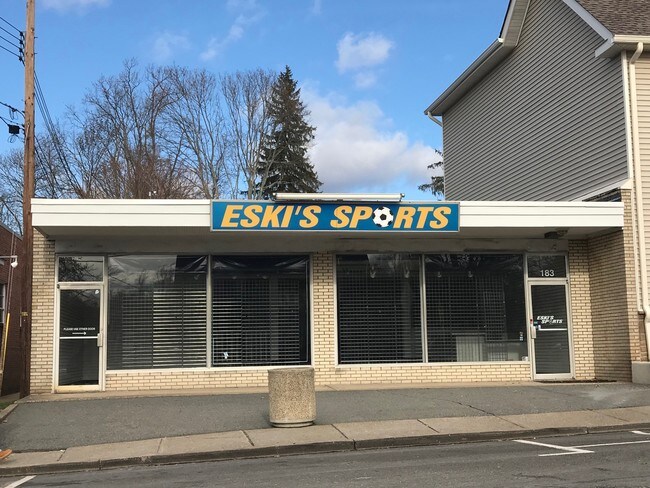
183 E Main St, Ramsey, NJ 07446


Property Detail
183 E Main St
48-04811-0000-00012
0.211AC
Commercialnec
Bergen
B1
New Jersey
B and X Area of moderate flood hazard, usually the area between the limits of the 100-year and 500-year floods.
12
2024
0.21 AC
2025
North 17 Corridor
044202
Northern New Jersey
1,812 SF
New York-Jersey City-White Plains, NY-NJ
NEARBY LISTINGS FOR SALE OR LEASE
-
-
-
-
-
-
-
No Photo
-
View all Ramsey listings for lease on LoopNet.com
DEMOGRAPHICS near 183 E Main St
1 mile
3 mile
5 mile
2025 Total Population
9,792
61,205
170,421
2030 Population
10,163
63,663
176,832
Pop Growth 2025-2030
+ 3.79%
+ 4.02%
+ 3.76%
Average Age
42
44
41
2025 Total Households
3,566
22,740
58,119
HH Growth 2025-2030
+ 3.79%
+ 3.98%
+ 3.80%
Median Household Inc
$163,461
$146,822
$144,994
Avg Household Size
2.70
2.60
2.80
2025 Avg HH Vehicles
2.00
2.00
2.00
Median Home Value
$752,849
$770,664
$760,693
Median Year Built
1967
1978
1969
Nearby Places
Map Layers
Map Styles
 Street
 Aerial
Transit
 Traffic
 Biking
Places
Listings with unknown addresses are not visible on the map
- Restaurants
- Banks
- Shops
- Fitness
- Groceries
PUBLIC TRANSPORTATION
COMMUTER RAIL
Ramsey (Bergen County/Port Jervis Line - NJ Transit Commuter Rail (NJ Transit), Main/Port Jervis Line - NJ Transit Commuter Rail (NJ Transit))
Drive
Walk
Distance
Ramsey (Bergen County/Port Jervis Line - NJ Transit Commuter Rail (NJ Transit), Main/Port Jervis Line - NJ Transit Commuter Rail (NJ Transit))
1 min
7 min
0.4 mi
Ramsey Route 17 (Bergen County/Port Jervis Line - NJ Transit Commuter Rail (NJ Transit), Main/Port Jervis Line - NJ Transit Commuter Rail (NJ Transit))
Drive
Walk
Distance
Ramsey Route 17 (Bergen County/Port Jervis Line - NJ Transit Commuter Rail (NJ Transit), Main/Port Jervis Line - NJ Transit Commuter Rail (NJ Transit))
4 min
1.9 mi
AIRPORT
LaGuardia
Drive
Walk
Distance
LaGuardia
46 min
30.0 mi
Newark Liberty International
Drive
Walk
Distance
Newark Liberty International
39 min
30.3 mi
Westchester County
Drive
Walk
Distance
Westchester County
49 min
36.1 mi
Freight Ports
Port Newark Container Terminal
Drive
Walk
Distance
Port Newark Container Terminal
46 min
32.0 mi
SALE & LEASE HISTORY
LISTING DATE
SALE/LEASE

Jun 13, 2017
For Lease
Jan 16, 2018
For Lease
Nearby Properties
Address
Land Use
TOTAL SIZE
Lot Size
Zoning
Address
Land Use
TOTAL SIZE
Lot Size
Zoning
284 AC
P40
Address
Land Use
TOTAL SIZE
Lot Size
Zoning
28.44 AC
Address
Land Use
TOTAL SIZE
Lot Size
Zoning
28.28 AC
GI80
Address
Land Use
TOTAL SIZE
Lot Size
Zoning
39.50 AC
Address
Land Use
TOTAL SIZE
Lot Size
Zoning
46.89 AC
IP120
Address
Land Use
TOTAL SIZE
Lot Size
Zoning
40.40 AC
PU
Address
Land Use
TOTAL SIZE
Lot Size
Zoning
61.37 AC
PED
Address
Land Use
TOTAL SIZE
Lot Size
Zoning
17.71 AC
B3
Address
Land Use
TOTAL SIZE
Lot Size
Zoning
2,379 SF
1.09 AC
LI
Address
Land Use
TOTAL SIZE
Lot Size
Zoning
7.11 AC
Address
Land Use
TOTAL SIZE
Lot Size
Zoning
16.02 AC
R3
Address
Land Use
TOTAL SIZE
Lot Size
Zoning
38.65 AC
Address
Land Use
TOTAL SIZE
Lot Size
Zoning
10.38 AC
Address
Land Use
TOTAL SIZE
Lot Size
Zoning
10.64 AC
AAA
Address
Land Use
TOTAL SIZE
Lot Size
Zoning
6.52 AC
Address
Land Use
TOTAL SIZE
Lot Size
Zoning
17.90 AC
IP
Address
Land Use
TOTAL SIZE
Lot Size
Zoning
2.33 AC
B3
Address
Land Use
TOTAL SIZE
Lot Size
Zoning
20 AC
ORP200
Address
Land Use
TOTAL SIZE
Lot Size
Zoning
170,941 SF
10.04 AC
IP
Address
Land Use
TOTAL SIZE
Lot Size
Zoning
124,528 SF
8.87 AC
EM
Address
Land Use
TOTAL SIZE
Lot Size
Zoning
14.09 AC
B200
Address
Land Use
TOTAL SIZE
Lot Size
Zoning
106,836 SF
8.85 AC
LO
Address
Land Use
TOTAL SIZE
Lot Size
Zoning
15.98 AC
Address
Land Use
TOTAL SIZE
Lot Size
Zoning
6.29 AC
B3
Address
Land Use
TOTAL SIZE
Lot Size
Zoning
99,832 SF
10.39 AC
E
Address
Land Use
TOTAL SIZE
Lot Size
Zoning
74,278 SF
6.91 AC
C2
Address
Land Use
TOTAL SIZE
Lot Size
Zoning
107,584 SF
9.19 AC
EM
Address
Land Use
TOTAL SIZE
Lot Size
Zoning
15.30 AC
R1
Address
Land Use
TOTAL SIZE
Lot Size
Zoning
133,140 SF
8.10 AC
B3
Address
Land Use
TOTAL SIZE
Lot Size
Zoning
146,442 SF
7.97 AC
LO
The World's #1 Commercial Real Estate Marketplace
Connect with us
© 2026 CoStar Group
The information above has been obtained from sources believed reliable. While we do not doubt its accuracy we have not verified it and make no guarantee, warranty or representation about it. It is your responsibility to independently confirm its accuracy and completeness. Any projections, opinions, assumptions, or estimates used are for example only and do not represent the current or future performance of the property. The value of this transaction to you depends on tax and other factors which should be evaluated by your tax, financial, and legal advisors. You and your advisors should conduct a careful, independent investigation of the property to determine to your satisfaction the suitability of the property for your needs.