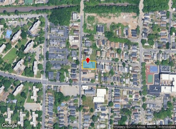
Property Record
183 Harbor Rd, Staten Island, NY 10303


NEARBY LISTINGS FOR SALE OR LEASE
Property Detail
183 Harbor Rd
01229-0009
Staten Island
Religious
New York
X
9
3604970168F
0.25 AC
0
Staten Island
2025
Long Island (New York)
023100
New York-Jersey City-White Plains, NY-NJ
4,200 SF
DEMOGRAPHICS near 183 Harbor Rd
1 mile
3 mile
5 mile
2024 Total Population
33,036
204,782
536,397
2029 Population
32,307
198,469
523,423
Pop Growth 2024-2029
(2.21%)
(3.08%)
(2.42%)
Average Age
37
39
39
2024 Total Households
10,444
68,470
187,408
HH Growth 2024-2029
(2.20%)
(3.22%)
(2.50%)
Median Household Inc
$72,502
$75,561
$71,228
Avg Household Size
3.10
2.90
2.70
2024 Avg HH Vehicles
1.00
1.00
1.00
Median Home Value
$441,470
$553,618
$522,195
Median Year Built
1978
1964
1963
Nearby Places
Map Layers
Map Styles
 Street
 Aerial
Transit
 Traffic
 Biking
Places
Listings with unknown addresses are not visible on the map
- Restaurants
- Banks
- Shops
- Fitness
- Groceries
PUBLIC TRANSPORTATION
COMMUTER RAIL
Elizabeth (North Jersey Coast Line - NJ Transit Commuter Rail (NJ Transit), Northeast Corridor Line - NJ Transit Commuter Rail (NJ Transit))
Drive
Walk
Distance
Elizabeth (North Jersey Coast Line - NJ Transit Commuter Rail (NJ Transit), Northeast Corridor Line - NJ Transit Commuter Rail (NJ Transit))
13 min
5.6 mi
Jefferson Avenue (Staten Island Railway - New York MTA Subway (The Subway))
Drive
Walk
Distance
Jefferson Avenue (Staten Island Railway - New York MTA Subway (The Subway))
18 min
7.3 mi
AIRPORT
Newark Liberty International
Drive
Walk
Distance
Newark Liberty International
20 min
11.9 mi
LaGuardia
Drive
Walk
Distance
LaGuardia
45 min
26.3 mi
John F Kennedy International
Drive
Walk
Distance
John F Kennedy International
48 min
28.8 mi
Freight Ports
New York Container Terminal
Drive
Walk
Distance
New York Container Terminal
6 min
2.2 mi
Nearby Properties
Address
Land Use
TOTAL SIZE
Lot Size
Zoning
Address
Land Use
TOTAL SIZE
Lot Size
Zoning
28.40 AC
Address
Land Use
TOTAL SIZE
Lot Size
Zoning
113.19 AC
Address
Land Use
TOTAL SIZE
Lot Size
Zoning
633,280 SF
202.90 AC
R3-2
Address
Land Use
TOTAL SIZE
Lot Size
Zoning
98.41 AC
Address
Land Use
TOTAL SIZE
Lot Size
Zoning
4,450,000 SF
95.24 AC
Address
Land Use
TOTAL SIZE
Lot Size
Zoning
22.49 AC
HC
Address
Land Use
TOTAL SIZE
Lot Size
Zoning
Address
Land Use
TOTAL SIZE
Lot Size
Zoning
70.39 AC
Address
Land Use
TOTAL SIZE
Lot Size
Zoning
16.63 AC
Address
Land Use
TOTAL SIZE
Lot Size
Zoning
2.21 AC
Address
Land Use
TOTAL SIZE
Lot Size
Zoning
149.68 AC
Address
Land Use
TOTAL SIZE
Lot Size
Zoning
1.01 AC
Address
Land Use
TOTAL SIZE
Lot Size
Zoning
51.62 AC
Address
Land Use
TOTAL SIZE
Lot Size
Zoning
20,000 SF
30.36 AC
Address
Land Use
TOTAL SIZE
Lot Size
Zoning
91,760 SF
210.43 AC
M3-1
Address
Land Use
TOTAL SIZE
Lot Size
Zoning
Address
Land Use
TOTAL SIZE
Lot Size
Zoning
3,500,000 SF
11.97 AC
MRC2
Address
Land Use
TOTAL SIZE
Lot Size
Zoning
51.61 AC
Address
Land Use
TOTAL SIZE
Lot Size
Zoning
39.64 AC
Address
Land Use
TOTAL SIZE
Lot Size
Zoning
566,000 SF
103.31 AC
R3-2
Address
Land Use
TOTAL SIZE
Lot Size
Zoning
6,188,000 SF
8.18 AC
Address
Land Use
TOTAL SIZE
Lot Size
Zoning
11.96 AC
Address
Land Use
TOTAL SIZE
Lot Size
Zoning
1 SF
20 AC
Address
Land Use
TOTAL SIZE
Lot Size
Zoning
1 SF
19.95 AC
Address
Land Use
TOTAL SIZE
Lot Size
Zoning
11.14 AC
Address
Land Use
TOTAL SIZE
Lot Size
Zoning
30.70 AC
Address
Land Use
TOTAL SIZE
Lot Size
Zoning
855,000 SF
48.74 AC
M3-1
Address
Land Use
TOTAL SIZE
Lot Size
Zoning
28.15 AC
Address
Land Use
TOTAL SIZE
Lot Size
Zoning
10 SF
9.18 AC
Address
Land Use
TOTAL SIZE
Lot Size
Zoning
1.72 AC
The World's #1 Commercial Real Estate Marketplace
Connect with us
© 2026 CoStar Group
The information above has been obtained from sources believed reliable. While we do not doubt its accuracy we have not verified it and make no guarantee, warranty or representation about it. It is your responsibility to independently confirm its accuracy and completeness. Any projections, opinions, assumptions, or estimates used are for example only and do not represent the current or future performance of the property. The value of this transaction to you depends on tax and other factors which should be evaluated by your tax, financial, and legal advisors. You and your advisors should conduct a careful, independent investigation of the property to determine to your satisfaction the suitability of the property for your needs.