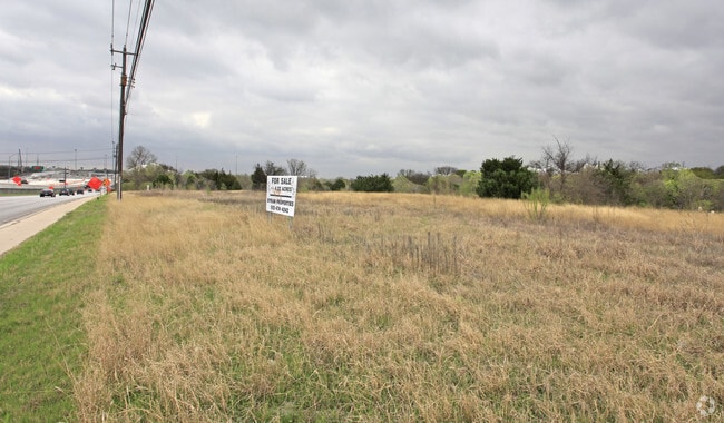
Property Record
183 N Us Hy 183 St, Round Rock, TX 78752


NEARBY LISTINGS FOR SALE OR LEASE
Property Detail
183 N Us Hy 183 St
Austin-Round Rock, TX
Salter Addn
230726
LOT A SALTER ADDN
Vacantlandnec
Travis
AE
Texas
48453C0460K
a
2024
2.80 AC
2025
Northeast
001503
Austin
DEMOGRAPHICS near 183 N Us Hy 183 St
1 Mile
3 Mile
5 Mile
2024 Total Population
15,022
131,998
343,080
2029 Population
16,276
143,962
373,759
Pop Growth 2024-2029
+ 8.35%
+ 9.06%
+ 8.94%
Average Age
36
36
35
2024 Total Households
5,742
53,994
140,700
HH Growth 2024-2029
+ 8.83%
+ 9.87%
+ 9.89%
Median Household Inc
$45,141
$59,522
$62,104
Avg Household Size
2.40
2.30
2.30
2024 Avg HH Vehicles
1.00
2.00
2.00
Median Home Value
$363,763
$426,096
$442,515
Median Year Built
1981
1983
1986
Nearby Places
Map Layers
Map Styles
 Street
 Aerial
- Restaurants
- Banks
- Shops
- Fitness
- Groceries
PUBLIC TRANSPORTATION
COMMUTER RAIL
Austin (Texas Eagle - Amtrak)
DRIVE
WALK
Distance
Austin (Texas Eagle - Amtrak)
15 min
8.3 mi
AIRPORT
Austin-Bergstrom International
DRIVE
WALK
Distance
Austin-Bergstrom International
23 min
14.7 mi
Freight Ports
Calhoun Port
DRIVE
WALK
Distance
Calhoun Port
189 min
158.1 mi
SALE & LEASE HISTORY
LISTING DATE
SALE/LEASE

Nov 11, 2016
For Sale
May 12, 2017
For Sale
Mar 26, 2018
For Sale
Jan 06, 2017
For Sale
Nearby Properties
Address
Land Use
TOTAL SIZE
Lot Size
Zoning
Address
Land Use
TOTAL SIZE
Lot Size
Zoning
548,399 SF
23.82 AC
Address
Land Use
TOTAL SIZE
Lot Size
Zoning
19,284 SF
178.26 AC
Address
Land Use
TOTAL SIZE
Lot Size
Zoning
241,998 SF
2.42 AC
Address
Land Use
TOTAL SIZE
Lot Size
Zoning
480,823 SF
18.46 AC
Address
Land Use
TOTAL SIZE
Lot Size
Zoning
322,150 SF
3.83 AC
Address
Land Use
TOTAL SIZE
Lot Size
Zoning
432,032 SF
6.70 AC
Address
Land Use
TOTAL SIZE
Lot Size
Zoning
609,823 SF
3.33 AC
Address
Land Use
TOTAL SIZE
Lot Size
Zoning
372,075 SF
4.97 AC
Address
Land Use
TOTAL SIZE
Lot Size
Zoning
265,000 SF
1.57 AC
Address
Land Use
TOTAL SIZE
Lot Size
Zoning
346,319 SF
6.53 AC
Address
Land Use
TOTAL SIZE
Lot Size
Zoning
297,356 SF
4.32 AC
Address
Land Use
TOTAL SIZE
Lot Size
Zoning
288,750 SF
4.81 AC
Address
Land Use
TOTAL SIZE
Lot Size
Zoning
425,200 SF
2.49 AC
Address
Land Use
TOTAL SIZE
Lot Size
Zoning
274,228 SF
4.95 AC
Address
Land Use
TOTAL SIZE
Lot Size
Zoning
126.15 AC
Address
Land Use
TOTAL SIZE
Lot Size
Zoning
276,772 SF
4.68 AC
Address
Land Use
TOTAL SIZE
Lot Size
Zoning
274,943 SF
42.35 AC
Address
Land Use
TOTAL SIZE
Lot Size
Zoning
18.45 AC
Address
Land Use
TOTAL SIZE
Lot Size
Zoning
236,688 SF
3.64 AC
Address
Land Use
TOTAL SIZE
Lot Size
Zoning
376,385 SF
26.47 AC
Address
Land Use
TOTAL SIZE
Lot Size
Zoning
248,325 SF
2.46 AC
Address
Land Use
TOTAL SIZE
Lot Size
Zoning
16.11 AC
Address
Land Use
TOTAL SIZE
Lot Size
Zoning
555,296 SF
4.07 AC
Address
Land Use
TOTAL SIZE
Lot Size
Zoning
278,429 SF
3.76 AC
Address
Land Use
TOTAL SIZE
Lot Size
Zoning
263,177 SF
4.65 AC
Address
Land Use
TOTAL SIZE
Lot Size
Zoning
115,640 SF
18 AC
Address
Land Use
TOTAL SIZE
Lot Size
Zoning
274,864 SF
3.33 AC
Address
Land Use
TOTAL SIZE
Lot Size
Zoning
278,100 SF
3.55 AC
Address
Land Use
TOTAL SIZE
Lot Size
Zoning
320,797 SF
12.04 AC
Address
Land Use
TOTAL SIZE
Lot Size
Zoning
264,401 SF
10.48 AC
The World's #1 Commercial Real Estate Marketplace
Connect with us
© 2026 CoStar Group
The information above has been obtained from sources believed reliable. While we do not doubt its accuracy we have not verified it and make no guarantee, warranty or representation about it. It is your responsibility to independently confirm its accuracy and completeness. Any projections, opinions, assumptions, or estimates used are for example only and do not represent the current or future performance of the property. The value of this transaction to you depends on tax and other factors which should be evaluated by your tax, financial, and legal advisors. You and your advisors should conduct a careful, independent investigation of the property to determine to your satisfaction the suitability of the property for your needs.