Property Record
183 Northpointe Blvd, Freeport, PA 16229
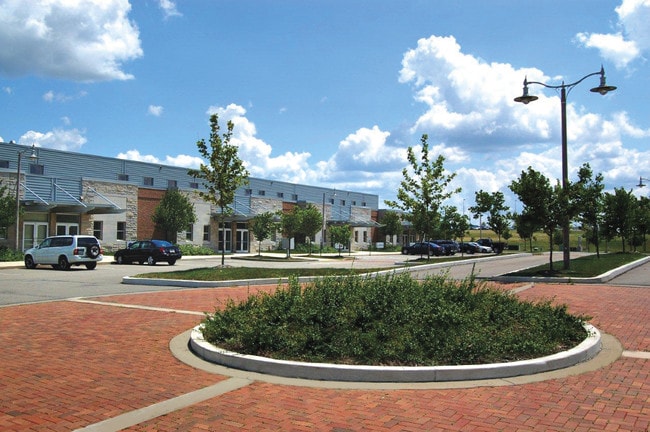

Property Detail
183 Northpointe Blvd
44-0-067600
MAP NO:152.00-01-08.006- ; LOT 17 - BLDG PB6 PG178-179 SL563-564
Industrialgeneral
Armstrong
B and X Area of moderate flood hazard, usually the area between the limits of the 100-year and 500-year floods.
Pennsylvania
2025
5.82 AC
2025
Armstrong County
951200
Pittsburgh
30,038 SF
Pittsburgh, PA
NEARBY LISTINGS FOR SALE OR LEASE
DEMOGRAPHICS near 183 Northpointe Blvd
1 mile
3 mile
5 mile
2025 Total Population
402
2,780
6,664
2030 Population
387
2,687
6,510
Pop Growth 2025-2030
(3.73%)
(3.35%)
(2.31%)
Average Age
44
46
46
2025 Total Households
154
1,126
2,696
HH Growth 2025-2030
(3.90%)
(3.37%)
(2.37%)
Median Household Inc
$85,000
$78,931
$76,881
Avg Household Size
2.60
2.40
2.40
2025 Avg HH Vehicles
2.00
2.00
2.00
Median Home Value
$242,683
$219,635
$225,232
Median Year Built
1966
1968
1970
Nearby Places
Map Layers
Map Styles
 Street
 Aerial
Layers
 Traffic
 Biking
Places
Listings with unknown addresses are not visible on the map
- Restaurants
- Banks
- Shops
- Fitness
- Groceries
Nearby Properties
Address
Land Use
TOTAL SIZE
Lot Size
Zoning
Address
Land Use
TOTAL SIZE
Lot Size
Zoning
44,000 SF
37.30 AC
Address
Land Use
TOTAL SIZE
Lot Size
Zoning
23,999 SF
5.43 AC
Address
Land Use
TOTAL SIZE
Lot Size
Zoning
45,373 SF
5.36 AC
Address
Land Use
TOTAL SIZE
Lot Size
Zoning
25,000 SF
3.95 AC
Address
Land Use
TOTAL SIZE
Lot Size
Zoning
49,033 SF
5.02 AC
Address
Land Use
TOTAL SIZE
Lot Size
Zoning
34,415 SF
8.54 AC
Address
Land Use
TOTAL SIZE
Lot Size
Zoning
34,290 SF
2.82 AC
Address
Land Use
TOTAL SIZE
Lot Size
Zoning
23,400 SF
3.85 AC
Address
Land Use
TOTAL SIZE
Lot Size
Zoning
14,960 SF
19 AC
RESIDENTIA
Address
Land Use
TOTAL SIZE
Lot Size
Zoning
2.20 AC
Address
Land Use
TOTAL SIZE
Lot Size
Zoning
16,843 SF
2.82 AC
Address
Land Use
TOTAL SIZE
Lot Size
Zoning
10,350 SF
2.22 AC
BUSINESS
Address
Land Use
TOTAL SIZE
Lot Size
Zoning
10,500 SF
2.68 AC
Address
Land Use
TOTAL SIZE
Lot Size
Zoning
12,636 SF
1 AC
BUSINESS
Address
Land Use
TOTAL SIZE
Lot Size
Zoning
28,191 SF
35 AC
RESIDENTIA
Address
Land Use
TOTAL SIZE
Lot Size
Zoning
6,420 SF
8.72 AC
AGRICULTUR
Address
Land Use
TOTAL SIZE
Lot Size
Zoning
113.66 AC
RESIDENTIA
Address
Land Use
TOTAL SIZE
Lot Size
Zoning
298.70 AC
AGRICULTUR
Address
Land Use
TOTAL SIZE
Lot Size
Zoning
45,913 SF
2 AC
Address
Land Use
TOTAL SIZE
Lot Size
Zoning
6,000 SF
1.07 AC
RESIDENTIA
Address
Land Use
TOTAL SIZE
Lot Size
Zoning
4,800 SF
12.14 AC
AGRICULTUR
Address
Land Use
TOTAL SIZE
Lot Size
Zoning
10,444 SF
2.11 AC
Address
Land Use
TOTAL SIZE
Lot Size
Zoning
10,260 SF
9.17 AC
Address
Land Use
TOTAL SIZE
Lot Size
Zoning
4,302 SF
2.23 AC
AGRICULTUR
Address
Land Use
TOTAL SIZE
Lot Size
Zoning
72.82 AC
Address
Land Use
TOTAL SIZE
Lot Size
Zoning
10,040 SF
1.74 AC
RESIDENTIA
Address
Land Use
TOTAL SIZE
Lot Size
Zoning
12,032 SF
1.35 AC
AGRICULTUR
Address
Land Use
TOTAL SIZE
Lot Size
Zoning
3,305 SF
38.96 AC
RESIDENTIA
Address
Land Use
TOTAL SIZE
Lot Size
Zoning
768 SF
27.25 AC
AGRICULTUR
The World's #1 Commercial Real Estate Marketplace
Connect with us
© 2026 CoStar Group
The information above has been obtained from sources believed reliable. While we do not doubt its accuracy we have not verified it and make no guarantee, warranty or representation about it. It is your responsibility to independently confirm its accuracy and completeness. Any projections, opinions, assumptions, or estimates used are for example only and do not represent the current or future performance of the property. The value of this transaction to you depends on tax and other factors which should be evaluated by your tax, financial, and legal advisors. You and your advisors should conduct a careful, independent investigation of the property to determine to your satisfaction the suitability of the property for your needs.