Property Record
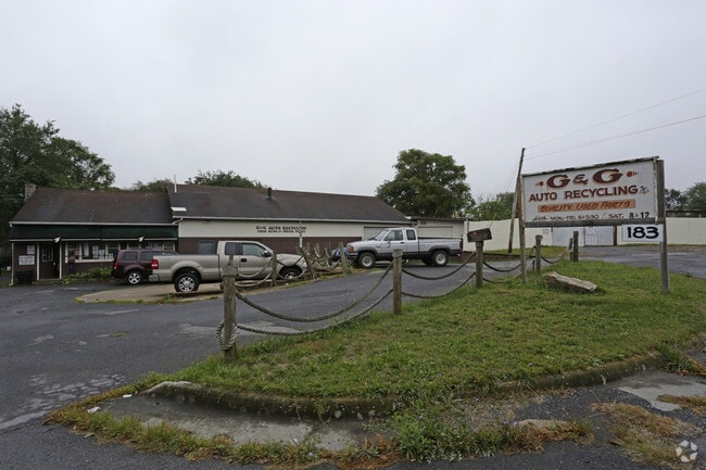
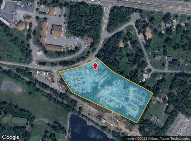
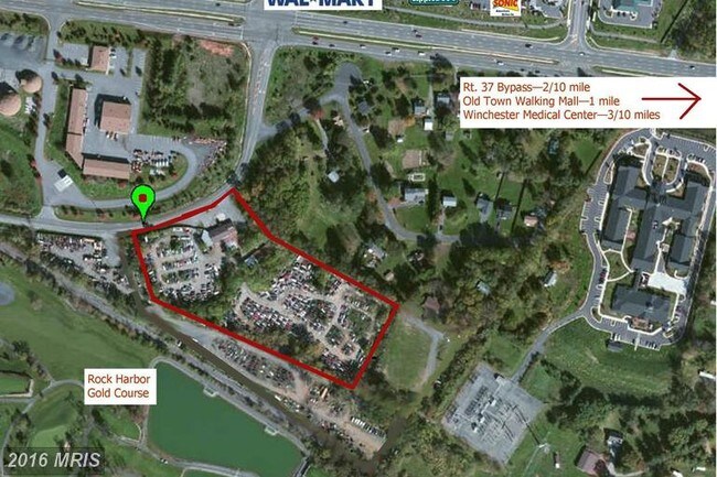
183 Round Hill Rd, Winchester, VA 22602
NEARBY LISTINGS FOR SALE OR LEASE
Property Detail
183 Round Hill Rd
52A-254A
1
Multipleuses
6.33 ACRES
A
Frederick
51069C0204E
Virginia
2025
6.33 AC
2025
Frederick County
050500
Washington, DC
3,336 SF
Winchester, VA-WV
DEMOGRAPHICS near 183 Round Hill Rd
1 Mile
3 Mile
5 Mile
2024 Total Population
1,627
28,133
56,940
2029 Population
1,782
28,428
59,613
Pop Growth 2024-2029
+ 9.53%
+ 1.05%
+ 4.69%
Average Age
51
41
41
2024 Total Households
719
11,734
22,179
HH Growth 2024-2029
+ 9.74%
+ 1.05%
+ 4.45%
Median Household Inc
$83,409
$67,115
$67,361
Avg Household Size
2.20
2.20
2.40
2024 Avg HH Vehicles
2.00
2.00
2.00
Median Home Value
$368,895
$341,363
$308,939
Median Year Built
2003
1976
1981
Nearby Places
- Restaurants
- Banks
- Shops
- Fitness
- Groceries
SALE & LEASE HISTORY
LISTING DATE
SALE/LEASE

Sep 23, 2016
For Sale
Oct 27, 2016
For Sale
Mar 03, 2017
For Sale
Jul 05, 2017
For Sale
Feb 15, 2019
For Sale
Nearby Properties
Address
Land Use
TOTAL SIZE
Lot Size
Zoning
Address
Land Use
TOTAL SIZE
Lot Size
Zoning
979,509 SF
161.49 AC
MC
Address
Land Use
TOTAL SIZE
Lot Size
Zoning
375,081 SF
74.09 AC
M2
Address
Land Use
TOTAL SIZE
Lot Size
Zoning
10,821 SF
68.86 AC
RA
Address
Land Use
TOTAL SIZE
Lot Size
Zoning
33,264 SF
10.59 AC
MR
Address
Land Use
TOTAL SIZE
Lot Size
Zoning
191,138 SF
35 AC
EIP
Address
Land Use
TOTAL SIZE
Lot Size
Zoning
11,979 SF
10.82 AC
HR
Address
Land Use
TOTAL SIZE
Lot Size
Zoning
27,464 SF
8.53 AC
B2
Address
Land Use
TOTAL SIZE
Lot Size
Zoning
65,320 SF
2.62 AC
B1
Address
Land Use
TOTAL SIZE
Lot Size
Zoning
64,711 SF
18.10 AC
B2
Address
Land Use
TOTAL SIZE
Lot Size
Zoning
5,293 SF
195.07 AC
LR
Address
Land Use
TOTAL SIZE
Lot Size
Zoning
96,721 SF
9.19 AC
EIP
Address
Land Use
TOTAL SIZE
Lot Size
Zoning
94,606 SF
4.92 AC
B2
Address
Land Use
TOTAL SIZE
Lot Size
Zoning
20,844 SF
11.58 AC
RP
Address
Land Use
TOTAL SIZE
Lot Size
Zoning
199,053 SF
20.53 AC
B2
Address
Land Use
TOTAL SIZE
Lot Size
Zoning
151,000 SF
26.91 AC
LR
Address
Land Use
TOTAL SIZE
Lot Size
Zoning
83,786 SF
2.71 AC
HE1
Address
Land Use
TOTAL SIZE
Lot Size
Zoning
73,226 SF
10.24 AC
B2
Address
Land Use
TOTAL SIZE
Lot Size
Zoning
69,975 SF
14.77 AC
B2
Address
Land Use
TOTAL SIZE
Lot Size
Zoning
74,336 SF
8.91 AC
MC
Address
Land Use
TOTAL SIZE
Lot Size
Zoning
12,000 SF
8.78 AC
CM1
Address
Land Use
TOTAL SIZE
Lot Size
Zoning
57,276 SF
1.07 AC
EIP
Address
Land Use
TOTAL SIZE
Lot Size
Zoning
31,134 SF
7.53 AC
MR
Address
Land Use
TOTAL SIZE
Lot Size
Zoning
75,734 SF
10 AC
RA
Address
Land Use
TOTAL SIZE
Lot Size
Zoning
51,550 SF
2.12 AC
EIP
Address
Land Use
TOTAL SIZE
Lot Size
Zoning
3,332 SF
6.86 AC
HR
Address
Land Use
TOTAL SIZE
Lot Size
Zoning
169,744 SF
9.68 AC
HR
Address
Land Use
TOTAL SIZE
Lot Size
Zoning
20,797 SF
9.36 AC
LR
Address
Land Use
TOTAL SIZE
Lot Size
Zoning
16,948 SF
5.44 AC
HR
Address
Land Use
TOTAL SIZE
Lot Size
Zoning
100,000 SF
10.21 AC
M1
Address
Land Use
TOTAL SIZE
Lot Size
Zoning
59,003 SF
8.50 AC
B2
The World's #1 Commercial Real Estate Marketplace
Connect with us
© 2025 CoStar Group
The information above has been obtained from sources believed reliable. While we do not doubt its accuracy we have not verified it and make no guarantee, warranty or representation about it. It is your responsibility to independently confirm its accuracy and completeness. Any projections, opinions, assumptions, or estimates used are for example only and do not represent the current or future performance of the property. The value of this transaction to you depends on tax and other factors which should be evaluated by your tax, financial, and legal advisors. You and your advisors should conduct a careful, independent investigation of the property to determine to your satisfaction the suitability of the property for your needs.