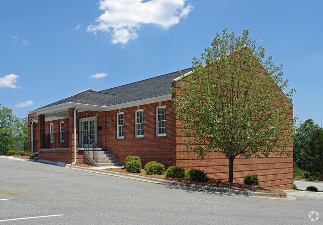
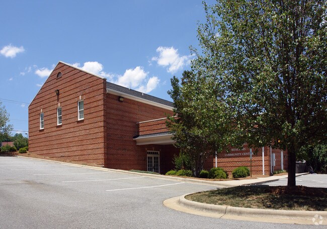
Property Record
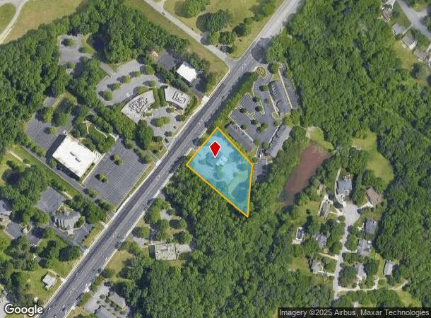
1830 Eastchester Dr, High Point, NC 27265
NEARBY LISTINGS FOR SALE OR LEASE
Property Detail
1830 Eastchester Dr
Greensboro-High Point, NC
Eastchester
0200126
HP REGIONAL ASSOC. OF REALTORS INC PL:208-74
Officebuilding
Guilford
X
North Carolina
3710780200J
5
2024
1.36 AC
2025
High Point/SW Guilford Cty
014412
Greensboro/Winston-Salem
3,854 SF
DEMOGRAPHICS near 1830 Eastchester Dr
1 Mile
3 Mile
5 Mile
2024 Total Population
4,060
56,691
127,314
2029 Population
4,009
56,562
127,889
Pop Growth 2024-2029
(1.26%)
(0.23%)
+ 0.45%
Average Age
41
40
40
2024 Total Households
1,720
21,584
50,289
HH Growth 2024-2029
(1.28%)
(0.29%)
+ 0.43%
Median Household Inc
$65,433
$60,819
$62,944
Avg Household Size
2.30
2.40
2.40
2024 Avg HH Vehicles
2.00
2.00
2.00
Median Home Value
$197,003
$186,985
$206,407
Median Year Built
1991
1985
1988
Nearby Places
Map Layers
Map Styles
 Street
 Aerial
- Restaurants
- Banks
- Shops
- Fitness
- Groceries
PUBLIC TRANSPORTATION
COMMUTER RAIL
High Point Station (Piedmont - North Carolina by Train (NC Train))
DRIVE
WALK
Distance
High Point Station (Piedmont - North Carolina by Train (NC Train))
8 min
4.0 mi
AIRPORT
Piedmont Triad International
DRIVE
WALK
Distance
Piedmont Triad International
19 min
8.4 mi
Nearby Properties
Address
Land Use
TOTAL SIZE
Lot Size
Zoning
Address
Land Use
TOTAL SIZE
Lot Size
Zoning
264,860 SF
62.75 AC
PI
Address
Land Use
TOTAL SIZE
Lot Size
Zoning
256,051 SF
37.69 AC
LI
Address
Land Use
TOTAL SIZE
Lot Size
Zoning
236,597 SF
13.83 AC
CU-PI
Address
Land Use
TOTAL SIZE
Lot Size
Zoning
805,958 SF
61.42 AC
LI
Address
Land Use
TOTAL SIZE
Lot Size
Zoning
291,895 SF
21.52 AC
RM-26
Address
Land Use
TOTAL SIZE
Lot Size
Zoning
136,202 SF
30.02 AC
CZ-I
Address
Land Use
TOTAL SIZE
Lot Size
Zoning
363,308 SF
29.41 AC
RM-16
Address
Land Use
TOTAL SIZE
Lot Size
Zoning
30,322 SF
964.25 AC
PNR
Address
Land Use
TOTAL SIZE
Lot Size
Zoning
53,362 SF
0.51 AC
LAR3
Address
Land Use
TOTAL SIZE
Lot Size
Zoning
274,999 SF
21.57 AC
LI
Address
Land Use
TOTAL SIZE
Lot Size
Zoning
240,936 SF
12.02 AC
PDM
Address
Land Use
TOTAL SIZE
Lot Size
Zoning
269,956 SF
19.44 AC
OI
Address
Land Use
TOTAL SIZE
Lot Size
Zoning
215,222 SF
15.14 AC
RC
Address
Land Use
TOTAL SIZE
Lot Size
Zoning
209,184 SF
13.52 AC
OI
Address
Land Use
TOTAL SIZE
Lot Size
Zoning
75,588 SF
6.49 AC
LI
Address
Land Use
TOTAL SIZE
Lot Size
Zoning
1.32 AC
PNR
Address
Land Use
TOTAL SIZE
Lot Size
Zoning
185,320 SF
15.08 AC
PI
Address
Land Use
TOTAL SIZE
Lot Size
Zoning
170,183 SF
13.94 AC
RM-16
Address
Land Use
TOTAL SIZE
Lot Size
Zoning
166,196 SF
19.99 AC
RM-16
Address
Land Use
TOTAL SIZE
Lot Size
Zoning
342,988 SF
29.36 AC
LI
Address
Land Use
TOTAL SIZE
Lot Size
Zoning
164,027 SF
12.52 AC
RM-16
Address
Land Use
TOTAL SIZE
Lot Size
Zoning
128,435 SF
10.40 AC
LI
Address
Land Use
TOTAL SIZE
Lot Size
Zoning
361,412 SF
35.81 AC
LI
Address
Land Use
TOTAL SIZE
Lot Size
Zoning
90,060 SF
3.15 AC
CZ-I
Address
Land Use
TOTAL SIZE
Lot Size
Zoning
311,785 SF
107.44 AC
PI
Address
Land Use
TOTAL SIZE
Lot Size
Zoning
56,029 SF
9.36 AC
CU-GB
Address
Land Use
TOTAL SIZE
Lot Size
Zoning
233,893 SF
51.31 AC
LI
Address
Land Use
TOTAL SIZE
Lot Size
Zoning
250,573 SF
48.53 AC
R-5
Address
Land Use
TOTAL SIZE
Lot Size
Zoning
324,986 SF
24.19 AC
LI
Address
Land Use
TOTAL SIZE
Lot Size
Zoning
136,759 SF
16.35 AC
RC
The World's #1 Commercial Real Estate Marketplace
Connect with us
© 2025 CoStar Group
The information above has been obtained from sources believed reliable. While we do not doubt its accuracy we have not verified it and make no guarantee, warranty or representation about it. It is your responsibility to independently confirm its accuracy and completeness. Any projections, opinions, assumptions, or estimates used are for example only and do not represent the current or future performance of the property. The value of this transaction to you depends on tax and other factors which should be evaluated by your tax, financial, and legal advisors. You and your advisors should conduct a careful, independent investigation of the property to determine to your satisfaction the suitability of the property for your needs.