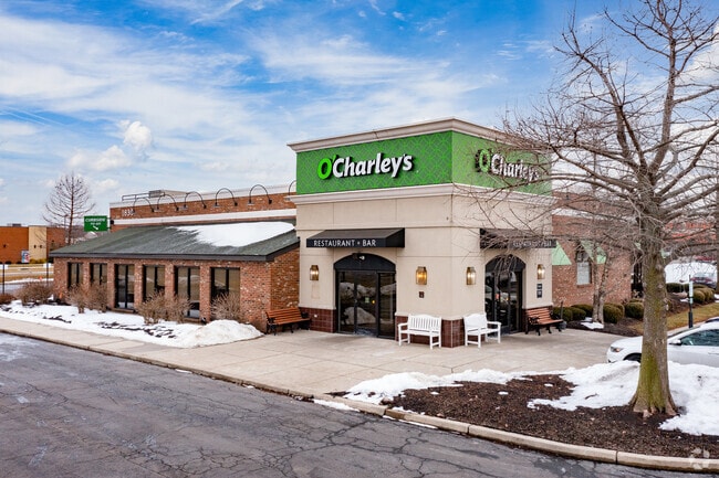
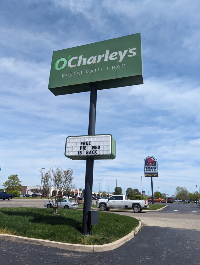
Property Record
1830 N Bechtle Ave, Springfield, OH 45504


Current Lease Availabilities
Property Detail
1830 N Bechtle Ave
Springfield, OH
NORTH BECHTLE SQUARE SEC 1 18864
33-00600-00610-2010
CLARK
Restaurantbuilding
Ohio
B and X Area of moderate flood hazard, usually the area between the limits of the 100-year and 500-year floods.
10
2024
1.74 AC
2025
Northeast Dayton
001900
Cincinnati/Dayton
6,682 SF
NEARBY LISTINGS FOR SALE OR LEASE
DEMOGRAPHICS near 1830 N Bechtle Ave
1 mile
3 mile
5 mile
2025 Total Population
3,045
41,436
85,623
2030 Population
2,979
41,792
85,829
Pop Growth 2025-2030
(2.17%)
+ 0.86%
+ 0.24%
Average Age
43
40
41
2025 Total Households
1,357
17,104
35,728
HH Growth 2025-2030
(2.21%)
+ 0.85%
+ 0.22%
Median Household Inc
$66,666
$47,742
$51,955
Avg Household Size
2.20
2.20
2.30
2025 Avg HH Vehicles
2.00
2.00
2.00
Median Home Value
$192,131
$159,000
$156,607
Median Year Built
1953
1955
1958
Nearby Places
Map Layers
Map Styles
 Street
 Aerial
Layers
 Traffic
 Biking
Places
Listings with unknown addresses are not visible on the map
- Restaurants
- Banks
- Shops
- Fitness
- Groceries
PUBLIC TRANSPORTATION
AIRPORT
James M Cox Dayton International
Drive
Walk
Distance
James M Cox Dayton International
34 min
26.4 mi
Freight Ports
Port of Toledo
Drive
Walk
Distance
Port of Toledo
185 min
130.2 mi
Nearby Properties
Address
Land Use
TOTAL SIZE
Lot Size
Zoning
Address
Land Use
TOTAL SIZE
Lot Size
Zoning
1.20 AC
Address
Land Use
TOTAL SIZE
Lot Size
Zoning
479,515 SF
1.69 AC
Address
Land Use
TOTAL SIZE
Lot Size
Zoning
32.89 AC
Address
Land Use
TOTAL SIZE
Lot Size
Zoning
107.87 AC
Address
Land Use
TOTAL SIZE
Lot Size
Zoning
17,280 SF
14.32 AC
Address
Land Use
TOTAL SIZE
Lot Size
Zoning
Address
Land Use
TOTAL SIZE
Lot Size
Zoning
234,478 SF
59.28 AC
Address
Land Use
TOTAL SIZE
Lot Size
Zoning
103,458 SF
5.51 AC
Address
Land Use
TOTAL SIZE
Lot Size
Zoning
61,376 SF
3.95 AC
Address
Land Use
TOTAL SIZE
Lot Size
Zoning
160,352 SF
22.89 AC
Address
Land Use
TOTAL SIZE
Lot Size
Zoning
25.44 AC
Address
Land Use
TOTAL SIZE
Lot Size
Zoning
1,582 SF
42.13 AC
Address
Land Use
TOTAL SIZE
Lot Size
Zoning
47,929 SF
2.77 AC
Address
Land Use
TOTAL SIZE
Lot Size
Zoning
Address
Land Use
TOTAL SIZE
Lot Size
Zoning
225,335 SF
22.73 AC
Address
Land Use
TOTAL SIZE
Lot Size
Zoning
103,589 SF
59.28 AC
Address
Land Use
TOTAL SIZE
Lot Size
Zoning
218,901 SF
19.15 AC
Address
Land Use
TOTAL SIZE
Lot Size
Zoning
136,700 SF
14.37 AC
Address
Land Use
TOTAL SIZE
Lot Size
Zoning
56,381 SF
2.37 AC
Address
Land Use
TOTAL SIZE
Lot Size
Zoning
Address
Land Use
TOTAL SIZE
Lot Size
Zoning
Address
Land Use
TOTAL SIZE
Lot Size
Zoning
32,566 SF
1.90 AC
Address
Land Use
TOTAL SIZE
Lot Size
Zoning
79,187 SF
7.70 AC
Address
Land Use
TOTAL SIZE
Lot Size
Zoning
111,936 SF
7.04 AC
Address
Land Use
TOTAL SIZE
Lot Size
Zoning
1.05 AC
Address
Land Use
TOTAL SIZE
Lot Size
Zoning
141,891 SF
15.77 AC
R-4
Address
Land Use
TOTAL SIZE
Lot Size
Zoning
41,710 SF
5.25 AC
Address
Land Use
TOTAL SIZE
Lot Size
Zoning
194,184 SF
24.01 AC
Address
Land Use
TOTAL SIZE
Lot Size
Zoning
812,844 SF
61.98 AC
Address
Land Use
TOTAL SIZE
Lot Size
Zoning
The World's #1 Commercial Real Estate Marketplace
Connect with us
© 2026 CoStar Group
The information above has been obtained from sources believed reliable. While we do not doubt its accuracy we have not verified it and make no guarantee, warranty or representation about it. It is your responsibility to independently confirm its accuracy and completeness. Any projections, opinions, assumptions, or estimates used are for example only and do not represent the current or future performance of the property. The value of this transaction to you depends on tax and other factors which should be evaluated by your tax, financial, and legal advisors. You and your advisors should conduct a careful, independent investigation of the property to determine to your satisfaction the suitability of the property for your needs.