Property Record
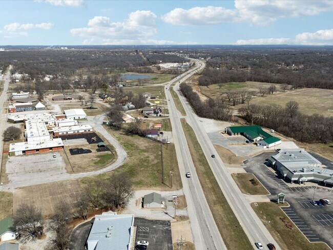
1830 N Highway 66, Catoosa, OK 74015


This Property Is For Sale
NEARBY LISTINGS FOR SALE OR LEASE
Property Detail
1830 N Highway 66
660025489
20N-15E
Barberhairsalon
BEG: N/L SW NE SE & INTERS HWY 66; W 100'; S41-31-38W 35'; N47-39-32W 50.72; N41-31-38E 8.62'; N47-39-06W 24.40'; S41-31-38W
X
Rogers
40131C0365J
Oklahoma
2025
0.28 AC
2025
Rogers County
050409
Tulsa
1,074 SF
Tulsa, OK
DEMOGRAPHICS near 1830 N Highway 66
1 Mile
3 Mile
5 Mile
2024 Total Population
2,609
10,629
22,767
2029 Population
3,058
12,540
27,332
Pop Growth 2024-2029
+ 17.21%
+ 17.98%
+ 20.05%
Average Age
39
40
39
2024 Total Households
1,030
4,131
8,325
HH Growth 2024-2029
+ 17.38%
+ 18.13%
+ 19.65%
Median Household Inc
$65,150
$69,098
$78,984
Avg Household Size
2.50
2.50
2.70
2024 Avg HH Vehicles
2.00
2.00
2.00
Median Home Value
$253,658
$200,764
$231,661
Median Year Built
1994
1985
1992
Nearby Places
Map Layers
Map Styles
 Street
 Aerial
- Restaurants
- Banks
- Shops
- Fitness
- Groceries
PUBLIC TRANSPORTATION
AIRPORT
Tulsa International
DRIVE
WALK
Distance
Tulsa International
20 min
13.8 mi
Freight Ports
Tulsa Port Of Catoosa
DRIVE
WALK
Distance
Tulsa Port Of Catoosa
9 min
5.3 mi
Nearby Properties
Address
Land Use
TOTAL SIZE
Lot Size
Zoning
Address
Land Use
TOTAL SIZE
Lot Size
Zoning
3,720 SF
158.66 AC
Address
Land Use
TOTAL SIZE
Lot Size
Zoning
153,297 SF
16.29 AC
Address
Land Use
TOTAL SIZE
Lot Size
Zoning
103,820 SF
2.70 AC
Address
Land Use
TOTAL SIZE
Lot Size
Zoning
133,875 SF
7.68 AC
Address
Land Use
TOTAL SIZE
Lot Size
Zoning
87,500 SF
4.12 AC
IL
Address
Land Use
TOTAL SIZE
Lot Size
Zoning
2,456 SF
2.18 AC
Address
Land Use
TOTAL SIZE
Lot Size
Zoning
68,725 SF
2.74 AC
Address
Land Use
TOTAL SIZE
Lot Size
Zoning
1,440 SF
4.84 AC
Address
Land Use
TOTAL SIZE
Lot Size
Zoning
11,115 SF
2.61 AC
RS3
Address
Land Use
TOTAL SIZE
Lot Size
Zoning
57,268 SF
6.87 AC
Address
Land Use
TOTAL SIZE
Lot Size
Zoning
60,000 SF
11.53 AC
Address
Land Use
TOTAL SIZE
Lot Size
Zoning
6,568 SF
6.51 AC
RS1
Address
Land Use
TOTAL SIZE
Lot Size
Zoning
9,710 SF
3.91 AC
RS3
Address
Land Use
TOTAL SIZE
Lot Size
Zoning
35,000 SF
4.55 AC
Address
Land Use
TOTAL SIZE
Lot Size
Zoning
60,000 SF
Address
Land Use
TOTAL SIZE
Lot Size
Zoning
101,980 SF
5.49 AC
CS
Address
Land Use
TOTAL SIZE
Lot Size
Zoning
3,815 SF
20.82 AC
Address
Land Use
TOTAL SIZE
Lot Size
Zoning
44,476 SF
2.40 AC
IL
Address
Land Use
TOTAL SIZE
Lot Size
Zoning
1 SF
12.50 AC
CS
Address
Land Use
TOTAL SIZE
Lot Size
Zoning
51,950 SF
9.10 AC
Address
Land Use
TOTAL SIZE
Lot Size
Zoning
22,952 SF
3.88 AC
Address
Land Use
TOTAL SIZE
Lot Size
Zoning
900 SF
48.42 AC
Address
Land Use
TOTAL SIZE
Lot Size
Zoning
24,000 SF
6.75 AC
Address
Land Use
TOTAL SIZE
Lot Size
Zoning
45,886 SF
20 AC
Address
Land Use
TOTAL SIZE
Lot Size
Zoning
42,450 SF
4.60 AC
RS1
Address
Land Use
TOTAL SIZE
Lot Size
Zoning
39,136 SF
1.25 AC
Address
Land Use
TOTAL SIZE
Lot Size
Zoning
6,152 SF
4.84 AC
Address
Land Use
TOTAL SIZE
Lot Size
Zoning
42,207 SF
1.87 AC
CS
Address
Land Use
TOTAL SIZE
Lot Size
Zoning
19.87 AC
Address
Land Use
TOTAL SIZE
Lot Size
Zoning
12,176 SF
4.71 AC
The World's #1 Commercial Real Estate Marketplace
Connect with us
© 2026 CoStar Group
The information above has been obtained from sources believed reliable. While we do not doubt its accuracy we have not verified it and make no guarantee, warranty or representation about it. It is your responsibility to independently confirm its accuracy and completeness. Any projections, opinions, assumptions, or estimates used are for example only and do not represent the current or future performance of the property. The value of this transaction to you depends on tax and other factors which should be evaluated by your tax, financial, and legal advisors. You and your advisors should conduct a careful, independent investigation of the property to determine to your satisfaction the suitability of the property for your needs.