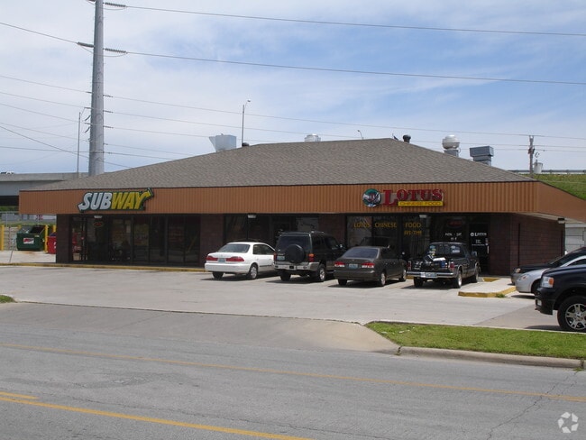
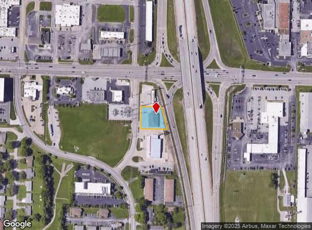
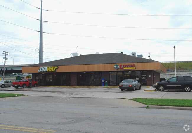
Property Record
1830 S Old Ingram Mill Rd, Springfield, MO 65804
NEARBY LISTINGS FOR SALE OR LEASE
Property Detail
1830 S Old Ingram Mill Rd
12-34-202-156
BEG 204.08 FT S & 30 FT W NW COR 34/29/21 S 136.83 FT E 160 FT M/L TO W R/W HWY65 NWLY 136.92 FT W 123.84 FT TO BEG
Communitycenter
Greene
X
Missouri
29077C0361E
0.45 AC
2025
Southeast
2025
Springfield
002600
Springfield, MO
3,800 SF
DEMOGRAPHICS near 1830 S Old Ingram Mill Rd
1 Mile
3 Mile
5 Mile
2024 Total Population
9,979
50,005
126,752
2029 Population
10,315
51,735
131,553
Pop Growth 2024-2029
+ 3.37%
+ 3.46%
+ 3.79%
Average Age
41
42
39
2024 Total Households
4,494
22,911
56,932
HH Growth 2024-2029
+ 3.49%
+ 3.64%
+ 4.02%
Median Household Inc
$57,633
$56,988
$48,234
Avg Household Size
2.20
2.10
2.00
2024 Avg HH Vehicles
2.00
2.00
2.00
Median Home Value
$225,900
$212,950
$185,063
Median Year Built
1976
1975
1976
Nearby Places
Map Layers
Map Styles
 Street
 Aerial
- Restaurants
- Banks
- Shops
- Fitness
- Groceries
PUBLIC TRANSPORTATION
AIRPORT
Springfield-Branson Ntl
DRIVE
WALK
Distance
Springfield-Branson Ntl
32 min
21.0 mi
SALE & LEASE HISTORY
LISTING DATE
SALE/LEASE

Sep 25, 2016
For Lease
Nearby Properties
Address
Land Use
TOTAL SIZE
Lot Size
Zoning
Address
Land Use
TOTAL SIZE
Lot Size
Zoning
2,981,315 SF
76.43 AC
INC
Address
Land Use
TOTAL SIZE
Lot Size
Zoning
343,758 SF
29.81 AC
INC
Address
Land Use
TOTAL SIZE
Lot Size
Zoning
299,725 SF
18.80 AC
INC
Address
Land Use
TOTAL SIZE
Lot Size
Zoning
376,072 SF
17.67 AC
INC
Address
Land Use
TOTAL SIZE
Lot Size
Zoning
210,374 SF
24.37 AC
INC
Address
Land Use
TOTAL SIZE
Lot Size
Zoning
779,221 SF
45.03 AC
INC
Address
Land Use
TOTAL SIZE
Lot Size
Zoning
2.31 AC
INC
Address
Land Use
TOTAL SIZE
Lot Size
Zoning
18.35 AC
Address
Land Use
TOTAL SIZE
Lot Size
Zoning
224,730 SF
19.99 AC
INC
Address
Land Use
TOTAL SIZE
Lot Size
Zoning
10.29 AC
INC.
Address
Land Use
TOTAL SIZE
Lot Size
Zoning
51.65 AC
INC
Address
Land Use
TOTAL SIZE
Lot Size
Zoning
211,041 SF
19.13 AC
INC
Address
Land Use
TOTAL SIZE
Lot Size
Zoning
25.51 AC
INC
Address
Land Use
TOTAL SIZE
Lot Size
Zoning
4.63 AC
O-2
Address
Land Use
TOTAL SIZE
Lot Size
Zoning
17.07 AC
INC.
Address
Land Use
TOTAL SIZE
Lot Size
Zoning
1.99 AC
INC
Address
Land Use
TOTAL SIZE
Lot Size
Zoning
108,153 SF
7.37 AC
INC.
Address
Land Use
TOTAL SIZE
Lot Size
Zoning
8.24 AC
INC
Address
Land Use
TOTAL SIZE
Lot Size
Zoning
324,341 SF
43 AC
INC
Address
Land Use
TOTAL SIZE
Lot Size
Zoning
16.73 AC
Address
Land Use
TOTAL SIZE
Lot Size
Zoning
70,500 SF
7.20 AC
INC
Address
Land Use
TOTAL SIZE
Lot Size
Zoning
2.69 AC
INC
Address
Land Use
TOTAL SIZE
Lot Size
Zoning
26,240 SF
2.39 AC
INC.
Address
Land Use
TOTAL SIZE
Lot Size
Zoning
2 AC
INC.
Address
Land Use
TOTAL SIZE
Lot Size
Zoning
162,312 SF
7.84 AC
INC
Address
Land Use
TOTAL SIZE
Lot Size
Zoning
Address
Land Use
TOTAL SIZE
Lot Size
Zoning
117,322 SF
12.67 AC
INC
Address
Land Use
TOTAL SIZE
Lot Size
Zoning
66,686 SF
1.91 AC
INC
Address
Land Use
TOTAL SIZE
Lot Size
Zoning
323,771 SF
31.48 AC
INC
Address
Land Use
TOTAL SIZE
Lot Size
Zoning
2.96 AC
INC.
The World's #1 Commercial Real Estate Marketplace
Connect with us
© 2026 CoStar Group
The information above has been obtained from sources believed reliable. While we do not doubt its accuracy we have not verified it and make no guarantee, warranty or representation about it. It is your responsibility to independently confirm its accuracy and completeness. Any projections, opinions, assumptions, or estimates used are for example only and do not represent the current or future performance of the property. The value of this transaction to you depends on tax and other factors which should be evaluated by your tax, financial, and legal advisors. You and your advisors should conduct a careful, independent investigation of the property to determine to your satisfaction the suitability of the property for your needs.