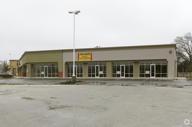
Property Record
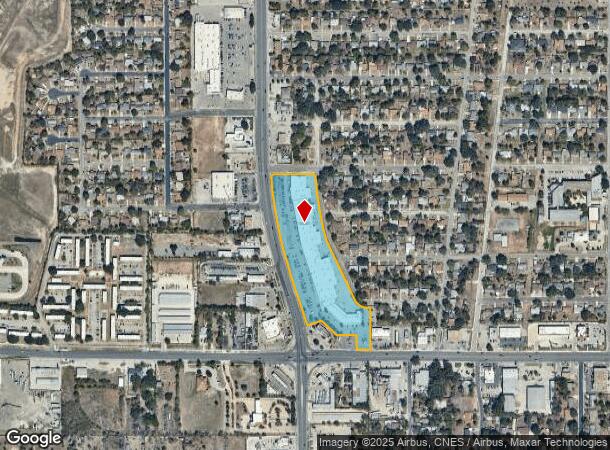
1830 S Ww White Rd, San Antonio, TX 78220
NEARBY LISTINGS FOR SALE OR LEASE
Property Detail
1830 S Ww White Rd
San Antonio-New Braunfels, TX
Dellcrest Subd
12591-001-0190
NCB 12591 BLK 1 LOT SW IRR 99.46FT OF 19 (DELLCREST SUBD) 2009-NEW ACCT PER PLAT 9583/188 FILED 3/7/08//2013-SPLIT PER CR # 27670
Regionalshoppingcenterormallwithanchorstore
Bexar
X
Texas
48029C0420G
14
2024
8.65 AC
2025
South
131300
San Antonio
126,989 SF
DEMOGRAPHICS near 1830 S Ww White Rd
1 Mile
3 Mile
5 Mile
2024 Total Population
8,251
74,664
184,166
2029 Population
8,739
80,184
197,643
Pop Growth 2024-2029
+ 5.91%
+ 7.39%
+ 7.32%
Average Age
39
36
36
2024 Total Households
3,017
25,363
63,517
HH Growth 2024-2029
+ 6.07%
+ 7.55%
+ 7.44%
Median Household Inc
$39,223
$42,840
$43,194
Avg Household Size
2.70
2.80
2.80
2024 Avg HH Vehicles
2.00
2.00
2.00
Median Home Value
$173,406
$142,040
$153,054
Median Year Built
1965
1973
1972
Nearby Places
Map Layers
Map Styles
 Street
 Aerial
- Restaurants
- Banks
- Shops
- Fitness
- Groceries
PUBLIC TRANSPORTATION
COMMUTER RAIL
San Antonio Amtrak Station (Sunset Limited - Amtrak, Texas Eagle - Amtrak)
DRIVE
WALK
Distance
San Antonio Amtrak Station (Sunset Limited - Amtrak, Texas Eagle - Amtrak)
11 min
6.3 mi
AIRPORT
San Antonio International
DRIVE
WALK
Distance
San Antonio International
21 min
13.8 mi
Freight Ports
Calhoun Port
DRIVE
WALK
Distance
Calhoun Port
170 min
140.2 mi
Nearby Properties
Address
Land Use
TOTAL SIZE
Lot Size
Zoning
Address
Land Use
TOTAL SIZE
Lot Size
Zoning
122,130 SF
541.40 AC
Address
Land Use
TOTAL SIZE
Lot Size
Zoning
397,806 SF
15.08 AC
Address
Land Use
TOTAL SIZE
Lot Size
Zoning
359,459 SF
15.81 AC
Address
Land Use
TOTAL SIZE
Lot Size
Zoning
380,949 SF
146.39 AC
Address
Land Use
TOTAL SIZE
Lot Size
Zoning
380,949 SF
135.47 AC
Address
Land Use
TOTAL SIZE
Lot Size
Zoning
35.76 AC
Address
Land Use
TOTAL SIZE
Lot Size
Zoning
273,370 SF
11.93 AC
Address
Land Use
TOTAL SIZE
Lot Size
Zoning
41.63 AC
Address
Land Use
TOTAL SIZE
Lot Size
Zoning
33.77 AC
Address
Land Use
TOTAL SIZE
Lot Size
Zoning
221,760 SF
7.22 AC
Address
Land Use
TOTAL SIZE
Lot Size
Zoning
101,517 SF
13.04 AC
Address
Land Use
TOTAL SIZE
Lot Size
Zoning
18.35 AC
Address
Land Use
TOTAL SIZE
Lot Size
Zoning
95,486 SF
12.54 AC
Address
Land Use
TOTAL SIZE
Lot Size
Zoning
332,148 SF
17.75 AC
Address
Land Use
TOTAL SIZE
Lot Size
Zoning
68,055 SF
18.06 AC
Address
Land Use
TOTAL SIZE
Lot Size
Zoning
141,955 SF
121.60 AC
Address
Land Use
TOTAL SIZE
Lot Size
Zoning
1,859 SF
60.40 AC
Address
Land Use
TOTAL SIZE
Lot Size
Zoning
201,672 SF
12.48 AC
Address
Land Use
TOTAL SIZE
Lot Size
Zoning
296,542 SF
26.32 AC
Address
Land Use
TOTAL SIZE
Lot Size
Zoning
44,800 SF
61.44 AC
Address
Land Use
TOTAL SIZE
Lot Size
Zoning
64,043 SF
14.96 AC
Address
Land Use
TOTAL SIZE
Lot Size
Zoning
143,012 SF
9.35 AC
Address
Land Use
TOTAL SIZE
Lot Size
Zoning
233,361 SF
9.65 AC
Address
Land Use
TOTAL SIZE
Lot Size
Zoning
180,000 SF
11.33 AC
Address
Land Use
TOTAL SIZE
Lot Size
Zoning
299,603 SF
14.09 AC
Address
Land Use
TOTAL SIZE
Lot Size
Zoning
204,166 SF
23.69 AC
Address
Land Use
TOTAL SIZE
Lot Size
Zoning
177,692 SF
9.16 AC
Address
Land Use
TOTAL SIZE
Lot Size
Zoning
259,779 SF
14.85 AC
Address
Land Use
TOTAL SIZE
Lot Size
Zoning
163,255 SF
10.43 AC
Address
Land Use
TOTAL SIZE
Lot Size
Zoning
373,025 SF
11.21 AC
The World's #1 Commercial Real Estate Marketplace
Connect with us
© 2026 CoStar Group
The information above has been obtained from sources believed reliable. While we do not doubt its accuracy we have not verified it and make no guarantee, warranty or representation about it. It is your responsibility to independently confirm its accuracy and completeness. Any projections, opinions, assumptions, or estimates used are for example only and do not represent the current or future performance of the property. The value of this transaction to you depends on tax and other factors which should be evaluated by your tax, financial, and legal advisors. You and your advisors should conduct a careful, independent investigation of the property to determine to your satisfaction the suitability of the property for your needs.