Property Record
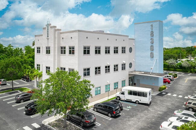
18300 Nw 62Nd Ave, Hialeah, FL 33015

NEARBY LISTINGS FOR SALE OR LEASE
Property Detail
18300 Nw 62Nd Ave
30-2012-043-0060
Miami Gardens Professional Centre Condo
Officebuilding
MIAMI GARDENS PROFESSIONAL CENTRE CONDO UNIT 210 UNDIV 7.35% INT IN COMMON ELEMENTS OFF REC 23133-1724 COC 23353-3170 04 2005 1
AE
Miami/Dade
12011C0710J
Florida
2024
Miami Lakes
2025
South Florida
011702
Miami-Miami Beach-Kendall, FL
1,491 SF
DEMOGRAPHICS near 18300 Nw 62Nd Ave
1 Mile
3 Mile
5 Mile
2024 Total Population
30,244
156,610
441,300
2029 Population
29,306
152,420
431,747
Pop Growth 2024-2029
(3.10%)
(2.68%)
(2.16%)
Average Age
40
40
40
2024 Total Households
10,042
50,298
146,025
HH Growth 2024-2029
(3.43%)
(2.97%)
(2.46%)
Median Household Inc
$56,305
$65,097
$58,608
Avg Household Size
2.90
3.00
2.90
2024 Avg HH Vehicles
2.00
2.00
2.00
Median Home Value
$319,454
$340,550
$325,326
Median Year Built
1984
1985
1986
Nearby Places
Map Layers
Map Styles
 Street
 Aerial
- Restaurants
- Banks
- Shops
- Fitness
- Groceries
PUBLIC TRANSPORTATION
COMMUTER RAIL
Opa-Locka (Tri-County Commuter - South Florida Regional Transportation Authority (Tri-Rail))
DRIVE
WALK
Distance
Opa-Locka (Tri-County Commuter - South Florida Regional Transportation Authority (Tri-Rail))
11 min
5.8 mi
Hialeah (Metrorail Green Line - Miami-Dade Transit (Metrorail/Metromover))
DRIVE
WALK
Distance
Hialeah (Metrorail Green Line - Miami-Dade Transit (Metrorail/Metromover))
15 min
7.8 mi
AIRPORT
Miami International
DRIVE
WALK
Distance
Miami International
25 min
13.8 mi
Fort Lauderdale/Hollywood International
DRIVE
WALK
Distance
Fort Lauderdale/Hollywood International
28 min
18.1 mi
Freight Ports
Port of Miami
DRIVE
WALK
Distance
Port of Miami
31 min
19.1 mi
SALE & LEASE HISTORY
LISTING DATE
SALE/LEASE

Oct 09, 2017
For Sale
Mar 31, 2022
For Lease
Jan 27, 2021
For Sale
Jan 22, 2025
For Lease
Jan 04, 2021
For Lease
Feb 19, 2020
For Sale
Dec 10, 2024
For Lease
Dec 05, 2017
For Lease
Dec 05, 2017
For Sale
Aug 05, 2017
For Sale
Nearby Properties
Address
Land Use
TOTAL SIZE
Lot Size
Zoning
Address
Land Use
TOTAL SIZE
Lot Size
Zoning
685,369 SF
22.67 AC
RM2
Address
Land Use
TOTAL SIZE
Lot Size
Zoning
368,107 SF
10.11 AC
ML
Address
Land Use
TOTAL SIZE
Lot Size
Zoning
1,589,724 SF
95.63 AC
7100
Address
Land Use
TOTAL SIZE
Lot Size
Zoning
436,707 SF
32.94 AC
RM3
Address
Land Use
TOTAL SIZE
Lot Size
Zoning
426,620 SF
17.69 AC
RM3
Address
Land Use
TOTAL SIZE
Lot Size
Zoning
344,589 SF
13.91 AC
ML
Address
Land Use
TOTAL SIZE
Lot Size
Zoning
359,351 SF
28.25 AC
RM3
Address
Land Use
TOTAL SIZE
Lot Size
Zoning
371,952 SF
13.41 AC
ML
Address
Land Use
TOTAL SIZE
Lot Size
Zoning
649,901 SF
124.04 AC
9400
Address
Land Use
TOTAL SIZE
Lot Size
Zoning
696,550 SF
2.97 AC
6109
Address
Land Use
TOTAL SIZE
Lot Size
Zoning
1,165,101 SF
115.84 AC
8000
Address
Land Use
TOTAL SIZE
Lot Size
Zoning
110,869 SF
155.94 AC
RL
Address
Land Use
TOTAL SIZE
Lot Size
Zoning
355,120 SF
18 AC
5000
Address
Land Use
TOTAL SIZE
Lot Size
Zoning
292,018 SF
12.46 AC
RM2
Address
Land Use
TOTAL SIZE
Lot Size
Zoning
331,131 SF
12.09 AC
3900
Address
Land Use
TOTAL SIZE
Lot Size
Zoning
155,975 SF
19.92 AC
B2
Address
Land Use
TOTAL SIZE
Lot Size
Zoning
370,044 SF
17.86 AC
6051
Address
Land Use
TOTAL SIZE
Lot Size
Zoning
315,033 SF
11.48 AC
6109
Address
Land Use
TOTAL SIZE
Lot Size
Zoning
866,013 SF
0.11 AC
8000
Address
Land Use
TOTAL SIZE
Lot Size
Zoning
432,595 SF
22.60 AC
PID
Address
Land Use
TOTAL SIZE
Lot Size
Zoning
536,184 SF
29.16 AC
7100
Address
Land Use
TOTAL SIZE
Lot Size
Zoning
551,945 SF
31.31 AC
PID
Address
Land Use
TOTAL SIZE
Lot Size
Zoning
552,632 SF
6.05 AC
4100
Address
Land Use
TOTAL SIZE
Lot Size
Zoning
189,293 SF
6.08 AC
RM3
Address
Land Use
TOTAL SIZE
Lot Size
Zoning
389,450 SF
50.72 AC
9400
Address
Land Use
TOTAL SIZE
Lot Size
Zoning
261,263 SF
9.22 AC
6109
Address
Land Use
TOTAL SIZE
Lot Size
Zoning
468,316 SF
13.20 AC
4100
Address
Land Use
TOTAL SIZE
Lot Size
Zoning
286,547 SF
9.47 AC
6109
Address
Land Use
TOTAL SIZE
Lot Size
Zoning
167,427 SF
6.85 AC
3900
Address
Land Use
TOTAL SIZE
Lot Size
Zoning
68,227 SF
388.62 AC
8000
The World's #1 Commercial Real Estate Marketplace
Connect with us
© 2025 CoStar Group
The information above has been obtained from sources believed reliable. While we do not doubt its accuracy we have not verified it and make no guarantee, warranty or representation about it. It is your responsibility to independently confirm its accuracy and completeness. Any projections, opinions, assumptions, or estimates used are for example only and do not represent the current or future performance of the property. The value of this transaction to you depends on tax and other factors which should be evaluated by your tax, financial, and legal advisors. You and your advisors should conduct a careful, independent investigation of the property to determine to your satisfaction the suitability of the property for your needs.