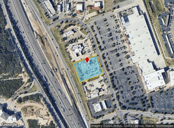
Property Record
18303 W Interstate 10, San Antonio, TX 78257

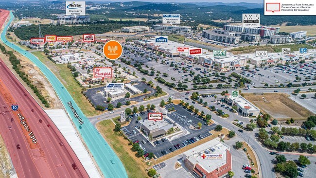

NEARBY LISTINGS FOR SALE OR LEASE
Property Detail
18303 W Interstate 10
San Antonio-New Braunfels, TX
Ncb 14747 (The Rim Subd)
14747-001-0100
NCB 14747 (THE RIM SUBD UT-6), BLOCK 1 LOT 10 NEW FOR 2007 PER PLATS 9572/110, 9572/114
Restaurantdrivein
Bexar
X
Texas
48029C0230G
10
2024
1.66 AC
2025
Far Northwest
191807
San Antonio
3,171 SF
DEMOGRAPHICS near 18303 W Interstate 10
1 Mile
3 Mile
5 Mile
2024 Total Population
6,073
46,931
140,516
2029 Population
6,616
50,895
150,149
Pop Growth 2024-2029
+ 8.94%
+ 8.45%
+ 6.86%
Average Age
35
33
37
2024 Total Households
3,332
20,529
56,881
HH Growth 2024-2029
+ 9.09%
+ 8.76%
+ 7.18%
Median Household Inc
$78,467
$70,281
$85,830
Avg Household Size
1.80
2.10
2.40
2024 Avg HH Vehicles
2.00
2.00
2.00
Median Home Value
$387,131
$428,963
$339,530
Median Year Built
2010
2010
2003
Nearby Places
Map Layers
Map Styles
 Street
 Aerial
- Restaurants
- Banks
- Shops
- Fitness
- Groceries
PUBLIC TRANSPORTATION
AIRPORT
San Antonio International
DRIVE
WALK
Distance
San Antonio International
22 min
14.7 mi
SALE & LEASE HISTORY
LISTING DATE
SALE/LEASE

Oct 01, 2019
For Sale
Nearby Properties
Address
Land Use
TOTAL SIZE
Lot Size
Zoning
Address
Land Use
TOTAL SIZE
Lot Size
Zoning
23,242.10 AC
Address
Land Use
TOTAL SIZE
Lot Size
Zoning
437,060 SF
91.31 AC
Address
Land Use
TOTAL SIZE
Lot Size
Zoning
405,133 SF
16.41 AC
Address
Land Use
TOTAL SIZE
Lot Size
Zoning
538,895 SF
54.58 AC
Address
Land Use
TOTAL SIZE
Lot Size
Zoning
335,841 SF
33.70 AC
Address
Land Use
TOTAL SIZE
Lot Size
Zoning
538,895 SF
60.25 AC
Address
Land Use
TOTAL SIZE
Lot Size
Zoning
509,312 SF
43.63 AC
Address
Land Use
TOTAL SIZE
Lot Size
Zoning
384,503 SF
15.95 AC
Address
Land Use
TOTAL SIZE
Lot Size
Zoning
391,367 SF
11.36 AC
Address
Land Use
TOTAL SIZE
Lot Size
Zoning
940,089 SF
63.74 AC
Address
Land Use
TOTAL SIZE
Lot Size
Zoning
499,480 SF
19.57 AC
Address
Land Use
TOTAL SIZE
Lot Size
Zoning
21,348 SF
14.50 AC
Address
Land Use
TOTAL SIZE
Lot Size
Zoning
462,227 SF
31.21 AC
Address
Land Use
TOTAL SIZE
Lot Size
Zoning
13,128 SF
5.23 AC
Address
Land Use
TOTAL SIZE
Lot Size
Zoning
300,264 SF
27.81 AC
Address
Land Use
TOTAL SIZE
Lot Size
Zoning
21,852 SF
5.25 AC
Address
Land Use
TOTAL SIZE
Lot Size
Zoning
481,373 SF
44.28 AC
Address
Land Use
TOTAL SIZE
Lot Size
Zoning
10,622 SF
8.01 AC
Address
Land Use
TOTAL SIZE
Lot Size
Zoning
389,048 SF
16.25 AC
Address
Land Use
TOTAL SIZE
Lot Size
Zoning
375,702 SF
10 AC
Address
Land Use
TOTAL SIZE
Lot Size
Zoning
329,050 SF
17.10 AC
Address
Land Use
TOTAL SIZE
Lot Size
Zoning
320,406 SF
12.11 AC
Address
Land Use
TOTAL SIZE
Lot Size
Zoning
515,812 SF
200.45 AC
Address
Land Use
TOTAL SIZE
Lot Size
Zoning
305,497 SF
9.99 AC
Address
Land Use
TOTAL SIZE
Lot Size
Zoning
395,039 SF
31 AC
Address
Land Use
TOTAL SIZE
Lot Size
Zoning
6,809 SF
9.04 AC
Address
Land Use
TOTAL SIZE
Lot Size
Zoning
238,999 SF
8.43 AC
Address
Land Use
TOTAL SIZE
Lot Size
Zoning
309,429 SF
5.17 AC
Address
Land Use
TOTAL SIZE
Lot Size
Zoning
331,741 SF
16.53 AC
Address
Land Use
TOTAL SIZE
Lot Size
Zoning
309,901 SF
15.46 AC
The World's #1 Commercial Real Estate Marketplace
Connect with us
© 2025 CoStar Group
The information above has been obtained from sources believed reliable. While we do not doubt its accuracy we have not verified it and make no guarantee, warranty or representation about it. It is your responsibility to independently confirm its accuracy and completeness. Any projections, opinions, assumptions, or estimates used are for example only and do not represent the current or future performance of the property. The value of this transaction to you depends on tax and other factors which should be evaluated by your tax, financial, and legal advisors. You and your advisors should conduct a careful, independent investigation of the property to determine to your satisfaction the suitability of the property for your needs.