Property Record
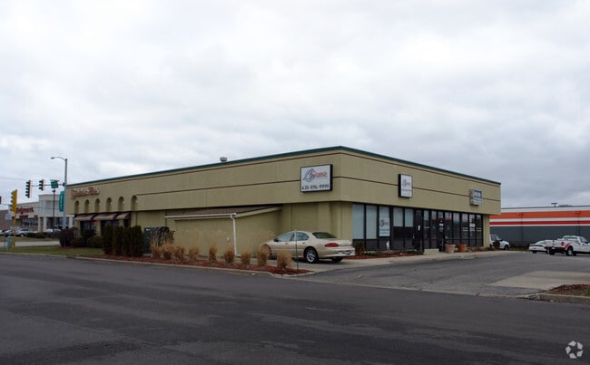
1831 Douglas Rd, Montgomery, IL 60538


NEARBY LISTINGS FOR SALE OR LEASE
Property Detail
1831 Douglas Rd
03-04-227-004
Village Of Montgomery
Commercialnec
SEC. 4-37-8 1.12 ACS DOC 89-3057 & & 89-3058 - PT NE NE - BEG 723.34' N INT N LN U S 30 & W LN DOUGLAS RD, N201.44', NW28.28', W30', SW241.47', S22.79', E66.2', S140.00', E215' TO POB VILLAGE OF MONTGOMERY
X
Kendall
17089C0402H
Illinois
2024
1.12 AC
2024
Western East/West Corr
890201
Chicago
6,296 SF
Chicago-Naperville-Elgin, IL-IN-WI
DEMOGRAPHICS near 1831 Douglas Rd
1 Mile
3 Mile
5 Mile
2024 Total Population
10,780
96,640
229,764
2029 Population
11,325
99,764
235,310
Pop Growth 2024-2029
+ 5.06%
+ 3.23%
+ 2.41%
Average Age
38
36
37
2024 Total Households
3,822
31,635
75,459
HH Growth 2024-2029
+ 5.23%
+ 3.52%
+ 2.48%
Median Household Inc
$66,474
$68,343
$82,088
Avg Household Size
2.80
2.90
3.00
2024 Avg HH Vehicles
2.00
2.00
2.00
Median Home Value
$181,995
$202,044
$235,067
Median Year Built
1981
1975
1988
Nearby Places
Map Layers
Map Styles
 Street
 Aerial
- Restaurants
- Banks
- Shops
- Fitness
- Groceries
PUBLIC TRANSPORTATION
COMMUTER RAIL
Aurora Station (Burlington Northern-Santa Fe Railway Line - Northeast Illinois Regional Commuter Railroad (Metra))
DRIVE
WALK
Distance
Aurora Station (Burlington Northern-Santa Fe Railway Line - Northeast Illinois Regional Commuter Railroad (Metra))
9 min
3.3 mi
Route 59 Station (Burlington Northern-Santa Fe Railway Line - Northeast Illinois Regional Commuter Railroad (Metra))
DRIVE
WALK
Distance
Route 59 Station (Burlington Northern-Santa Fe Railway Line - Northeast Illinois Regional Commuter Railroad (Metra))
18 min
9.4 mi
AIRPORT
Chicago Midway International
DRIVE
WALK
Distance
Chicago Midway International
54 min
32.9 mi
Chicago O'Hare International
DRIVE
WALK
Distance
Chicago O'Hare International
60 min
39.5 mi
Freight Ports
Port Milwaukee
DRIVE
WALK
Distance
Port Milwaukee
141 min
111.2 mi
Nearby Properties
Address
Land Use
TOTAL SIZE
Lot Size
Zoning
Address
Land Use
TOTAL SIZE
Lot Size
Zoning
272,948 SF
16.10 AC
Address
Land Use
TOTAL SIZE
Lot Size
Zoning
19.80 AC
Address
Land Use
TOTAL SIZE
Lot Size
Zoning
121,608 SF
27.48 AC
Address
Land Use
TOTAL SIZE
Lot Size
Zoning
296,502 SF
19.01 AC
Address
Land Use
TOTAL SIZE
Lot Size
Zoning
350.78 AC
Address
Land Use
TOTAL SIZE
Lot Size
Zoning
244,494 SF
16.08 AC
Address
Land Use
TOTAL SIZE
Lot Size
Zoning
320,874 SF
1.49 AC
Address
Land Use
TOTAL SIZE
Lot Size
Zoning
989,724 SF
49.41 AC
Address
Land Use
TOTAL SIZE
Lot Size
Zoning
56.02 AC
Address
Land Use
TOTAL SIZE
Lot Size
Zoning
233,437 SF
13.11 AC
Address
Land Use
TOTAL SIZE
Lot Size
Zoning
218,020 SF
21.35 AC
Address
Land Use
TOTAL SIZE
Lot Size
Zoning
169,918 SF
20 AC
Address
Land Use
TOTAL SIZE
Lot Size
Zoning
428,544 SF
41.38 AC
Address
Land Use
TOTAL SIZE
Lot Size
Zoning
73,880 SF
0.75 AC
Address
Land Use
TOTAL SIZE
Lot Size
Zoning
8.87 AC
Address
Land Use
TOTAL SIZE
Lot Size
Zoning
97,136 SF
6.08 AC
Address
Land Use
TOTAL SIZE
Lot Size
Zoning
20.76 AC
Address
Land Use
TOTAL SIZE
Lot Size
Zoning
9.86 AC
Address
Land Use
TOTAL SIZE
Lot Size
Zoning
220,091 SF
22.09 AC
Address
Land Use
TOTAL SIZE
Lot Size
Zoning
156,614 SF
17.63 AC
Address
Land Use
TOTAL SIZE
Lot Size
Zoning
366,503 SF
11.88 AC
Address
Land Use
TOTAL SIZE
Lot Size
Zoning
207,596 SF
20.63 AC
Address
Land Use
TOTAL SIZE
Lot Size
Zoning
85,440 SF
0.58 AC
Address
Land Use
TOTAL SIZE
Lot Size
Zoning
122,387 SF
21.92 AC
Address
Land Use
TOTAL SIZE
Lot Size
Zoning
51,375 SF
8.73 AC
Address
Land Use
TOTAL SIZE
Lot Size
Zoning
140,888 SF
16.31 AC
Address
Land Use
TOTAL SIZE
Lot Size
Zoning
56.13 AC
Address
Land Use
TOTAL SIZE
Lot Size
Zoning
217,505 SF
17.50 AC
Address
Land Use
TOTAL SIZE
Lot Size
Zoning
82,150 SF
23.67 AC
Address
Land Use
TOTAL SIZE
Lot Size
Zoning
0.46 AC
The World's #1 Commercial Real Estate Marketplace
Connect with us
© 2025 CoStar Group
The information above has been obtained from sources believed reliable. While we do not doubt its accuracy we have not verified it and make no guarantee, warranty or representation about it. It is your responsibility to independently confirm its accuracy and completeness. Any projections, opinions, assumptions, or estimates used are for example only and do not represent the current or future performance of the property. The value of this transaction to you depends on tax and other factors which should be evaluated by your tax, financial, and legal advisors. You and your advisors should conduct a careful, independent investigation of the property to determine to your satisfaction the suitability of the property for your needs.