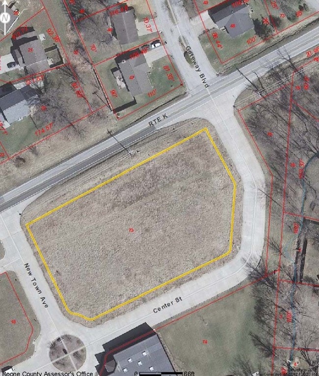
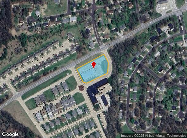
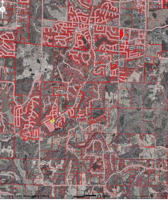
Property Record
1835 W Route K, Columbia, MO 65203
NEARBY LISTINGS FOR SALE OR LEASE
Property Detail
1835 W Route K
Columbia, MO
New Town Sd
20-216-10-06-073-00-01
NEW TOWN SD BLK 4 LOT C-4
Conveniencestore
Boone
X
Missouri
29019C0355D
c-4
2025
1.35 AC
2025
Columbia/Jefferson City
001202
Other Market Areas
8,988 SF
DEMOGRAPHICS near 1835 W Route K
1 Mile
3 Mile
5 Mile
2024 Total Population
3,040
21,874
57,150
2029 Population
3,220
23,086
60,271
Pop Growth 2024-2029
+ 5.92%
+ 5.54%
+ 5.46%
Average Age
38
38
36
2024 Total Households
1,066
8,303
22,345
HH Growth 2024-2029
+ 6.19%
+ 5.73%
+ 5.84%
Median Household Inc
$109,722
$89,004
$70,967
Avg Household Size
2.80
2.60
2.30
2024 Avg HH Vehicles
2.00
2.00
2.00
Median Home Value
$358,860
$361,551
$301,647
Median Year Built
2002
1997
1995
Nearby Places
Map Layers
Map Styles
 Street
 Aerial
- Restaurants
- Banks
- Shops
- Fitness
- Groceries
PUBLIC TRANSPORTATION
AIRPORT
Columbia Regional
DRIVE
WALK
Distance
Columbia Regional
21 min
13.6 mi
SALE & LEASE HISTORY
LISTING DATE
SALE/LEASE

Sep 24, 2016
For Sale
Nearby Properties
Address
Land Use
TOTAL SIZE
Lot Size
Zoning
Address
Land Use
TOTAL SIZE
Lot Size
Zoning
373,370 SF
77.30 AC
O1
Address
Land Use
TOTAL SIZE
Lot Size
Zoning
24,624 SF
21.42 AC
Address
Land Use
TOTAL SIZE
Lot Size
Zoning
77,804 SF
7.77 AC
Address
Land Use
TOTAL SIZE
Lot Size
Zoning
5,920 SF
8.91 AC
R3
Address
Land Use
TOTAL SIZE
Lot Size
Zoning
25,960 SF
5.32 AC
R3
Address
Land Use
TOTAL SIZE
Lot Size
Zoning
41,052 SF
2.06 AC
CP
Address
Land Use
TOTAL SIZE
Lot Size
Zoning
46,273 SF
3.28 AC
CP
Address
Land Use
TOTAL SIZE
Lot Size
Zoning
46,348 SF
4.01 AC
C3C1
Address
Land Use
TOTAL SIZE
Lot Size
Zoning
33,558 SF
12.75 AC
C3
Address
Land Use
TOTAL SIZE
Lot Size
Zoning
17,041 SF
2.21 AC
CP
Address
Land Use
TOTAL SIZE
Lot Size
Zoning
25,092 SF
1.29 AC
CP
Address
Land Use
TOTAL SIZE
Lot Size
Zoning
39,194 SF
2.83 AC
O1C1
Address
Land Use
TOTAL SIZE
Lot Size
Zoning
23,924 SF
1.99 AC
CP
Address
Land Use
TOTAL SIZE
Lot Size
Zoning
26,080 SF
1.64 AC
C1
Address
Land Use
TOTAL SIZE
Lot Size
Zoning
12,916 SF
2.08 AC
C2
Address
Land Use
TOTAL SIZE
Lot Size
Zoning
36,760 SF
3.94 AC
R3
Address
Land Use
TOTAL SIZE
Lot Size
Zoning
5,050 SF
2.61 AC
Address
Land Use
TOTAL SIZE
Lot Size
Zoning
10,725 SF
2 AC
CP
Address
Land Use
TOTAL SIZE
Lot Size
Zoning
19,569 SF
1.35 AC
Address
Land Use
TOTAL SIZE
Lot Size
Zoning
11,242 SF
0.78 AC
CP
Address
Land Use
TOTAL SIZE
Lot Size
Zoning
25,228 SF
3.10 AC
C1
Address
Land Use
TOTAL SIZE
Lot Size
Zoning
8,766 SF
1.12 AC
R3
Address
Land Use
TOTAL SIZE
Lot Size
Zoning
56,976 SF
2.34 AC
Address
Land Use
TOTAL SIZE
Lot Size
Zoning
1,472 SF
6.59 AC
C1
Address
Land Use
TOTAL SIZE
Lot Size
Zoning
8,304 SF
2.91 AC
R3
Address
Land Use
TOTAL SIZE
Lot Size
Zoning
7,467 SF
0.96 AC
R3
Address
Land Use
TOTAL SIZE
Lot Size
Zoning
13,265 SF
1.87 AC
C3
Address
Land Use
TOTAL SIZE
Lot Size
Zoning
13,392 SF
2.24 AC
CP
Address
Land Use
TOTAL SIZE
Lot Size
Zoning
32,368 SF
1.73 AC
C1R3
Address
Land Use
TOTAL SIZE
Lot Size
Zoning
7,701 SF
1.49 AC
The World's #1 Commercial Real Estate Marketplace
Connect with us
© 2026 CoStar Group
The information above has been obtained from sources believed reliable. While we do not doubt its accuracy we have not verified it and make no guarantee, warranty or representation about it. It is your responsibility to independently confirm its accuracy and completeness. Any projections, opinions, assumptions, or estimates used are for example only and do not represent the current or future performance of the property. The value of this transaction to you depends on tax and other factors which should be evaluated by your tax, financial, and legal advisors. You and your advisors should conduct a careful, independent investigation of the property to determine to your satisfaction the suitability of the property for your needs.