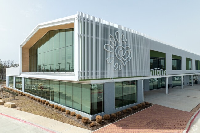
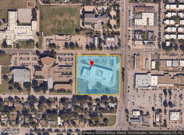
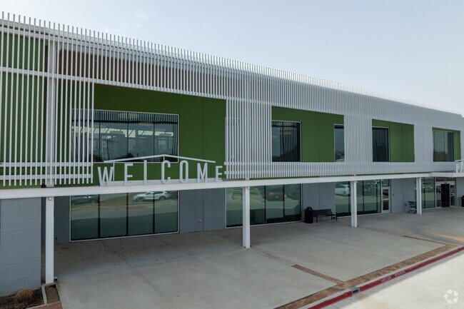
Property Record
1835 Walnut St, Grand Prairie, TX 75050
NEARBY LISTINGS FOR SALE OR LEASE
Property Detail
1835 Walnut St
Dallas/Ft Worth
Metrocrest
Dallas-Fort Worth-Arlington, TX
METROCREST BLK 1 LT 1R ACS 4.658 INT202000334162 DD12012020 CO-DC 0408600100100 9CC04086001
140607600101R0000
Dallas
Religious
Texas
0
1r
2025
4.66 AC
015600
Lewisville
45,875 SF
DEMOGRAPHICS near 1835 Walnut St
1 Mile
3 Mile
5 Mile
2024 Total Population
16,941
97,435
330,894
2029 Population
16,917
99,550
351,021
Pop Growth 2024-2029
(0.14%)
+ 2.17%
+ 6.08%
Average Age
34
39
38
2024 Total Households
5,328
37,854
140,867
HH Growth 2024-2029
+ 0.02%
+ 2.12%
+ 6.27%
Median Household Inc
$65,757
$77,014
$78,791
Avg Household Size
3.10
2.50
2.30
2024 Avg HH Vehicles
2.00
2.00
2.00
Median Home Value
$228,898
$285,967
$342,474
Median Year Built
1971
1981
1987
Nearby Places
Map Layers
Map Styles
 Street
 Aerial
- Restaurants
- Banks
- Shops
- Fitness
- Groceries
PUBLIC TRANSPORTATION
COMMUTER RAIL
Trinity Mills Station (Green Line - Dallas Area Rapid Transit (DART))
DRIVE
WALK
Distance
Trinity Mills Station (Green Line - Dallas Area Rapid Transit (DART))
7 min
3.8 mi
Hebron Station (A-train - Denton County Transportation Authority)
DRIVE
WALK
Distance
Hebron Station (A-train - Denton County Transportation Authority)
13 min
6.8 mi
AIRPORT
Dallas Love Field
DRIVE
WALK
Distance
Dallas Love Field
23 min
13.5 mi
Dallas-Fort Worth International
DRIVE
WALK
Distance
Dallas-Fort Worth International
23 min
16.6 mi
Freight Ports
Port of Shreveport
DRIVE
WALK
Distance
Port of Shreveport
228 min
209.3 mi
Nearby Properties
Address
Land Use
TOTAL SIZE
Lot Size
Zoning
Address
Land Use
TOTAL SIZE
Lot Size
Zoning
597,347 SF
4.40 AC
Z09
Address
Land Use
TOTAL SIZE
Lot Size
Zoning
284,890 SF
40.44 AC
Z274
Address
Land Use
TOTAL SIZE
Lot Size
Zoning
561,139 SF
3.64 AC
Z09
Address
Land Use
TOTAL SIZE
Lot Size
Zoning
605,278 SF
10.70 AC
Z236
Address
Land Use
TOTAL SIZE
Lot Size
Zoning
660,842 SF
4.82 AC
Z09
Address
Land Use
TOTAL SIZE
Lot Size
Zoning
584,128 SF
3.51 AC
Z241
Address
Land Use
TOTAL SIZE
Lot Size
Zoning
513,871 SF
3.63 AC
Z235
Address
Land Use
TOTAL SIZE
Lot Size
Zoning
534,929 SF
4.19 AC
Z236
Address
Land Use
TOTAL SIZE
Lot Size
Zoning
321,732 SF
4.05 AC
Z235
Address
Land Use
TOTAL SIZE
Lot Size
Zoning
255,627 SF
14.79 AC
Z123
Address
Land Use
TOTAL SIZE
Lot Size
Zoning
315,426 SF
3.52 AC
Z241
Address
Land Use
TOTAL SIZE
Lot Size
Zoning
266,871 SF
87 SF
Address
Land Use
TOTAL SIZE
Lot Size
Zoning
725,972 SF
4 AC
Address
Land Use
TOTAL SIZE
Lot Size
Zoning
497,851 SF
3.34 AC
Z241
Address
Land Use
TOTAL SIZE
Lot Size
Zoning
308,779 SF
19.42 AC
Z235
Address
Land Use
TOTAL SIZE
Lot Size
Zoning
268,132 SF
16.19 AC
Z235
Address
Land Use
TOTAL SIZE
Lot Size
Zoning
285,576 SF
22.13 AC
Z236
Address
Land Use
TOTAL SIZE
Lot Size
Zoning
270,915 SF
3.91 AC
Z84
Address
Land Use
TOTAL SIZE
Lot Size
Zoning
396,899 SF
3.68 AC
Z236
Address
Land Use
TOTAL SIZE
Lot Size
Zoning
330,000 SF
3.05 AC
Z236
Address
Land Use
TOTAL SIZE
Lot Size
Zoning
374,093 SF
21.54 AC
Z268
Address
Land Use
TOTAL SIZE
Lot Size
Zoning
210,289 SF
10.16 AC
Z147
Address
Land Use
TOTAL SIZE
Lot Size
Zoning
264,847 SF
14.26 AC
Z236
Address
Land Use
TOTAL SIZE
Lot Size
Zoning
300,956 SF
8.79 AC
Z236
Address
Land Use
TOTAL SIZE
Lot Size
Zoning
228,674 SF
11.81 AC
Z235
Address
Land Use
TOTAL SIZE
Lot Size
Zoning
399,880 SF
25.21 AC
Z236
Address
Land Use
TOTAL SIZE
Lot Size
Zoning
222,452 SF
3.12 AC
Z137
Address
Land Use
TOTAL SIZE
Lot Size
Zoning
213,216 SF
18.94 AC
Z235
Address
Land Use
TOTAL SIZE
Lot Size
Zoning
311,298 SF
2.66 AC
Z236
Address
Land Use
TOTAL SIZE
Lot Size
Zoning
360,360 SF
17.33 AC
Z236
The World's #1 Commercial Real Estate Marketplace
Connect with us
© 2025 CoStar Group
The information above has been obtained from sources believed reliable. While we do not doubt its accuracy we have not verified it and make no guarantee, warranty or representation about it. It is your responsibility to independently confirm its accuracy and completeness. Any projections, opinions, assumptions, or estimates used are for example only and do not represent the current or future performance of the property. The value of this transaction to you depends on tax and other factors which should be evaluated by your tax, financial, and legal advisors. You and your advisors should conduct a careful, independent investigation of the property to determine to your satisfaction the suitability of the property for your needs.