Property Record
1837 Kalakaua Ave, Honolulu, HI 96815

NEARBY LISTINGS FOR SALE OR LEASE
-
-
-
-
-
2139 Kuhio Ave. 27TH and 34th Floor
Honolulu, HI 96815
$10,235,000 - $13,650,000
6,992 - 7,293 SF
Multifamily
-
-
-
-
-
-
-
-
-
-
-
View all Honolulu listings for lease on LoopNet.com
Property Detail
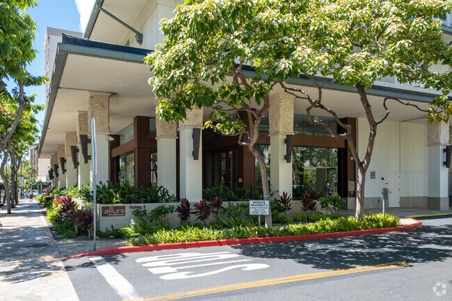
1837 Kalakaua Ave
Urban Honolulu, HI
Allure Waikiki
1-2-6-013-022-0125
Honolulu
Condominium
Hawaii
AO
2.29 AC
15003C0366G
Waikiki
1,234 SF
Hawaii
DEMOGRAPHICS near 1837 Kalakaua Ave
1 Mile
3 Mile
5 Mile
2024 Total Population
77,120
241,646
331,420
2029 Population
78,757
241,328
327,421
Pop Growth 2024-2029
+ 2.12%
(0.13%)
(1.21%)
Average Age
46
45
44
2024 Total Households
39,484
108,683
134,117
HH Growth 2024-2029
+ 1.75%
(0.28%)
(1.12%)
Median Household Inc
$65,719
$71,116
$75,066
Avg Household Size
1.90
2.10
2.30
2024 Avg HH Vehicles
1.00
1.00
1.00
Median Home Value
$620,812
$736,030
$804,412
Median Year Built
1974
1974
1972
Nearby Places
Map Layers
Map Styles
 Street
 Aerial
- Restaurants
- Banks
- Shops
- Fitness
- Groceries
PUBLIC TRANSPORTATION
AIRPORT
Daniel K Inouye International
DRIVE
WALK
Distance
Daniel K Inouye International
18 min
9.0 mi
Freight Ports
Honolulu Harbor, Oahu
DRIVE
WALK
Distance
Honolulu Harbor, Oahu
19 min
7.7 mi
SALE & LEASE HISTORY
LISTING DATE
SALE/LEASE

Apr 06, 2018
For Lease
Apr 06, 2018
For Lease
Nearby Properties
Address
Land Use
TOTAL SIZE
Lot Size
Zoning
Address
Land Use
TOTAL SIZE
Lot Size
Zoning
7,944,732 SF
34.93 AC
BMX-3
Address
Land Use
TOTAL SIZE
Lot Size
Zoning
119.90 AC
U/X7/60
Address
Land Use
TOTAL SIZE
Lot Size
Zoning
492,607 SF
9.06 AC
ResMix
Address
Land Use
TOTAL SIZE
Lot Size
Zoning
264,870 SF
3.47 AC
ResMix
Address
Land Use
TOTAL SIZE
Lot Size
Zoning
13,088 SF
75.21 AC
P-2
Address
Land Use
TOTAL SIZE
Lot Size
Zoning
193,478 SF
10.34 AC
ResMix
Address
Land Use
TOTAL SIZE
Lot Size
Zoning
1,100,000 SF
9.65 AC
BMX-3
Address
Land Use
TOTAL SIZE
Lot Size
Zoning
292,691 SF
1.09 AC
ResMix
Address
Land Use
TOTAL SIZE
Lot Size
Zoning
55.93 AC
WI
Address
Land Use
TOTAL SIZE
Lot Size
Zoning
164,234 SF
2.56 AC
ResMix
Address
Land Use
TOTAL SIZE
Lot Size
Zoning
495,002 SF
2.42 AC
ResMix
Address
Land Use
TOTAL SIZE
Lot Size
Zoning
476,537 SF
6.31 AC
ResMix
Address
Land Use
TOTAL SIZE
Lot Size
Zoning
130,002 SF
2.50 AC
ResMix
Address
Land Use
TOTAL SIZE
Lot Size
Zoning
45.65 AC
Kak
Address
Land Use
TOTAL SIZE
Lot Size
Zoning
42.67 AC
P-2
Address
Land Use
TOTAL SIZE
Lot Size
Zoning
1,599,500 SF
7.27 AC
BMX-3
Address
Land Use
TOTAL SIZE
Lot Size
Zoning
107,721 SF
2.76 AC
ResMix
Address
Land Use
TOTAL SIZE
Lot Size
Zoning
2.32 AC
Kak
Address
Land Use
TOTAL SIZE
Lot Size
Zoning
103,284 SF
1.84 AC
ResMix
Address
Land Use
TOTAL SIZE
Lot Size
Zoning
254,832 SF
2.92 AC
BMX-4
Address
Land Use
TOTAL SIZE
Lot Size
Zoning
242,241 SF
2.40 AC
ResMix
Address
Land Use
TOTAL SIZE
Lot Size
Zoning
64,300 SF
0.77 AC
ResMix
Address
Land Use
TOTAL SIZE
Lot Size
Zoning
104,386 SF
1.04 AC
ResMix
Address
Land Use
TOTAL SIZE
Lot Size
Zoning
172,305 SF
2.54 AC
ResMix
Address
Land Use
TOTAL SIZE
Lot Size
Zoning
144,855 SF
1.74 AC
ResMix
Address
Land Use
TOTAL SIZE
Lot Size
Zoning
1.13 AC
ResMix
Address
Land Use
TOTAL SIZE
Lot Size
Zoning
9,272 SF
141.38 AC
P-2
Address
Land Use
TOTAL SIZE
Lot Size
Zoning
1,618,933 SF
1.77 AC
ResMix
Address
Land Use
TOTAL SIZE
Lot Size
Zoning
139,740 SF
2.82 AC
ResMix
Address
Land Use
TOTAL SIZE
Lot Size
Zoning
142,306 SF
3.02 AC
ResMix
The World's #1 Commercial Real Estate Marketplace
Connect with us
© 2026 CoStar Group
The information above has been obtained from sources believed reliable. While we do not doubt its accuracy we have not verified it and make no guarantee, warranty or representation about it. It is your responsibility to independently confirm its accuracy and completeness. Any projections, opinions, assumptions, or estimates used are for example only and do not represent the current or future performance of the property. The value of this transaction to you depends on tax and other factors which should be evaluated by your tax, financial, and legal advisors. You and your advisors should conduct a careful, independent investigation of the property to determine to your satisfaction the suitability of the property for your needs.