Property Record
1837 Union Ave, Memphis, TN 38104
NEARBY LISTINGS FOR SALE OR LEASE
-
-
View all Memphis listings for sale on LoopNet.com
Property Detail
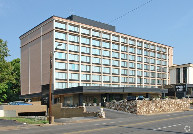
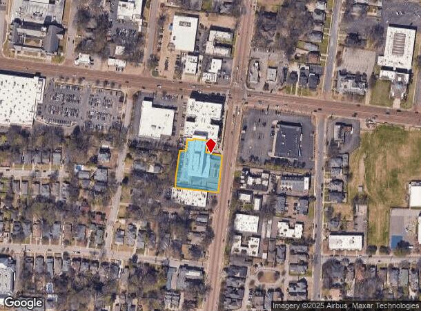
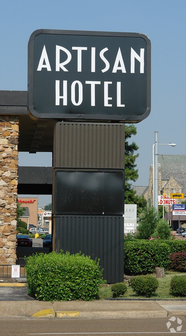
1837 Union Ave
01-6043-0-0021
Union And Mclean Mixed Use
Apartment
WS MCLEAN 240 SOUTH OF UNION SEE MAP 139C
X
Shelby
05035C0375E
Tennessee
0
0.93 AC
2025
Memphis CBD
003200
Memphis
100,246 SF
Memphis, TN-MS-AR
DEMOGRAPHICS near 1837 Union Ave
1 Mile
3 Mile
5 Mile
2024 Total Population
17,011
112,123
224,345
2029 Population
16,974
113,126
225,841
Pop Growth 2024-2029
(0.22%)
+ 0.89%
+ 0.67%
Average Age
40
39
38
2024 Total Households
8,939
50,334
98,789
HH Growth 2024-2029
(0.11%)
+ 0.75%
+ 0.50%
Median Household Inc
$59,269
$37,941
$40,104
Avg Household Size
1.80
2.10
2.20
2024 Avg HH Vehicles
1.00
1.00
1.00
Median Home Value
$365,136
$187,941
$151,059
Median Year Built
1948
1954
1956
Nearby Places
Map Layers
Map Styles
 Street
 Aerial
- Restaurants
- Banks
- Shops
- Fitness
- Groceries
PUBLIC TRANSPORTATION
COMMUTER RAIL
Central Station (Riverfront Loop - Memphis Area Transit Authority Trolley (MataTrolley))
DRIVE
WALK
Distance
Central Station (Riverfront Loop - Memphis Area Transit Authority Trolley (MataTrolley))
7 min
4.0 mi
AIRPORT
Memphis International
DRIVE
WALK
Distance
Memphis International
11 min
7.2 mi
Freight Ports
Port of Shreveport
DRIVE
WALK
Distance
Port of Shreveport
402 min
371.6 mi
Nearby Properties
Address
Land Use
TOTAL SIZE
Lot Size
Zoning
Address
Land Use
TOTAL SIZE
Lot Size
Zoning
409,950 SF
5.16 AC
CMP-1
Address
Land Use
TOTAL SIZE
Lot Size
Zoning
660,788 SF
8.28 AC
CMP-1
Address
Land Use
TOTAL SIZE
Lot Size
Zoning
61,983 SF
3.95 AC
U
Address
Land Use
TOTAL SIZE
Lot Size
Zoning
237,575 SF
2.34 AC
SE
Address
Land Use
TOTAL SIZE
Lot Size
Zoning
413,375 SF
33.87 AC
U
Address
Land Use
TOTAL SIZE
Lot Size
Zoning
300,225 SF
9.61 AC
U
Address
Land Use
TOTAL SIZE
Lot Size
Zoning
182,595 SF
3.17 AC
SE
Address
Land Use
TOTAL SIZE
Lot Size
Zoning
138,093 SF
7.05 AC
EMP
Address
Land Use
TOTAL SIZE
Lot Size
Zoning
516,768 SF
6.11 AC
CMP-1
Address
Land Use
TOTAL SIZE
Lot Size
Zoning
357,917 SF
2.66 AC
SE
Address
Land Use
TOTAL SIZE
Lot Size
Zoning
79,200 SF
1.91 AC
CMP-1
Address
Land Use
TOTAL SIZE
Lot Size
Zoning
99,590 SF
1.73 AC
SE
Address
Land Use
TOTAL SIZE
Lot Size
Zoning
116,399 SF
4.30 AC
SDR
Address
Land Use
TOTAL SIZE
Lot Size
Zoning
113,416 SF
3.35 AC
SDR
Address
Land Use
TOTAL SIZE
Lot Size
Zoning
56,716 SF
0.49 AC
SE
Address
Land Use
TOTAL SIZE
Lot Size
Zoning
2.20 AC
U
Address
Land Use
TOTAL SIZE
Lot Size
Zoning
115,053 SF
4.63 AC
CMU-1
Address
Land Use
TOTAL SIZE
Lot Size
Zoning
2,137 SF
346 AC
R-15
Address
Land Use
TOTAL SIZE
Lot Size
Zoning
109,000 SF
1.18 AC
SE
Address
Land Use
TOTAL SIZE
Lot Size
Zoning
43,779 SF
2.11 AC
RU-3
Address
Land Use
TOTAL SIZE
Lot Size
Zoning
82,064 SF
3.53 AC
CMP-1
Address
Land Use
TOTAL SIZE
Lot Size
Zoning
99,732 SF
1.08 AC
CMU-3
Address
Land Use
TOTAL SIZE
Lot Size
Zoning
25,278 SF
0.48 AC
CBD
Address
Land Use
TOTAL SIZE
Lot Size
Zoning
33,391 SF
1.26 AC
CMU-1
Address
Land Use
TOTAL SIZE
Lot Size
Zoning
110,072 SF
1.38 AC
SE
Address
Land Use
TOTAL SIZE
Lot Size
Zoning
87,504 SF
0.88 AC
CMU-3
Address
Land Use
TOTAL SIZE
Lot Size
Zoning
222,671 SF
8.77 AC
EMP
Address
Land Use
TOTAL SIZE
Lot Size
Zoning
66,004 SF
0.51 AC
SE
Address
Land Use
TOTAL SIZE
Lot Size
Zoning
53,088 SF
1.51 AC
CMU-3
The World's #1 Commercial Real Estate Marketplace
Connect with us
© 2026 CoStar Group
The information above has been obtained from sources believed reliable. While we do not doubt its accuracy we have not verified it and make no guarantee, warranty or representation about it. It is your responsibility to independently confirm its accuracy and completeness. Any projections, opinions, assumptions, or estimates used are for example only and do not represent the current or future performance of the property. The value of this transaction to you depends on tax and other factors which should be evaluated by your tax, financial, and legal advisors. You and your advisors should conduct a careful, independent investigation of the property to determine to your satisfaction the suitability of the property for your needs.