Property Record
18372 College Rd, Hagerstown, MD 21740


NEARBY LISTINGS FOR SALE OR LEASE
-
-
View all Hagerstown listings for lease on LoopNet.com
Property Detail
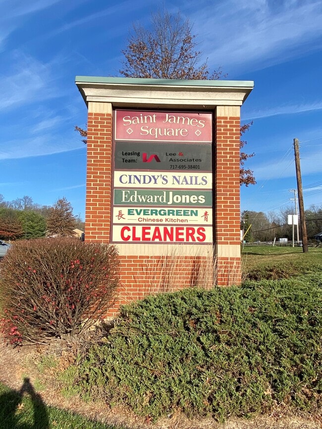
18372 College Rd
10-047927
St James Village North
Communitycenter
5.74 ACRES 18372 COLLEGE RD
X
Washington
24043C0305D
Maryland
2024
5.74 AC
2025
Washington County
010901
Washington, DC
6,930 SF
Hagerstown-Martinsburg, MD-WV
DEMOGRAPHICS near 18372 College Rd
1 Mile
3 Mile
5 Mile
2024 Total Population
4,591
24,267
79,390
2029 Population
4,685
24,635
80,562
Pop Growth 2024-2029
+ 2.05%
+ 1.52%
+ 1.48%
Average Age
38
41
40
2024 Total Households
1,497
9,532
31,859
HH Growth 2024-2029
+ 2.20%
+ 1.53%
+ 1.51%
Median Household Inc
$106,660
$69,795
$54,455
Avg Household Size
2.90
2.40
2.40
2024 Avg HH Vehicles
2.00
2.00
2.00
Median Home Value
$309,358
$218,832
$207,009
Median Year Built
2001
1972
1969
Nearby Places
Map Layers
Map Styles
 Street
 Aerial
- Restaurants
- Banks
- Shops
- Fitness
- Groceries
PUBLIC TRANSPORTATION
AIRPORT
Hagerstown Regional/Richard A Henson Field
DRIVE
WALK
Distance
Hagerstown Regional/Richard A Henson Field
18 min
8.9 mi
SALE & LEASE HISTORY
LISTING DATE
SALE/LEASE

May 09, 2025
For Lease
Feb 25, 2021
For Lease
Feb 23, 2021
For Sale
Aug 22, 2019
For Sale
Apr 16, 2020
For Sale
Nearby Properties
Address
Land Use
TOTAL SIZE
Lot Size
Zoning
Address
Land Use
TOTAL SIZE
Lot Size
Zoning
1,236,085 SF
134.31 AC
IMU
Address
Land Use
TOTAL SIZE
Lot Size
Zoning
1,234,240 SF
134.80 AC
HI
Address
Land Use
TOTAL SIZE
Lot Size
Zoning
1,247,111 SF
74.55 AC
IMU
Address
Land Use
TOTAL SIZE
Lot Size
Zoning
6,683 SF
746.36 AC
U
Address
Land Use
TOTAL SIZE
Lot Size
Zoning
103,131 SF
53.74 AC
RMOD
Address
Land Use
TOTAL SIZE
Lot Size
Zoning
76.18 AC
U
Address
Land Use
TOTAL SIZE
Lot Size
Zoning
167,084 SF
64.62 AC
RMOD
Address
Land Use
TOTAL SIZE
Lot Size
Zoning
5,640 SF
31.48 AC
A(R)
Address
Land Use
TOTAL SIZE
Lot Size
Zoning
290,600 SF
51.35 AC
IMU
Address
Land Use
TOTAL SIZE
Lot Size
Zoning
85,277 SF
13.62 AC
RT
Address
Land Use
TOTAL SIZE
Lot Size
Zoning
52,259 SF
60.86 AC
HI
Address
Land Use
TOTAL SIZE
Lot Size
Zoning
39,578 SF
64.90 AC
ORI
Address
Land Use
TOTAL SIZE
Lot Size
Zoning
58,065 SF
15.42 AC
BG
Address
Land Use
TOTAL SIZE
Lot Size
Zoning
8,546 SF
4 AC
IG
Address
Land Use
TOTAL SIZE
Lot Size
Zoning
138,132 SF
22.90 AC
HI
Address
Land Use
TOTAL SIZE
Lot Size
Zoning
28,584 SF
4.13 AC
HI
Address
Land Use
TOTAL SIZE
Lot Size
Zoning
16,102 SF
14 AC
ORI
Address
Land Use
TOTAL SIZE
Lot Size
Zoning
29,405 SF
29.47 AC
RH
Address
Land Use
TOTAL SIZE
Lot Size
Zoning
28,445 SF
49.29 AC
RT
Address
Land Use
TOTAL SIZE
Lot Size
Zoning
15.46 AC
RM
Address
Land Use
TOTAL SIZE
Lot Size
Zoning
9.86 AC
CR
Address
Land Use
TOTAL SIZE
Lot Size
Zoning
147,423 SF
10.96 AC
CG
Address
Land Use
TOTAL SIZE
Lot Size
Zoning
10,659 SF
142.91 AC
IR
Address
Land Use
TOTAL SIZE
Lot Size
Zoning
80,430 SF
44.88 AC
ORI
Address
Land Use
TOTAL SIZE
Lot Size
Zoning
107,520 SF
6.88 AC
RH
Address
Land Use
TOTAL SIZE
Lot Size
Zoning
64,791 SF
15.05 AC
RU
Address
Land Use
TOTAL SIZE
Lot Size
Zoning
28,387 SF
11.54 AC
RU
Address
Land Use
TOTAL SIZE
Lot Size
Zoning
30,000 SF
8.39 AC
IG
Address
Land Use
TOTAL SIZE
Lot Size
Zoning
28,395 SF
6.20 AC
RH
Address
Land Use
TOTAL SIZE
Lot Size
Zoning
106,460 SF
11.63 AC
IR
The World's #1 Commercial Real Estate Marketplace
Connect with us
© 2025 CoStar Group
The information above has been obtained from sources believed reliable. While we do not doubt its accuracy we have not verified it and make no guarantee, warranty or representation about it. It is your responsibility to independently confirm its accuracy and completeness. Any projections, opinions, assumptions, or estimates used are for example only and do not represent the current or future performance of the property. The value of this transaction to you depends on tax and other factors which should be evaluated by your tax, financial, and legal advisors. You and your advisors should conduct a careful, independent investigation of the property to determine to your satisfaction the suitability of the property for your needs.