Property Record
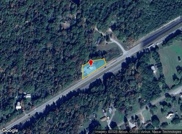
18387 Highway Fifty Eight, Boydton, VA 23917

NEARBY LISTINGS FOR SALE OR LEASE
-
-
View all Boydton listings for sale on LoopNet.com
Property Detail
18387 Highway Fifty Eight
Multipleuses
PT YANCEY PLACE
X
Mecklenburg
51117C0242C
Virginia
2024
1.64 AC
2024
Virginia South Central
930600
Other Market Areas
1,580 SF
4904
DEMOGRAPHICS near 18387 Highway Fifty Eight
1 Mile
3 Mile
5 Mile
2024 Total Population
333
670
1,458
2029 Population
323
653
1,435
Pop Growth 2024-2029
(3.00%)
(2.54%)
(1.58%)
Average Age
48
48
47
2024 Total Households
157
312
668
HH Growth 2024-2029
(3.18%)
(2.56%)
(1.80%)
Median Household Inc
$71,785
$66,562
$62,143
Avg Household Size
2.10
2.10
2.10
2024 Avg HH Vehicles
2.00
2.00
2.00
Median Home Value
$150,000
$157,857
$171,942
Median Year Built
1972
1972
1972
Nearby Places
Map Layers
Map Styles
 Street
 Aerial
- Restaurants
- Banks
- Shops
- Fitness
- Groceries
SALE & LEASE HISTORY
LISTING DATE
SALE/LEASE

Sep 25, 2016
For Lease
Sep 23, 2016
For Sale
Dec 11, 2019
For Sale
Nearby Properties
Address
Land Use
TOTAL SIZE
Lot Size
Zoning
Address
Land Use
TOTAL SIZE
Lot Size
Zoning
241,392 SF
214.92 AC
M1
Address
Land Use
TOTAL SIZE
Lot Size
Zoning
89,580 SF
226.45 AC
M1
Address
Land Use
TOTAL SIZE
Lot Size
Zoning
75.17 AC
M1
Address
Land Use
TOTAL SIZE
Lot Size
Zoning
50.69 AC
M1
Address
Land Use
TOTAL SIZE
Lot Size
Zoning
41,518 SF
12.62 AC
C1
Address
Land Use
TOTAL SIZE
Lot Size
Zoning
48,103 SF
15.87 AC
AG
Address
Land Use
TOTAL SIZE
Lot Size
Zoning
18,281 SF
0.29 AC
C1
Address
Land Use
TOTAL SIZE
Lot Size
Zoning
27,478 SF
7 AC
AG
Address
Land Use
TOTAL SIZE
Lot Size
Zoning
450.71 AC
AG
Address
Land Use
TOTAL SIZE
Lot Size
Zoning
4,455 SF
27.53 AC
AG
Address
Land Use
TOTAL SIZE
Lot Size
Zoning
11,504 SF
0.46 AC
C1
Address
Land Use
TOTAL SIZE
Lot Size
Zoning
4,428 SF
45.71 AC
AG
Address
Land Use
TOTAL SIZE
Lot Size
Zoning
40,431 SF
6.14 AC
M1
Address
Land Use
TOTAL SIZE
Lot Size
Zoning
410.46 AC
AG
Address
Land Use
TOTAL SIZE
Lot Size
Zoning
4,554 SF
131.96 AC
AG
Address
Land Use
TOTAL SIZE
Lot Size
Zoning
1,296 SF
226.78 AC
AG
Address
Land Use
TOTAL SIZE
Lot Size
Zoning
3,428 SF
82.30 AC
AG
Address
Land Use
TOTAL SIZE
Lot Size
Zoning
7,140 SF
3.48 AC
C1
Address
Land Use
TOTAL SIZE
Lot Size
Zoning
9,481 SF
0.96 AC
C1
Address
Land Use
TOTAL SIZE
Lot Size
Zoning
16,224 SF
1.19 AC
C1
Address
Land Use
TOTAL SIZE
Lot Size
Zoning
2,584 SF
27.48 AC
AG
Address
Land Use
TOTAL SIZE
Lot Size
Zoning
7,374 SF
4.65 AC
B1
Address
Land Use
TOTAL SIZE
Lot Size
Zoning
10,304 SF
0.21 AC
C1
Address
Land Use
TOTAL SIZE
Lot Size
Zoning
4,800 SF
32.24 AC
AG
Address
Land Use
TOTAL SIZE
Lot Size
Zoning
1,574 SF
104.50 AC
AG
Address
Land Use
TOTAL SIZE
Lot Size
Zoning
2,766 SF
27.55 AC
AG
Address
Land Use
TOTAL SIZE
Lot Size
Zoning
8,094 SF
0.74 AC
R2
Address
Land Use
TOTAL SIZE
Lot Size
Zoning
14,099 SF
0.86 AC
C1
Address
Land Use
TOTAL SIZE
Lot Size
Zoning
6,018 SF
0.88 AC
R1
Address
Land Use
TOTAL SIZE
Lot Size
Zoning
2,611 SF
42.90 AC
AG
The World's #1 Commercial Real Estate Marketplace
Connect with us
© 2025 CoStar Group
The information above has been obtained from sources believed reliable. While we do not doubt its accuracy we have not verified it and make no guarantee, warranty or representation about it. It is your responsibility to independently confirm its accuracy and completeness. Any projections, opinions, assumptions, or estimates used are for example only and do not represent the current or future performance of the property. The value of this transaction to you depends on tax and other factors which should be evaluated by your tax, financial, and legal advisors. You and your advisors should conduct a careful, independent investigation of the property to determine to your satisfaction the suitability of the property for your needs.