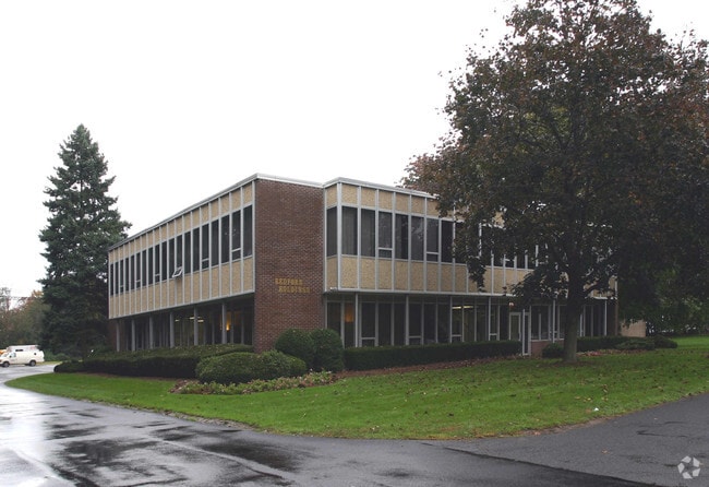
Property Record
184 Central Ave, Old Tappan, NJ 07675


NEARBY LISTINGS FOR SALE OR LEASE
Property Detail
184 Central Ave
43-01605-0000-00007
3.374AC
Commercialnec
Bergen
X
New Jersey
34003C0113H
7
2024
3.37 AC
2025
Northeast Bergen
024100
Northern New Jersey
29,942 SF
New York-Jersey City-White Plains, NY-NJ
DEMOGRAPHICS near 184 Central Ave
1 Mile
3 Mile
5 Mile
2024 Total Population
5,822
64,309
175,329
2029 Population
5,799
64,293
175,121
Pop Growth 2024-2029
(0.40%)
(0.02%)
(0.12%)
Average Age
43
43
43
2024 Total Households
1,971
22,097
60,826
HH Growth 2024-2029
(0.51%)
(0.09%)
(0.16%)
Median Household Inc
$163,719
$147,874
$141,018
Avg Household Size
2.90
2.80
2.80
2024 Avg HH Vehicles
2.00
2.00
2.00
Median Home Value
$810,329
$687,333
$666,251
Median Year Built
1980
1964
1961
Nearby Places
Map Layers
Map Styles
 Street
 Aerial
- Restaurants
- Banks
- Shops
- Fitness
- Groceries
PUBLIC TRANSPORTATION
COMMUTER RAIL
Woodcliff Lake (Pascack Valley Line - NJ Transit Commuter Rail (NJ Transit))
DRIVE
WALK
Distance
Woodcliff Lake (Pascack Valley Line - NJ Transit Commuter Rail (NJ Transit))
10 min
4.2 mi
Westwood (Pascack Valley Line - NJ Transit Commuter Rail (NJ Transit))
DRIVE
WALK
Distance
Westwood (Pascack Valley Line - NJ Transit Commuter Rail (NJ Transit))
12 min
4.2 mi
AIRPORT
LaGuardia
DRIVE
WALK
Distance
LaGuardia
42 min
24.1 mi
Westchester County
DRIVE
WALK
Distance
Westchester County
40 min
25.3 mi
Newark Liberty International
DRIVE
WALK
Distance
Newark Liberty International
38 min
26.7 mi
Freight Ports
NY - Red Hook Container Terminal
DRIVE
WALK
Distance
NY - Red Hook Container Terminal
52 min
29.0 mi
SALE & LEASE HISTORY
LISTING DATE
SALE/LEASE

Aug 30, 2022
For Sale
Nearby Properties
Address
Land Use
TOTAL SIZE
Lot Size
Zoning
Address
Land Use
TOTAL SIZE
Lot Size
Zoning
19.96 AC
HSO
Address
Land Use
TOTAL SIZE
Lot Size
Zoning
8.78 AC
HSO
Address
Land Use
TOTAL SIZE
Lot Size
Zoning
9.20 AC
OR
Address
Land Use
TOTAL SIZE
Lot Size
Zoning
8.08 AC
C
Address
Land Use
TOTAL SIZE
Lot Size
Zoning
845.02 AC
Address
Land Use
TOTAL SIZE
Lot Size
Zoning
3.33 AC
R3
Address
Land Use
TOTAL SIZE
Lot Size
Zoning
35,631 SF
8.60 AC
LI
Address
Land Use
TOTAL SIZE
Lot Size
Zoning
6.72 AC
C
Address
Land Use
TOTAL SIZE
Lot Size
Zoning
48.19 AC
P
Address
Land Use
TOTAL SIZE
Lot Size
Zoning
191,950 SF
43.03 AC
RA25
Address
Land Use
TOTAL SIZE
Lot Size
Zoning
15.23 AC
C
Address
Land Use
TOTAL SIZE
Lot Size
Zoning
2.80 AC
R10
Address
Land Use
TOTAL SIZE
Lot Size
Zoning
8 AC
AH1CC
Address
Land Use
TOTAL SIZE
Lot Size
Zoning
62,728 SF
14.49 AC
RA15
Address
Land Use
TOTAL SIZE
Lot Size
Zoning
1,295,615 SF
93.54 AC
OP
Address
Land Use
TOTAL SIZE
Lot Size
Zoning
5.96 AC
Address
Land Use
TOTAL SIZE
Lot Size
Zoning
4 AC
HSO
Address
Land Use
TOTAL SIZE
Lot Size
Zoning
144,751 SF
22.87 AC
RA
Address
Land Use
TOTAL SIZE
Lot Size
Zoning
231,978 SF
48.30 AC
R-40
Address
Land Use
TOTAL SIZE
Lot Size
Zoning
440 SF
98.43 AC
EO
Address
Land Use
TOTAL SIZE
Lot Size
Zoning
40.47 AC
DISTRICTN
Address
Land Use
TOTAL SIZE
Lot Size
Zoning
41,552 SF
115.62 AC
A-1
Address
Land Use
TOTAL SIZE
Lot Size
Zoning
8.42 AC
LI
Address
Land Use
TOTAL SIZE
Lot Size
Zoning
6.50 AC
LM
Address
Land Use
TOTAL SIZE
Lot Size
Zoning
4,938 SF
119 AC
Address
Land Use
TOTAL SIZE
Lot Size
Zoning
3.50 AC
R3
Address
Land Use
TOTAL SIZE
Lot Size
Zoning
4.50 AC
R3
Address
Land Use
TOTAL SIZE
Lot Size
Zoning
161.33 AC
P
Address
Land Use
TOTAL SIZE
Lot Size
Zoning
4.90 AC
LM
Address
Land Use
TOTAL SIZE
Lot Size
Zoning
60,798 SF
22.08 AC
A
The World's #1 Commercial Real Estate Marketplace
Connect with us
© 2026 CoStar Group
The information above has been obtained from sources believed reliable. While we do not doubt its accuracy we have not verified it and make no guarantee, warranty or representation about it. It is your responsibility to independently confirm its accuracy and completeness. Any projections, opinions, assumptions, or estimates used are for example only and do not represent the current or future performance of the property. The value of this transaction to you depends on tax and other factors which should be evaluated by your tax, financial, and legal advisors. You and your advisors should conduct a careful, independent investigation of the property to determine to your satisfaction the suitability of the property for your needs.