Property Record
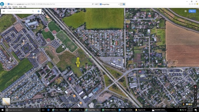
184 Tonea Way, Chico, CA 95973

Property Detail
184 Tonea Way
006-220-015-000
003.97 AC TONEA WAY
Multifamilydwelling
Butte
R1
California
B and X Area of moderate flood hazard, usually the area between the limits of the 100-year and 500-year floods.
3.97 AC
2024
Redding/Chico
2025
Other Market Areas
000300
Chico, CA
9,784 SF
NEARBY LISTINGS FOR SALE OR LEASE
DEMOGRAPHICS near 184 Tonea Way
1 mile
3 mile
5 mile
2025 Total Population
9,985
48,463
92,741
2030 Population
9,986
47,532
90,915
Pop Growth 2025-2030
+ 0.01%
(1.92%)
(1.97%)
Average Age
37
38
37
2025 Total Households
3,834
19,791
37,499
HH Growth 2025-2030
(0.08%)
(2.18%)
(2.17%)
Median Household Inc
$92,342
$72,767
$67,615
Avg Household Size
2.50
2.30
2.30
2025 Avg HH Vehicles
2.00
2.00
2.00
Median Home Value
$586,677
$469,268
$478,840
Median Year Built
2001
1983
1980
Nearby Places
Map Layers
Map Styles
 Street
 Aerial
Layers
 Traffic
 Biking
Places
Listings with unknown addresses are not visible on the map
- Restaurants
- Banks
- Shops
- Fitness
- Groceries
PUBLIC TRANSPORTATION
COMMUTER RAIL
Chico Amtrak (Coast Starlight - Amtrak)
Drive
Walk
Distance
Chico Amtrak (Coast Starlight - Amtrak)
9 min
4.4 mi
Freight Ports
Port of Stockton
Drive
Walk
Distance
Port of Stockton
163 min
135.2 mi
SALE & LEASE HISTORY
LISTING DATE
SALE/LEASE

Sep 06, 2017
For Sale
Nearby Properties
Address
Land Use
TOTAL SIZE
Lot Size
Zoning
Address
Land Use
TOTAL SIZE
Lot Size
Zoning
150,000 SF
2.31 AC
Address
Land Use
TOTAL SIZE
Lot Size
Zoning
135,668 SF
3.43 AC
PQ
Address
Land Use
TOTAL SIZE
Lot Size
Zoning
12.63 AC
R1
Address
Land Use
TOTAL SIZE
Lot Size
Zoning
8.55 AC
R3
Address
Land Use
TOTAL SIZE
Lot Size
Zoning
90,859 SF
5.60 AC
PQ
Address
Land Use
TOTAL SIZE
Lot Size
Zoning
190,996 SF
7.94 AC
R3
Address
Land Use
TOTAL SIZE
Lot Size
Zoning
8,008 SF
8.79 AC
Address
Land Use
TOTAL SIZE
Lot Size
Zoning
126,476 SF
6.75 AC
R3
Address
Land Use
TOTAL SIZE
Lot Size
Zoning
61,571 SF
6.47 AC
Address
Land Use
TOTAL SIZE
Lot Size
Zoning
1.58 AC
Address
Land Use
TOTAL SIZE
Lot Size
Zoning
247,613 SF
10.77 AC
CR
Address
Land Use
TOTAL SIZE
Lot Size
Zoning
160,354 SF
11.39 AC
00
Address
Land Use
TOTAL SIZE
Lot Size
Zoning
16,020 SF
12.01 AC
Address
Land Use
TOTAL SIZE
Lot Size
Zoning
83,886 SF
4.55 AC
Address
Land Use
TOTAL SIZE
Lot Size
Zoning
142,712 SF
7.24 AC
Address
Land Use
TOTAL SIZE
Lot Size
Zoning
132,768 SF
9.65 AC
R3
Address
Land Use
TOTAL SIZE
Lot Size
Zoning
92,292 SF
5.14 AC
Address
Land Use
TOTAL SIZE
Lot Size
Zoning
137,980 SF
15 AC
Address
Land Use
TOTAL SIZE
Lot Size
Zoning
123,494 SF
6.84 AC
R3
Address
Land Use
TOTAL SIZE
Lot Size
Zoning
115,792 SF
5.69 AC
R3
Address
Land Use
TOTAL SIZE
Lot Size
Zoning
2,248 SF
7.90 AC
R3
Address
Land Use
TOTAL SIZE
Lot Size
Zoning
5.03 AC
OC
Address
Land Use
TOTAL SIZE
Lot Size
Zoning
61,963 SF
6.53 AC
CC
Address
Land Use
TOTAL SIZE
Lot Size
Zoning
91,956 SF
3.68 AC
CR
Address
Land Use
TOTAL SIZE
Lot Size
Zoning
24,480 SF
1.29 AC
CC
Address
Land Use
TOTAL SIZE
Lot Size
Zoning
42,630 SF
3.95 AC
CC
Address
Land Use
TOTAL SIZE
Lot Size
Zoning
8,188 SF
3.23 AC
R2
Address
Land Use
TOTAL SIZE
Lot Size
Zoning
154,530 SF
9.40 AC
Address
Land Use
TOTAL SIZE
Lot Size
Zoning
5,776 SF
4.23 AC
The World's #1 Commercial Real Estate Marketplace
Connect with us
© 2026 CoStar Group
The information above has been obtained from sources believed reliable. While we do not doubt its accuracy we have not verified it and make no guarantee, warranty or representation about it. It is your responsibility to independently confirm its accuracy and completeness. Any projections, opinions, assumptions, or estimates used are for example only and do not represent the current or future performance of the property. The value of this transaction to you depends on tax and other factors which should be evaluated by your tax, financial, and legal advisors. You and your advisors should conduct a careful, independent investigation of the property to determine to your satisfaction the suitability of the property for your needs.